

<< Our Photo Pages >> Manorowen - Standing Stone (Menhir) in Wales in Pembrokeshire
Submitted by Klingon on Tuesday, 01 April 2008 Page Views: 5115
Neolithic and Bronze AgeSite Name: ManorowenCountry: Wales
NOTE: This site is 0.2 km away from the location you searched for.
County: Pembrokeshire Type: Standing Stone (Menhir)
Nearest Town: Fishguard Nearest Village: Manorowen
Map Ref: SM9324736021
Latitude: 51.984070N Longitude: 5.01226W
Condition:
| 5 | Perfect |
| 4 | Almost Perfect |
| 3 | Reasonable but with some damage |
| 2 | Ruined but still recognisable as an ancient site |
| 1 | Pretty much destroyed, possibly visible as crop marks |
| 0 | No data. |
| -1 | Completely destroyed |
| 5 | Superb |
| 4 | Good |
| 3 | Ordinary |
| 2 | Not Good |
| 1 | Awful |
| 0 | No data. |
| 5 | Can be driven to, probably with disabled access |
| 4 | Short walk on a footpath |
| 3 | Requiring a bit more of a walk |
| 2 | A long walk |
| 1 | In the middle of nowhere, a nightmare to find |
| 0 | No data. |
| 5 | co-ordinates taken by GPS or official recorded co-ordinates |
| 4 | co-ordinates scaled from a detailed map |
| 3 | co-ordinates scaled from a bad map |
| 2 | co-ordinates of the nearest village |
| 1 | co-ordinates of the nearest town |
| 0 | no data |
Internal Links:
External Links:
I have visited· I would like to visit
Penbron Klingon have visited here
")
You may be viewing yesterday's version of this page. To see the most up to date information please register for a free account.
")
")
Do not use the above information on other web sites or publications without permission of the contributor.
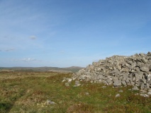
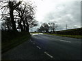
Nearby Images from Geograph Britain and Ireland:

©2022(licence)

©2015(licence)
©2010(licence)

©2015(licence)

©2009(licence)
The above images may not be of the site on this page, they are loaded from Geograph.
Please Submit an Image of this site or go out and take one for us!
Click here to see more info for this site
Nearby sites
Key: Red: member's photo, Blue: 3rd party photo, Yellow: other image, Green: no photo - please go there and take one, Grey: site destroyed
Download sites to:
KML (Google Earth)
GPX (GPS waypoints)
CSV (Garmin/Navman)
CSV (Excel)
To unlock full downloads you need to sign up as a Contributory Member. Otherwise downloads are limited to 50 sites.
Turn off the page maps and other distractions
Nearby sites listing. In the following links * = Image available
937m WSW 240° Penmeiddyn Stone Row / Alignment (SM9241535584)
1.2km WNW 290° Fynnon Drudion* Standing Stone (Menhir) (SM921365)
1.5km WNW 300° Ffynnondruidion* Chambered Tomb (SM920368)
2.0km WSW 251° Rhos y Clegyrn* Stone Circle (SM9133035456)
2.1km ENE 73° Castell Mwrtach* Hillfort (SM9531536571)
2.4km ENE 64° Lota Park Gorsedd Circle* Modern Stone Circle etc (SM955370)
2.6km SSW 204° Castell Hendre-Wen Ancient Village or Settlement (SM92083370)
2.6km ENE 66° Church of St. Mary (Fishguard)* Early Christian Sculptured Stone (SM957370)
2.9km WSW 245° Ffyst Samson* Chambered Tomb (SM90613491)
2.9km ENE 62° Fishguard Gorsedd Circle* Modern Stone Circle etc (SM9586837302)
3.0km N 358° Carn Wnda Standing Stone* Standing Stone (Menhir) (SM9327239010)
3.1km SSW 197° Jordanston* Round Barrow(s) (SM922331)
3.1km SSE 156° Llanstinan Bridge* Ancient Trackway (SM944331)
3.2km W 260° St Nicholas Stones* Early Christian Sculptured Stone (SM901356)
3.2km W 260° St Nicholas Well (N Pembrokeshire)* Holy Well or Sacred Spring (SM901356)
3.2km W 261° St Nicholas Church Inscribed Stones* Early Christian Sculptured Stone (SM9008535631)
3.2km N 5° Llanwnda Cemetery Crossroads stone* Early Christian Sculptured Stone (SM93683919)
3.2km NNE 15° Parc-y-Cromlech* Chambered Tomb (SM94223907)
3.2km N 359° Carn Wnda.* Chambered Tomb (SM93313923)
3.4km NNE 25° Garn Wen 1* Chambered Tomb (SM94813904)
3.4km NNE 24° Garn Wen 2* Chambered Tomb (SM94803910)
3.5km N 357° Ffynnon Wnda* Holy Well or Sacred Spring (SM9317939536)
3.5km NNE 24° Garn Wen 3* Chambered Tomb (SM94803920)
3.6km N 357° St Gwyndaf Stones* Early Christian Sculptured Stone (SM932396)
3.6km NNE 23° Garn Wen 4 Chambered Tomb (SM948393)
View more nearby sites and additional images


 We would like to know more about this location. Please feel free to add a brief description and any relevant information in your own language.
 Wir möchten mehr über diese Stätte erfahren. Bitte zögern Sie nicht, eine kurze Beschreibung und relevante Informationen in Deutsch hinzuzufügen.
 Nous aimerions en savoir encore un peu sur les lieux. S'il vous plaît n'hesitez pas à ajouter une courte description et tous les renseignements pertinents dans votre propre langue.
 Quisieramos informarnos un poco más de las lugares. No dude en añadir una breve descripción y otros datos relevantes en su propio idioma.