

<< Our Photo Pages >> Steen van Noordbarge - Natural Stone / Erratic / Other Natural Feature in Netherlands in Drenthe
Submitted by XIII on Saturday, 27 November 2021 Page Views: 2140
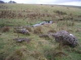
Natural PlacesSite Name: Steen van Noordbarge Alternative Name: D48, The Noordbarge StoneCountry: Netherlands
NOTE: This site is 11.997 km away from the location you searched for.
Province: Drenthe Type: Natural Stone / Erratic / Other Natural Feature
Nearest Town: Emmen Nearest Village: Noordbarge
Latitude: 52.770136N Longitude: 6.872522E
Condition:
| 5 | Perfect |
| 4 | Almost Perfect |
| 3 | Reasonable but with some damage |
| 2 | Ruined but still recognisable as an ancient site |
| 1 | Pretty much destroyed, possibly visible as crop marks |
| 0 | No data. |
| -1 | Completely destroyed |
| 5 | Superb |
| 4 | Good |
| 3 | Ordinary |
| 2 | Not Good |
| 1 | Awful |
| 0 | No data. |
| 5 | Can be driven to, probably with disabled access |
| 4 | Short walk on a footpath |
| 3 | Requiring a bit more of a walk |
| 2 | A long walk |
| 1 | In the middle of nowhere, a nightmare to find |
| 0 | No data. |
| 5 | co-ordinates taken by GPS or official recorded co-ordinates |
| 4 | co-ordinates scaled from a detailed map |
| 3 | co-ordinates scaled from a bad map |
| 2 | co-ordinates of the nearest village |
| 1 | co-ordinates of the nearest town |
| 0 | no data |
Internal Links:
External Links:
I have visited· I would like to visit
johnstone visited on 25th Jun 2021 - their rating: Cond: 3 Amb: 3 Access: 5
johnstone visited on 18th Apr 2005 - their rating: Cond: 3 Amb: 2 Access: 5
Average ratings for this site from all visit loggers: Condition: 3 Ambience: 2.5 Access: 5
")
Source and further reading (dutch): wikipedia
Short info (Site Hans Meijer)
You may be viewing yesterday's version of this page. To see the most up to date information please register for a free account.
")
")
")
")
")
")
")
Do not use the above information on other web sites or publications without permission of the contributor.
Click here to see more info for this site
Nearby sites
Click here to view sites on an interactive map of the areaKey: Red: member's photo, Blue: 3rd party photo, Yellow: other image, Green: no photo - please go there and take one, Grey: site destroyed
Download sites to:
KML (Google Earth)
GPX (GPS waypoints)
CSV (Garmin/Navman)
CSV (Excel)
To unlock full downloads you need to sign up as a Contributory Member. Otherwise downloads are limited to 50 sites.
Turn off the page maps and other distractions
Nearby sites listing. In the following links * = Image available
2.0km N 359° D44 Westenesch* Passage Grave
2.8km NNE 21° D43 Emmen Schimmeres* Passage Grave
2.8km NE 40° Zwerfkei Emmen Stationsplein* Natural Stone / Erratic / Other Natural Feature
2.9km N 357° D42 Emmeres* Passage Grave
3.4km NE 45° D45 Emmen* Passage Grave
3.4km NNE 15° D41 Emmermeer* Passage Grave
4.5km ENE 70° D46 Angelslo* Passage Grave
4.6km ENE 74° D47 Angelslo* Passage Grave
4.7km NNE 13° D40 Emmen* Passage Grave
4.7km NNE 12° D39 Emmen* Passage Grave
4.7km NNE 12° D38 Emmen* Passage Grave
4.7km NNE 14° Grafheuvel Emmen (45027) Round Barrow(s)
4.7km W 273° Zwerfkei Sleen* Natural Stone / Erratic / Other Natural Feature
4.9km NNE 13° Grafheuvels Emmen (45385) Round Barrow(s)
4.9km N 10° Grafheuvel Emmen (45384) Round Barrow(s)
5.6km N 8° D37a Valtherbos Chambered Tomb
5.6km N 9° Grafheuvel Emmen (45388) Round Barrow(s)
5.7km NE 41° The Broken Circle Natural Stone / Erratic / Other Natural Feature
5.7km N 7° Grafheuvels Emmen (45387) Round Barrow(s)
6.0km NE 45° Zwerfsteen Emmerschans Natural Stone / Erratic / Other Natural Feature
6.1km NNE 13° Grafheuvels Valthe (45389) Round Barrow(s)
6.4km WNW 295° D51 Noordsleen* Passage Grave
6.4km WNW 297° D50 Noordsleen* Passage Grave
6.7km ENE 77° Veenbruggen Emmen (45390) Ancient Trackway
7.2km N 359° D35 Valthe* Passage Grave
View more nearby sites and additional images


 We would like to know more about this location. Please feel free to add a brief description and any relevant information in your own language.
 Wir möchten mehr über diese Stätte erfahren. Bitte zögern Sie nicht, eine kurze Beschreibung und relevante Informationen in Deutsch hinzuzufügen.
 Nous aimerions en savoir encore un peu sur les lieux. S'il vous plaît n'hesitez pas à ajouter une courte description et tous les renseignements pertinents dans votre propre langue.
 Quisieramos informarnos un poco más de las lugares. No dude en añadir una breve descripción y otros datos relevantes en su propio idioma.