

<< Image Pages >> Shelton Stone Mound Complex - Cairn in United States in The South
Submitted by Andy B on Monday, 02 January 2023 Page Views: 433
Neolithic and Bronze AgeSite Name: Shelton Stone Mound Complex Alternative Name: 1CA637Country: United States
NOTE: This site is 30.615 km away from the location you searched for.
Region: The South Type: Cairn
Latitude: 33.804180N Longitude: 85.71696W
Condition:
| 5 | Perfect |
| 4 | Almost Perfect |
| 3 | Reasonable but with some damage |
| 2 | Ruined but still recognisable as an ancient site |
| 1 | Pretty much destroyed, possibly visible as crop marks |
| 0 | No data. |
| -1 | Completely destroyed |
| 5 | Superb |
| 4 | Good |
| 3 | Ordinary |
| 2 | Not Good |
| 1 | Awful |
| 0 | No data. |
| 5 | Can be driven to, probably with disabled access |
| 4 | Short walk on a footpath |
| 3 | Requiring a bit more of a walk |
| 2 | A long walk |
| 1 | In the middle of nowhere, a nightmare to find |
| 0 | No data. |
| 5 | co-ordinates taken by GPS or official recorded co-ordinates |
| 4 | co-ordinates scaled from a detailed map |
| 3 | co-ordinates scaled from a bad map |
| 2 | co-ordinates of the nearest village |
| 1 | co-ordinates of the nearest town |
| 0 | no data |
Internal Links:
External Links:
")
JSU-ARL researchers, based on early historical records and comparative site information, believe these stone structures were constructed during the Woodland period, 1000 BC to AD 600.
Full report at ResearchGate
You may be viewing yesterday's version of this page. To see the most up to date information please register for a free account.
")
Do not use the above information on other web sites or publications without permission of the contributor.
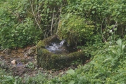
Nearby Images from Flickr


The above images may not be of the site on this page, but were taken nearby. They are loaded from Flickr so please click on them for image credits.
Click here to see more info for this site
Nearby sites
Click here to view sites on an interactive map of the areaKey: Red: member's photo, Blue: 3rd party photo, Yellow: other image, Green: no photo - please go there and take one, Grey: site destroyed
Download sites to:
KML (Google Earth)
GPX (GPS waypoints)
CSV (Garmin/Navman)
CSV (Excel)
To unlock full downloads you need to sign up as a Contributory Member. Otherwise downloads are limited to 50 sites.
Turn off the page maps and other distractions
Nearby sites listing. In the following links * = Image available
13.3km SSW 197° Choccolocco Stone Standing Stone (Menhir)
23.3km SSW 197° Choccolocco Creek Mounds* Artificial Mound
23.4km SSW 194° Oxford Stone Mound* Artificial Mound
30.0km S 191° Talladega National Forest Stone 1Ta756 Standing Stone (Menhir)
50.6km NNE 13° Coker Ford Site* Ancient Village or Settlement
53.0km NNW 345° Collinsville Indian Mound* Artificial Mound
58.8km SSE 159° Rother L. Harris Reservoir Stone Standing Stone (Menhir)
71.3km SSW 209° Horn Mountain Stone Standing Stone (Menhir)
81.5km SSW 213° Talladega Natl Forest Stone 1Ta719* Standing Stone (Menhir)
91.0km ENE 65° Arborrigg* Modern Stone Circle etc
91.1km ENE 67° Etowah Mounds - Mound B* Artificial Mound
91.1km ENE 67° Etowah Mounds - Mound A* Artificial Mound
91.2km ENE 67° Etowah Mounds - Mound C* Artificial Mound
91.3km ENE 67° Etowah Mounds - Ditch and Palisade* Misc. Earthwork
91.3km ENE 67° Etowah Mounds Museum* Museum
121.7km ENE 61° Funk Heritage Center* Museum
122.7km WSW 249° Bessemer Mounds* Artificial Mound
130.8km N 356° Russell Cave* Cave or Rock Shelter
130.8km N 356° Russell Cave Mound* Artificial Mound
141.6km NE 41° Fort Mountain Stone Enclosure* Cairn
148.9km NNE 16° Roxbury Indian Mound* Artificial Mound
152.1km WNW 298° Oakville Mounds* Artificial Mound
153.1km SSW 199° Mound at Fort Toulouse - Fort Jackson Park* Artificial Mound
174.6km NNE 25° Candies Creek Village Archaeological Preserve* Ancient Village or Settlement
190.1km N 349° Old Stone Fort* Hillfort
View more nearby sites and additional images


 We would like to know more about this location. Please feel free to add a brief description and any relevant information in your own language.
 Wir möchten mehr über diese Stätte erfahren. Bitte zögern Sie nicht, eine kurze Beschreibung und relevante Informationen in Deutsch hinzuzufügen.
 Nous aimerions en savoir encore un peu sur les lieux. S'il vous plaît n'hesitez pas à ajouter une courte description et tous les renseignements pertinents dans votre propre langue.
 Quisieramos informarnos un poco más de las lugares. No dude en añadir una breve descripción y otros datos relevantes en su propio idioma.