Featured: Hare and Tabor T Shirts for discerning antiquarians

Hare and Tabor T Shirts for discerning antiquarians

Random Image


Parc Y Llyn

Solving Stonehenge, the new key to an ancient enigma

Solving Stonehenge, the new key to an ancient enigma

Who's Online

There are currently, 142 guests and 0 members online.

You are a guest. To join in, please register for free by clicking here

Sponsors

<< Other Photo Pages >> Etowah Mounds - Mound A - Artificial Mound in United States in The South

Submitted by woode on Tuesday, 20 December 2022  Page Views: 9229

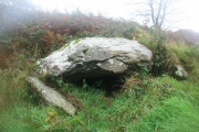
Pre-ColumbianSite Name: Etowah Mounds - Mound A
Country: United States Region: The South Type: Artificial Mound
Nearest Town: Cartersville
Latitude: 34.125000N  Longitude: 84.8075W
Condition:
5Perfect
4Almost Perfect
3Reasonable but with some damage
2Ruined but still recognisable as an ancient site
1Pretty much destroyed, possibly visible as crop marks
0No data.
-1Completely destroyed
4 Ambience:
5Superb
4Good
3Ordinary
2Not Good
1Awful
0No data.
5 Access:
5Can be driven to, probably with disabled access
4Short walk on a footpath
3Requiring a bit more of a walk
2A long walk
1In the middle of nowhere, a nightmare to find
0No data.
5 Accuracy:
5co-ordinates taken by GPS or official recorded co-ordinates
4co-ordinates scaled from a detailed map
3co-ordinates scaled from a bad map
2co-ordinates of the nearest village
1co-ordinates of the nearest town
0no data
4

Internal Links:
External Links:

Etowah Mounds - Mound A
Etowah Mounds - Mound A submitted by reer01 : View From Atop Mound A - Etowah Mound Site northwest Georgia Nov 2022 (Vote or comment on this photo)
Artificial Mound in Bartow County, Georgia, USA. Mound A is the largest of 6 mounds on the site. It stands 19m (63 feet) tall, the second tallest mound in the US. When it was built the flat platform supported a wood structure, probably a temple. The site may have been settled as early the Tenth Century CE by people of the Mississippian Culture. Woode writes: When I visited Etowah Mounds several years ago, there was no one there but me and my traveling companion. It was amazingly serene and a refreshing change from the hustle and bustle of nearby Atlanta, where I lived at the time.

More information can be found at: The New Georgia Encyclopedia: Etowah Mounds (The site incorrectly states that the human effigy sculptures uncovered here are clay, when they are actually marble.) and also the Georgia Department of Natural Resources website, including admission prices and times.

See below for details of geophysical study describing Etowah Mounds village and communal buildings.
You may be viewing yesterday's version of this page. To see the most up to date information please register for a free account.


Etowah Mounds - Mound A
Etowah Mounds - Mound A submitted by AKFisher : Photo credit Gregory L. Little, Ed.D. Shell gorgets from the Etowah, Georgia mound group. From: Sheltrone (1930). Photo courtesy Greg Little author of the Illustrated Encyclopedia of Native American Indian Mounds & Earthworks (2016). (Vote or comment on this photo)

Etowah Mounds - Mound A
Etowah Mounds - Mound A submitted by AKFisher : The smallest platform mound at the site, photo taken from the tall mound. Photo credit Gregory L. Little, Ed.D. (Vote or comment on this photo)

Etowah Mounds - Mound A
Etowah Mounds - Mound A submitted by Flickr : Etowah Mounds A and C The main platform mounds at Etowah, Mound A is 19m high and 12,000 m^2 at the base. It was likely the ceremonial center of the city, with four structures on top surrounding a courtyard. The mound was constructed in 1000, then added on in the 1320s. A clay and log stairway more than 6m wide led to the top. Etowah Mounds State Historic Site, Cartersville, Georgia Image cop... (Vote or comment on this photo)

Etowah Mounds - Mound A
Etowah Mounds - Mound A submitted by Flickr : Etowah Indian Mounds Image copyright: idyllopus, hosted on Flickr and displayed under the terms of their API. (Vote or comment on this photo)

Etowah Mounds - Mound A
Etowah Mounds - Mound A submitted by Flickr : Looking up at the largest mound Them are little peoples up top there if it helps to get a perspective of its size. Image copyright: Dixie Cheese (Stacy Fox), hosted on Flickr and displayed under the terms of their API.

Etowah Mounds - Mound A
Etowah Mounds - Mound A submitted by Flickr : Mound A & B Image copyright: C.S. McDonald (Colin McDonald), hosted on Flickr and displayed under the terms of their API.

Etowah Mounds - Mound A
Etowah Mounds - Mound A submitted by Flickr : Mound A Image copyright: C.S. McDonald (Colin McDonald), hosted on Flickr and displayed under the terms of their API.

Etowah Mounds - Mound A
Etowah Mounds - Mound A submitted by Flickr : Mound A, South side Image copyright: C.S. McDonald (Colin McDonald), hosted on Flickr and displayed under the terms of their API.

Etowah Mounds - Mound A
Etowah Mounds - Mound A submitted by durhamnature : Old picture from "Prehistoric America; The Mound Builders" via archive.org

Do not use the above information on other web sites or publications without permission of the contributor.
Click here to see more info for this site

Nearby sites

Click here to view sites on an interactive map of the area

Key: Red: member's photo, Blue: 3rd party photo, Yellow: other image, Green: no photo - please go there and take one, Grey: site destroyed

Download sites to:
KML (Google Earth)
GPX (GPS waypoints)
CSV (Garmin/Navman)
CSV (Excel)

To unlock full downloads you need to sign up as a Contributory Member. Otherwise downloads are limited to 50 sites.


Turn off the page maps and other distractions

Nearby sites listing. In the following links * = Image available
 101m ESE 117° Etowah Mounds - Mound C* Artificial Mound
 126m SSW 192° Etowah Mounds - Mound B* Artificial Mound
 270m N 0° Etowah Mounds - Ditch and Palisade* Misc. Earthwork
 336m N 9° Etowah Mounds Museum* Museum
 2.5km NNW 333° Arborrigg* Modern Stone Circle etc
 32.0km NE 47° Funk Heritage Center* Museum
 71.4km N 8° Fort Mountain Stone Enclosure* Cairn
 73.1km W 281° Coker Ford Site* Ancient Village or Settlement
 91.1km WSW 247° Shelton Stone Mound Complex* Cairn
 98.3km W 279° Collinsville Indian Mound* Artificial Mound
 100.3km WSW 241° Choccolocco Stone Standing Stone (Menhir)
 107.1km WSW 237° Oxford Stone Mound* Artificial Mound
 107.8km WSW 238° Choccolocco Creek Mounds* Artificial Mound
 110.4km SW 215° Rother L. Harris Reservoir Stone Standing Stone (Menhir)
 110.9km SW 234° Talladega National Forest Stone 1Ta756 Standing Stone (Menhir)
 115.0km NNW 339° Roxbury Indian Mound* Artificial Mound
 115.5km NE 55° Hickorynut Track Rock* Rock Art
 118.4km ENE 58° Nacoochee* Barrow Cemetery
 120.1km NE 45° Track Rock* Rock Art
 120.1km NE 45° Track Rock Gap Archaeological Area* Stone Row / Alignment
 120.5km ENE 59° Kenimer* Artificial Mound
 121.2km ENE 59° Sautee-Nacoochee earthwork Ancient Village or Settlement
 122.0km N 356° Candies Creek Village Archaeological Preserve* Ancient Village or Settlement
 132.0km NW 316° Russell Cave Mound* Artificial Mound
 132.0km NW 316° Russell Cave* Cave or Rock Shelter
View more nearby sites and additional images

<< Early Archaic Settlement Site on North King Street

Arcola Mounds >>

Please add your thoughts on this site

Metallurgical Reports on British and Irish Bronze Age Implements

Metallurgical Reports on British and Irish Bronze Age Implements

Sponsors

Auto-Translation (Google)

Translate from English into:

"Etowah Mounds - Mound A" | Login/Create an Account | 7 News and Comments
  
Go back to top of page    Comments are owned by the poster. We aren't responsible for their content.
Street View Etowah Mounds by bat400 on Friday, 09 April 2010
(User Info | Send a Message)

View Larger Map
[ Reply to This ]

Re: Etowah Mounds - Archaologists see the past without digging. by Anonymous on Tuesday, 03 July 2007
Great to read that the Creek peoples have requested that no further digging would be at this sacred site. Etowah is an incredible site to experience, and in the visitors center, one can see the high degree of ancient arts, from it's marble statues, to it's elaborate copper chestplates, are stunning and easily rival any civilisation in the Americas.
[ Reply to This ]
    Re: Etowah Mounds - Archaologists see the past without digging. by bat400 on Tuesday, 03 July 2007
    (User Info | Send a Message)
    Yes, but if they hadn't excavated the site, then there would have been nothing to see in that museum. There is a good case to be made that most of those artifacts are "sacred" and they should have never been dug up and exposed in a museum.
    Its excellent that the technology exists to better define the actual village where the majority of average people lived, as opposed to focus entirely on the mounds - the only visible remains of the ancient culture. But there is a basic conflict between digging up artifacts to learn and be inspired by the artistic, social, and technical abilities of the ancients and deciding that one's culture or basic nature depends on not digging up anything. It would be nice if some meeting of the minds would allow respectful, limited excavations, with a return of human remains, and pre-agreement on the final deposition of other finds.
    [ Reply to This ]

Etowah Mounds - Archaologists see the past without digging. by bat400 on Monday, 02 July 2007
(User Info | Send a Message)
Submitted by coldrum ---

One of the Southeast's premier archaeological sites, Etowah Mounds, loom over the landscape — as imposing today as they were five centuries ago.

At their base, the broad, grassy plain sloping toward the Etowah River gets scant attention from the 32,000 people who visit the park each year. Mounds, after all, are what Etowah is about. Like casual visitors today, they missed a lot, including the area where most of the people lived.

"The focus of early archaeology was to get stuff – important, exciting stuff," says University of South Carolina archaeologist Adam King. "Everyone knew they were going to find stuff in the mounds, so that's where they dug." And spectacular "stuff" it was — showy feathered headdresses, stone effigies, intricately carved shell ornaments and embossed copper plates that King says demonstrate that, in its day, Etowah was a veritable "Athens of the prehistoric South."

"The problem is that the mounds were where the important people lived and were buried," King says. "For a place that has been excavated on and off since 1884, we know very little about the rest of the people who lived here."

To remedy that, he and his team or archaeologists have focused on what other experts ignored – the grassy plain where the common people of Etowah lived and worked.

In the course of three surveys at Etowah since 2005 – the latest concluded last month — the team has not yet turned a shovelful of dirt or unearthed a single artifact.

But, with an assist from modern imaging technology that "sees" beneath the soil without disturbing it, they have found some intriguing new clues about the people who lived here long before white men set foot on the continent.

The ancient mounds — three large earthen pyramids and three smaller ones — were built along the Etowah River starting around A.D. 1000. The site was inhabited for nearly 500 years.

The clay daub and other materials used in dwellings and other buildings has different properties from the surrounding soil. A map of the difference in the magnetic properties shows the buried footprints of a thriving village that was dominated by Mound A, which towers more than 60 feet above the plain.

"There is a lot out there," says King. "To the north of Mound A and to the west, we see dense clusters of houses arranged around little plazas. I think what we are seeing are little neighborhoods within the larger Etowah — exactly what I would expect in terms of a village."

King says the smaller buildings are less than 30 feet across, but there are also a number of much larger structures.

"We see some monster buildings out there behind Mound A and a couple between A and C. There is at least one big one that may be 30 meters (100 feet) on a side," he says.

Estimates of Etowah's population have varied widely over the years, but King says the density of dwellings he has encountered so far suggest that, at its peak, there may have been 1,000 people or so.

Hard evidence and details of the village, however, have been more elusive. King was surprised to detect tangible traces of the village that survived 500 years of repeated flooding of the river plain and a century of plowing by people who farmed it before and after the Civil War.

"It may be that periodic flooding covered the area with enough sediment to protect the site," he says. More mapping — currently funded by the Lannan Foundation of Santa Fe, a family foundation that supports indigenous cultural projects — lies ahead.

King estimates that it will take another year or two to completely map the entire 54-acre site, the first time that has ever been done. Using a variety of remote sensing techniques — ground-penetrating radar, magnetometers and electrical resistivity measurements — he hopes to develop an increasingly detailed view of what lies underground.

In a field where discovery and digging have long

Read the rest of this post...
[ Reply to This ]

Re: Etowah Mounds - Mound A by davidmorgan on Friday, 26 January 2007
(User Info | Send a Message)
As the guy says in the video - these ain't your plains injuns!
Wonderful!
[ Reply to This ]

Re: Etowah Mounds - Mound A by Aluta on Friday, 03 November 2006
(User Info | Send a Message)
The video at this link shows indigenous stonework and mounds in Georgia (USA). That these sites are recognised in the south should eventually help the northeastern and mid-Atlantic sites gain recognition.
[ Reply to This ]

Your Name: Anonymous [ Register Now ]
Subject:


Add your comment or contribution to this page. Spam or offensive posts are deleted immediately, don't even bother

<<< What is five plus one as a number? (Please type the answer to this question in the little box on the left)
You can also embed videos and other things. For Youtube please copy and paste the 'embed code'.
For Google Street View please include Street View in the text.
Create a web link like this: <a href="https://www.megalithic.co.uk">This is a link</a>  

Allowed HTML is:
<p> <b> <i> <a> <img> <em> <br> <strong> <blockquote> <tt> <li> <ol> <ul> <object> <param> <embed> <iframe>

We would like to know more about this location. Please feel free to add a brief description and any relevant information in your own language.
Wir möchten mehr über diese Stätte erfahren. Bitte zögern Sie nicht, eine kurze Beschreibung und relevante Informationen in Deutsch hinzuzufügen.
Nous aimerions en savoir encore un peu sur les lieux. S'il vous plaît n'hesitez pas à ajouter une courte description et tous les renseignements pertinents dans votre propre langue.
Quisieramos informarnos un poco más de las lugares. No dude en añadir una breve descripción y otros datos relevantes en su propio idioma.