 with our Megalithic Portal iPhone app")

<< Image Pages >> Talladega Natl Forest Stone 1Ta719 - Standing Stone (Menhir) in United States in The South
Submitted by bat400 on Saturday, 12 January 2013 Page Views: 4935
Neolithic and Bronze AgeSite Name: Talladega Natl Forest Stone 1Ta719Country: United States Region: The South Type: Standing Stone (Menhir)
Nearest Town: Birningham, AL Nearest Village: Sylacauga, AL
Latitude: 33.186000N Longitude: 86.19W
Condition:
| 5 | Perfect |
| 4 | Almost Perfect |
| 3 | Reasonable but with some damage |
| 2 | Ruined but still recognisable as an ancient site |
| 1 | Pretty much destroyed, possibly visible as crop marks |
| 0 | No data. |
| -1 | Completely destroyed |
| 5 | Superb |
| 4 | Good |
| 3 | Ordinary |
| 2 | Not Good |
| 1 | Awful |
| 0 | No data. |
| 5 | Can be driven to, probably with disabled access |
| 4 | Short walk on a footpath |
| 3 | Requiring a bit more of a walk |
| 2 | A long walk |
| 1 | In the middle of nowhere, a nightmare to find |
| 0 | No data. |
| 5 | co-ordinates taken by GPS or official recorded co-ordinates |
| 4 | co-ordinates scaled from a detailed map |
| 3 | co-ordinates scaled from a bad map |
| 2 | co-ordinates of the nearest village |
| 1 | co-ordinates of the nearest town |
| 0 | no data |
Be the first person to rate this site - see the 'Contribute!' box in the right hand menu.
Internal Links:
External Links:
")
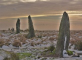
Made of local schist, this thick tabular slab is 3 feet wide at the base and nearly 4 feet high. It overlooks the Tallaseehatchee Creek. Nine stone mounds and a stone wall were also recorded as being in the general vicinity of this stone by Marcus Ridley in a 2008 survey conducted prior to a timber sale.
IMPORTANT NOTE: The location given is for the general area of the Tallaseehatchee Creek and should not be used for locating the site. The location will be updated when possible.
[Source: Donald B. Ball and John C. Waggoner, Jr., "Megaliths in the Upland South: Imposing Stones of Uncertain Function," (PDF) Journal of Alabama Archaeology, Vol 56, No. I, 2010.]
You may be viewing yesterday's version of this page. To see the most up to date information please register for a free account.
Do not use the above information on other web sites or publications without permission of the contributor.
Nearby Images from Flickr

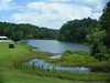
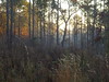
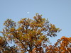

The above images may not be of the site on this page, but were taken nearby. They are loaded from Flickr so please click on them for image credits.
Click here to see more info for this site
Nearby sites
Click here to view sites on an interactive map of the areaKey: Red: member's photo, Blue: 3rd party photo, Yellow: other image, Green: no photo - please go there and take one, Grey: site destroyed
Download sites to:
KML (Google Earth)
GPX (GPS waypoints)
CSV (Garmin/Navman)
CSV (Excel)
To unlock full downloads you need to sign up as a Contributory Member. Otherwise downloads are limited to 50 sites.
Turn off the page maps and other distractions
Nearby sites listing. In the following links * = Image available
11.4km ENE 57° Horn Mountain Stone Standing Stone (Menhir)
54.8km NE 44° Talladega National Forest Stone 1Ta756 Standing Stone (Menhir)
59.4km NE 38° Choccolocco Creek Mounds* Artificial Mound
59.7km NE 39° Oxford Stone Mound* Artificial Mound
66.5km ENE 78° Rother L. Harris Reservoir Stone Standing Stone (Menhir)
68.8km NE 35° Choccolocco Stone Standing Stone (Menhir)
74.6km WNW 289° Bessemer Mounds* Artificial Mound
76.1km S 185° Mound at Fort Toulouse - Fort Jackson Park* Artificial Mound
81.5km NNE 32° Shelton Stone Mound Complex* Cairn
123.8km NNE 14° Collinsville Indian Mound* Artificial Mound
128.5km SW 222° Old Cahawba Archaeological Park* Misc. Earthwork
130.4km NNE 25° Coker Ford Site* Ancient Village or Settlement
136.0km W 262° Moundville Archeological Park* Ancient Village or Settlement
165.1km NE 50° Etowah Mounds - Mound B* Artificial Mound
165.2km NE 50° Etowah Mounds - Mound A* Artificial Mound
165.2km NE 50° Etowah Mounds - Mound C* Artificial Mound
165.3km NE 50° Etowah Mounds - Ditch and Palisade* Misc. Earthwork
165.4km NE 50° Etowah Mounds Museum* Museum
165.7km NE 50° Arborrigg* Modern Stone Circle etc
166.8km NNW 327° Oakville Mounds* Artificial Mound
194.6km WNW 302° Hamilton Mounds* Artificial Mound
197.1km NE 50° Funk Heritage Center* Museum
202.3km N 10° Russell Cave Mound* Artificial Mound
202.3km N 10° Russell Cave* Cave or Rock Shelter
222.6km NE 38° Fort Mountain Stone Enclosure* Cairn
View more nearby sites and additional images


 We would like to know more about this location. Please feel free to add a brief description and any relevant information in your own language.
 Wir möchten mehr über diese Stätte erfahren. Bitte zögern Sie nicht, eine kurze Beschreibung und relevante Informationen in Deutsch hinzuzufügen.
 Nous aimerions en savoir encore un peu sur les lieux. S'il vous plaît n'hesitez pas à ajouter une courte description et tous les renseignements pertinents dans votre propre langue.
 Quisieramos informarnos un poco más de las lugares. No dude en añadir una breve descripción y otros datos relevantes en su propio idioma.