<< Our Photo Pages >> Mounds State Park (Indiana) - Earthwork D - Misc. Earthwork in United States in Great Lakes Midwest
Submitted by bat400 on Monday, 23 October 2006 Page Views: 3784
Multi-periodSite Name: Mounds State Park (Indiana) - Earthwork D Alternative Name: Mounds Park, Mounds State ParkCountry: United States
NOTE: This site is 14.531 km away from the location you searched for.
Region: Great Lakes Midwest Type: Misc. Earthwork
Nearest Town: Anderson, Indiana
Latitude: 40.093763N Longitude: 85.623864W
Condition:
| 5 | Perfect |
| 4 | Almost Perfect |
| 3 | Reasonable but with some damage |
| 2 | Ruined but still recognisable as an ancient site |
| 1 | Pretty much destroyed, possibly visible as crop marks |
| 0 | No data. |
| -1 | Completely destroyed |
| 5 | Superb |
| 4 | Good |
| 3 | Ordinary |
| 2 | Not Good |
| 1 | Awful |
| 0 | No data. |
| 5 | Can be driven to, probably with disabled access |
| 4 | Short walk on a footpath |
| 3 | Requiring a bit more of a walk |
| 2 | A long walk |
| 1 | In the middle of nowhere, a nightmare to find |
| 0 | No data. |
| 5 | co-ordinates taken by GPS or official recorded co-ordinates |
| 4 | co-ordinates scaled from a detailed map |
| 3 | co-ordinates scaled from a bad map |
| 2 | co-ordinates of the nearest village |
| 1 | co-ordinates of the nearest town |
| 0 | no data |
Internal Links:
External Links:
I have visited· I would like to visit
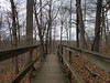
stonetracker visited - their rating: Cond: 3 Amb: 3 Access: 3 Visited in late Oct 2023. This is ~ 150 yds or so southwest of the Great Mound, about 100 ft NE off of a side trail. Requires a bit more walking than the other earthworks closer to the Great Mound.
bat400 have visited here
 - Earthwork D (PID:25367)")
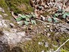
Earthwork D is a circular enclosure about 100 feet in diameter with a central platform about 45 feet across. Forest debris slowly covered this enclosure. Now the encircling ditch is less than a foot deep, but excavations show that it was originally 2-3 feet deep, similar to nearby Fiddleback Enclosure.
Although it was recorded in the 1800's it was "lost" in the early 1900's and only rediscovered during Ball State University survey in 1988.
Excavations show that the structure (120 BC) was built after the features of the Great Mound structure were complete. On the sunset of the summer solstice observers in the center of the Great Mound would see the summer solstice sunset beyond Earthwork D. As with the other earthworks of the Mounds southern complex, Earthwork D lies on a bluff overlooking the White River. The location given is approximate.
[Information from Mounds State Park information pamphlets, and "The Archaeology of Anderson Mounds, Mounds State Park, Anderson Indiana" by Donald Cochran and Beth McCord, 2001.]
You may be viewing yesterday's version of this page. To see the most up to date information please register for a free account.
Do not use the above information on other web sites or publications without permission of the contributor.
Nearby Images from Flickr


The above images may not be of the site on this page, but were taken nearby. They are loaded from Flickr so please click on them for image credits.
Click here to see more info for this site
Nearby sites
Click here to view sites on an interactive map of the areaKey: Red: member's photo, Blue: 3rd party photo, Yellow: other image, Green: no photo - please go there and take one, Grey: site destroyed
Download sites to:
KML (Google Earth)
GPX (GPS waypoints)
CSV (Garmin/Navman)
CSV (Excel)
To unlock full downloads you need to sign up as a Contributory Member. Otherwise downloads are limited to 50 sites.
Turn off the page maps and other distractions
Nearby sites listing. In the following links * = Image available
115m NNE 25° Mounds (Indiana) - Fiddleback Mound* Misc. Earthwork
129m ENE 57° Mounds (Indiana) - Great Mound* Henge
160m E 89° Mounds (Indiana) - Earthwork B* Misc. Earthwork
406m NE 54° Mounds (Indiana)* Henge
1.1km NNE 22° Mounds (Indiana) - Circle Mound* Misc. Earthwork
16.3km NE 54° Yorktown Enclosure Misc. Earthwork
27.2km ESE 121° New Castle Complex* Henge
28.0km W 278° Castor Farm Ancient Village or Settlement
28.1km W 278° Strawtown Enclosure* Ancient Village or Settlement
29.3km SE 134° Chrysler Enclosure* Henge
36.2km ENE 79° Windsor Mound* Artificial Mound
48.4km SE 126° Cambridge City Henge Complex* Henge
58.9km SW 232° Indiana State Museum* Museum
69.5km ESE 104° Whitehead Mound* Artificial Mound
93.9km SW 225° Blue Bluff Rock Outcrop
101.6km SW 224° Bundy-Voyles Site* Ancient Village or Settlement
103.7km SE 135° Enyart Mound* Artificial Mound
103.9km SE 135° Reily Cemetery Mound* Artificial Mound
119.9km SE 132° Fortified Hill Works* Hillfort
121.5km SE 137° Dunlap Works* Artificial Mound
122.5km SE 127° Rentschler Park Hilltop Enclosure* Hillfort
125.9km ESE 114° Miamisburg Mound* Artificial Mound
125.9km ESE 109° Sunwatch* Ancient Village or Settlement
128.0km ESE 108° Calvary Cemetery Hilltop Enclosure* Hillfort
128.0km SE 145° Conrad Mound* Artificial Mound
View more nearby sites and additional images


 We would like to know more about this location. Please feel free to add a brief description and any relevant information in your own language.
 Wir möchten mehr über diese Stätte erfahren. Bitte zögern Sie nicht, eine kurze Beschreibung und relevante Informationen in Deutsch hinzuzufügen.
 Nous aimerions en savoir encore un peu sur les lieux. S'il vous plaît n'hesitez pas à ajouter une courte description et tous les renseignements pertinents dans votre propre langue.
 Quisieramos informarnos un poco más de las lugares. No dude en añadir una breve descripción y otros datos relevantes en su propio idioma.