

<< Our Photo Pages >> Dun Mor (Lismore) - Stone Fort or Dun in Scotland in Argyll
Submitted by SolarMegalith on Wednesday, 01 November 2023 Page Views: 165
Iron Age and Later PrehistorySite Name: Dun Mor (Lismore)Country: Scotland
NOTE: This site is 0.882 km away from the location you searched for.
County: Argyll Type: Stone Fort or Dun
Nearest Town: Oban Nearest Village: Achnacroish
Map Ref: NM83724003
Latitude: 56.502484N Longitude: 5.515899W
Condition:
| 5 | Perfect |
| 4 | Almost Perfect |
| 3 | Reasonable but with some damage |
| 2 | Ruined but still recognisable as an ancient site |
| 1 | Pretty much destroyed, possibly visible as crop marks |
| 0 | No data. |
| -1 | Completely destroyed |
| 5 | Superb |
| 4 | Good |
| 3 | Ordinary |
| 2 | Not Good |
| 1 | Awful |
| 0 | No data. |
| 5 | Can be driven to, probably with disabled access |
| 4 | Short walk on a footpath |
| 3 | Requiring a bit more of a walk |
| 2 | A long walk |
| 1 | In the middle of nowhere, a nightmare to find |
| 0 | No data. |
| 5 | co-ordinates taken by GPS or official recorded co-ordinates |
| 4 | co-ordinates scaled from a detailed map |
| 3 | co-ordinates scaled from a bad map |
| 2 | co-ordinates of the nearest village |
| 1 | co-ordinates of the nearest town |
| 0 | no data |
Internal Links:
External Links:
I have visited· I would like to visit
SolarMegalith visited on 7th Sep 2022 - their rating: Cond: 2 Amb: 4 Access: 4
 (PID:265997)")
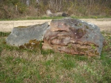
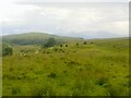
A sub-oval dun is located on a small plateau in the central part o the Isle of Lismore. It is protected by steep slopes, the easiest access is frorm the south. The outline of the wall is visible on most of the dun’s perimeter, some remains of the outer wall-face can be seen at the south. Slight remains of an entrance can be distinguished in western part of the dun.
Canmore entry
You may be viewing yesterday's version of this page. To see the most up to date information please register for a free account.
 (PID:265999)")
 (PID:265998)")
Do not use the above information on other web sites or publications without permission of the contributor.
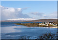
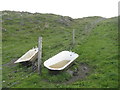
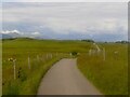
Nearby Images from Geograph Britain and Ireland:
©2016(licence)
©2019(licence)
©2021(licence)
©2021(licence)
©2011(licence)
The above images may not be of the site on this page, they are loaded from Geograph.
Please Submit an Image of this site or go out and take one for us!
Click here to see more info for this site
Nearby sites
Key: Red: member's photo, Blue: 3rd party photo, Yellow: other image, Green: no photo - please go there and take one, Grey: site destroyed
Download sites to:
KML (Google Earth)
GPX (GPS waypoints)
CSV (Garmin/Navman)
CSV (Excel)
To unlock full downloads you need to sign up as a Contributory Member. Otherwise downloads are limited to 50 sites.
Turn off the page maps and other distractions
Nearby sites listing. In the following links * = Image available
78m SW 217° Balygrundle North* Cairn (NM83673997)
540m SE 143° Dun Vamha Chradha* Cairn (NM84023958)
573m S 184° Balygrundle South* Cairn (NM83653946)
760m E 92° Sean Dun (Lismore)* Stone Fort or Dun (NM84483996)
1.2km W 274° Dun Cuilein* Stone Fort or Dun (NM82504018)
1.6km SW 217° Kilcheran Fort* Hillfort (NM82663877)
2.3km SW 219° Kilcheran Dun* Stone Fort or Dun (NM82213834)
2.5km WSW 239° Barr Mor* Cairn (NM81493886)
3.5km SW 225° An Dun Broch* Broch or Nuraghe (NM81133768)
4.0km SW 232° Aon Garbh Cist* Cist (NM80393772)
4.1km NNE 32° Clach na h-ealea (Clachan)* Natural Stone / Erratic / Other Natural Feature (NM86094342)
4.1km NNE 29° Carn Mor (Lismore)* Cairn (NM85934354)
4.1km NNE 32° Lismore Grave Slabs* Sculptured Stone (NM8608043445)
4.2km NE 43° Tirefour Castle* Broch or Nuraghe (NM8675542912)
4.3km SW 231° Aon Garbh Cairns* Cairn (NM80213751)
4.4km SW 221° Fiart Dun* Stone Fort or Dun (NM80673687)
4.7km NNE 31° Cnoc Aingil Cairn (NM86384397)
5.1km SW 224° An Dun 2 (Lismore)* Stone Fort or Dun (NM79983651)
6.0km SW 225° Dun Chruban* Stone Fort or Dun (NM79243598)
6.0km ENE 73° Balure Cairns* Cairn (NM89604145)
6.1km E 90° Kintaline Mill Farm Kist* Cist (NM89793971)
6.3km ENE 78° Achnamoine 2* Cairn (NM89974104)
6.5km E 80° Achnamoine Cairn* Cairn (NM90184082)
6.8km ENE 67° Eriska Crannog* Crannog (NM90114239)
6.8km ESE 102° Dun Mac Sniachan* Vitrified Fort (NM90323822)
View more nearby sites and additional images


 We would like to know more about this location. Please feel free to add a brief description and any relevant information in your own language.
 Wir möchten mehr über diese Stätte erfahren. Bitte zögern Sie nicht, eine kurze Beschreibung und relevante Informationen in Deutsch hinzuzufügen.
 Nous aimerions en savoir encore un peu sur les lieux. S'il vous plaît n'hesitez pas à ajouter une courte description et tous les renseignements pertinents dans votre propre langue.
 Quisieramos informarnos un poco más de las lugares. No dude en añadir una breve descripción y otros datos relevantes en su propio idioma.