<< Text Pages >> Caervallack Holy Well - Holy Well or Sacred Spring in England in Cornwall
Submitted by Thorgrim on Monday, 29 March 2004 Page Views: 10150
Springs and Holy WellsSite Name: Caervallack Holy Well Alternative Name: Caer VallackCountry: England
NOTE: This site is 1.045 km away from the location you searched for.
County: Cornwall Type: Holy Well or Sacred Spring
Nearest Town: Helston Nearest Village: St Martin-in-Meneage
Map Ref: SW7279724512 Landranger Map Number: 204
Latitude: 50.077200N Longitude: 5.17688W
Condition:
| 5 | Perfect |
| 4 | Almost Perfect |
| 3 | Reasonable but with some damage |
| 2 | Ruined but still recognisable as an ancient site |
| 1 | Pretty much destroyed, possibly visible as crop marks |
| 0 | No data. |
| -1 | Completely destroyed |
| 5 | Superb |
| 4 | Good |
| 3 | Ordinary |
| 2 | Not Good |
| 1 | Awful |
| 0 | No data. |
| 5 | Can be driven to, probably with disabled access |
| 4 | Short walk on a footpath |
| 3 | Requiring a bit more of a walk |
| 2 | A long walk |
| 1 | In the middle of nowhere, a nightmare to find |
| 0 | No data. |
| 5 | co-ordinates taken by GPS or official recorded co-ordinates |
| 4 | co-ordinates scaled from a detailed map |
| 3 | co-ordinates scaled from a bad map |
| 2 | co-ordinates of the nearest village |
| 1 | co-ordinates of the nearest town |
| 0 | no data |
Internal Links:
External Links:
Holy Well / Spring in Cornwall
This site is recorded as Historic England List ID 1226092 (Well house approx. 4m east of Caervallack Farmhouse).
You may be viewing yesterday's version of this page. To see the most up to date information please register for a free account.
Do not use the above information on other web sites or publications without permission of the contributor.
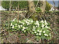
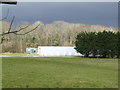
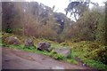
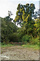
Nearby Images from Geograph Britain and Ireland:
©2007(licence)
©2007(licence)
©2009(licence)
©2018(licence)
©2009(licence)
The above images may not be of the site on this page, they are loaded from Geograph.
Please Submit an Image of this site or go out and take one for us!
Click here to see more info for this site
Nearby sites
Key: Red: member's photo, Blue: 3rd party photo, Yellow: other image, Green: no photo - please go there and take one, Grey: site destroyed
Download sites to:
KML (Google Earth)
GPX (GPS waypoints)
CSV (Garmin/Navman)
CSV (Excel)
To unlock full downloads you need to sign up as a Contributory Member. Otherwise downloads are limited to 50 sites.
Turn off the page maps and other distractions
Nearby sites listing. In the following links * = Image available
185m W 281° Caervallack Fort* Hillfort (SW7261624555)
760m WNW 290° Gear Round (Helston)* Hillfort (SW7209324805)
1.6km WSW 246° Halliggye* Souterrain (Fogou, Earth House) (SW71312394)
2.1km W 277° Mawgan in Meneage* Standing Stone (Menhir) (SW7071524869)
3.0km S 183° Goonhilly tumuli* Round Barrow(s) (SW725215)
3.4km S 182° Dry Tree Menhir* Standing Stone (Menhir) (SW72562116)
3.5km WSW 252° Polwyn Round Ancient Village or Settlement (SW694236)
3.5km E 81° Manaccan Well* Holy Well or Sacred Spring (SW763249)
3.5km WSW 246° Kaledna Round Ancient Village or Settlement (SW695232)
3.5km SSE 161° Traboe Barrow Cemetery* Barrow Cemetery (SW7378321099)
3.9km NW 323° Tolvan* Holed Stone (SW70622770)
4.0km E 93° Boden Fogou* Souterrain (Fogou, Earth House) (SW768241)
4.1km SSW 192° Bochym Tumuli* Barrow Cemetery (SW71762056)
4.3km WSW 247° Treloskan Round Ancient Village or Settlement (SW688230)
4.6km N 3° Tolmen Stone (Constantine) Burial Chamber or Dolmen (SW7326429059)
5.1km S 178° Croft Pascoe Forrest Barrows* Barrow Cemetery (SW7273819434)
5.2km SSW 194° Goonhilly Downs Kerb Cairn* Barrow Cemetery (SW71331951)
5.3km SSW 199° Carn Maer Tumuli* Barrow Cemetery (SW70861954)
5.3km ESE 103° Roskruge Beacon* Round Barrow(s) (SW7796623106)
5.4km NNW 332° Merther Euny* Holy Well or Sacred Spring (SW70422939)
5.5km ENE 76° St Anthony in Meneage Cross* Ancient Cross (SW782256)
5.5km N 358° Piskey’s Hall – The Fairy’s Fogou* Souterrain (Fogou, Earth House) (SW72803003)
5.5km SW 214° Clahar Tumulus* Cairn (SW69502007)
5.6km ENE 75° St Anthony's Well (St Anthony-in-Meneag)* Holy Well or Sacred Spring (SW783257)
5.8km SE 142° Three Brothers of Grugith* Burial Chamber or Dolmen (SW76161978)
View more nearby sites and additional images


 We would like to know more about this location. Please feel free to add a brief description and any relevant information in your own language.
 Wir möchten mehr über diese Stätte erfahren. Bitte zögern Sie nicht, eine kurze Beschreibung und relevante Informationen in Deutsch hinzuzufügen.
 Nous aimerions en savoir encore un peu sur les lieux. S'il vous plaît n'hesitez pas à ajouter une courte description et tous les renseignements pertinents dans votre propre langue.
 Quisieramos informarnos un poco más de las lugares. No dude en añadir una breve descripción y otros datos relevantes en su propio idioma.