


<< Our Photo Pages >> Croft Pascoe Forrest Barrows - Barrow Cemetery in England in Cornwall
Submitted by dooclay on Monday, 12 June 2023 Page Views: 270
Neolithic and Bronze AgeSite Name: Croft Pascoe Forrest Barrows Alternative Name: Goonhilly DownsCountry: England County: Cornwall Type: Barrow Cemetery
Nearest Village: Garras
Map Ref: SW7273819434
Latitude: 50.031578N Longitude: 5.17469W
Condition:
| 5 | Perfect |
| 4 | Almost Perfect |
| 3 | Reasonable but with some damage |
| 2 | Ruined but still recognisable as an ancient site |
| 1 | Pretty much destroyed, possibly visible as crop marks |
| 0 | No data. |
| -1 | Completely destroyed |
| 5 | Superb |
| 4 | Good |
| 3 | Ordinary |
| 2 | Not Good |
| 1 | Awful |
| 0 | No data. |
| 5 | Can be driven to, probably with disabled access |
| 4 | Short walk on a footpath |
| 3 | Requiring a bit more of a walk |
| 2 | A long walk |
| 1 | In the middle of nowhere, a nightmare to find |
| 0 | No data. |
| 5 | co-ordinates taken by GPS or official recorded co-ordinates |
| 4 | co-ordinates scaled from a detailed map |
| 3 | co-ordinates scaled from a bad map |
| 2 | co-ordinates of the nearest village |
| 1 | co-ordinates of the nearest town |
| 0 | no data |
Internal Links:
External Links:
")
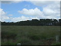
HER Number: 10713, This is a bowl barrow 25m in diameter and 1.6m high. The barrow has a slight pit on top and three small pits in the sides. The barrow is covered in gorse and has been surveyed at 1:2500 by the OS.
HER Number: 10712.01 Mentions a modern gun position on a Barrow - which is only mentioned incidentally.
You may be viewing yesterday's version of this page. To see the most up to date information please register for a free account.
")
Do not use the above information on other web sites or publications without permission of the contributor.
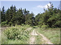
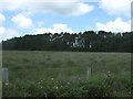
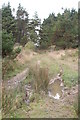
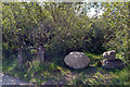
Nearby Images from Geograph Britain and Ireland:
©2006(licence)
©2017(licence)
©2009(licence)
©2020(licence)
©2017(licence)
The above images may not be of the site on this page, they are loaded from Geograph.
Please Submit an Image of this site or go out and take one for us!
Click here to see more info for this site
Nearby sites
Key: Red: member's photo, Blue: 3rd party photo, Yellow: other image, Green: no photo - please go there and take one, Grey: site destroyed
Download sites to:
KML (Google Earth)
GPX (GPS waypoints)
CSV (Garmin/Navman)
CSV (Excel)
To unlock full downloads you need to sign up as a Contributory Member. Otherwise downloads are limited to 50 sites.
Turn off the page maps and other distractions
Nearby sites listing. In the following links * = Image available
1.4km W 271° Goonhilly Downs Kerb Cairn* Barrow Cemetery (SW71331951)
1.5km NW 317° Bochym Tumuli* Barrow Cemetery (SW71762056)
1.7km SSE 159° Goonhilly Downs Barrows* Barrow Cemetery (SW73261786)
1.7km N 352° Dry Tree Menhir* Standing Stone (Menhir) (SW72562116)
1.9km W 271° Carn Maer Tumuli* Barrow Cemetery (SW70861954)
2.0km NNE 30° Traboe Barrow Cemetery* Barrow Cemetery (SW7378321099)
2.1km N 351° Goonhilly tumuli* Round Barrow(s) (SW725215)
3.3km W 279° Clahar Tumulus* Cairn (SW69502007)
3.4km WSW 246° Penhale Barrow 2* Round Barrow(s) (SW69601821)
3.4km WSW 249° Penhale Enclosure Misc. Earthwork (SW69511833)
3.4km SE 138° Poldowrian Round House* Ancient Village or Settlement (SW749168)
3.4km E 82° Three Brothers of Grugith* Burial Chamber or Dolmen (SW76161978)
3.5km S 191° Treal Barrows* Barrow Cemetery (SW71921605)
3.5km WSW 247° Penhale Barrow 3* Round Barrow(s) (SW69421822)
3.8km WSW 246° Penhale Barrow 1* Round Barrow(s) (SW69231806)
3.8km SW 235° Ponson Joppa Barrow Round Barrow(s) (SW69531736)
3.9km WSW 240° North Predannack Downs Barrow* Round Barrow(s) (SW69281767)
3.9km SW 231° Hayle Kimbro Pool Barrow* Round Barrow(s) (SW69591711)
4.0km SE 134° Carrick Luz* Promontory Fort / Cliff Castle (SW755165)
4.1km S 180° Carleon Stone Circle* Stone Circle (SW72551535)
4.2km E 90° Tide Rock* Rock Outcrop (SW76921923)
4.4km SW 223° Hyrven* Standing Stone (Menhir) (SW696164)
4.4km SW 222° St Helena Barrow Round Barrow(s) (SW69661632)
4.6km SSW 213° Moyle's Burrow* Round Barrow(s) (SW70051569)
4.6km E 82° St Keverne Beacon Tumulus* Chambered Cairn (SW77361987)
View more nearby sites and additional images


 We would like to know more about this location. Please feel free to add a brief description and any relevant information in your own language.
 Wir möchten mehr über diese Stätte erfahren. Bitte zögern Sie nicht, eine kurze Beschreibung und relevante Informationen in Deutsch hinzuzufügen.
 Nous aimerions en savoir encore un peu sur les lieux. S'il vous plaît n'hesitez pas à ajouter une courte description et tous les renseignements pertinents dans votre propre langue.
 Quisieramos informarnos un poco más de las lugares. No dude en añadir una breve descripción y otros datos relevantes en su propio idioma.