 with our Megalithic Portal iPhone app")

<< Our Photo Pages >> Penhale Barrow 1 - Round Barrow(s) in England in Cornwall
Submitted by coldrum on Wednesday, 06 July 2011 Page Views: 2265
Neolithic and Bronze AgeSite Name: Penhale Barrow 1Country: England County: Cornwall Type: Round Barrow(s)
Nearest Town: Falmouth Nearest Village: Mullion
Map Ref: SW69231806
Latitude: 50.017890N Longitude: 5.222766W
Condition:
| 5 | Perfect |
| 4 | Almost Perfect |
| 3 | Reasonable but with some damage |
| 2 | Ruined but still recognisable as an ancient site |
| 1 | Pretty much destroyed, possibly visible as crop marks |
| 0 | No data. |
| -1 | Completely destroyed |
| 5 | Superb |
| 4 | Good |
| 3 | Ordinary |
| 2 | Not Good |
| 1 | Awful |
| 0 | No data. |
| 5 | Can be driven to, probably with disabled access |
| 4 | Short walk on a footpath |
| 3 | Requiring a bit more of a walk |
| 2 | A long walk |
| 1 | In the middle of nowhere, a nightmare to find |
| 0 | No data. |
| 5 | co-ordinates taken by GPS or official recorded co-ordinates |
| 4 | co-ordinates scaled from a detailed map |
| 3 | co-ordinates scaled from a bad map |
| 2 | co-ordinates of the nearest village |
| 1 | co-ordinates of the nearest town |
| 0 | no data |
Internal Links:
External Links:
")
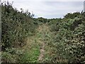
An extensively damaged bowl barrow approximately 24.0 metres in
diameter and up to 0.8 metres high. The centre and the east side of
the mound have been dug away. Gorse covered.
Source: Pastscape
You may be viewing yesterday's version of this page. To see the most up to date information please register for a free account.
")
")
Do not use the above information on other web sites or publications without permission of the contributor.
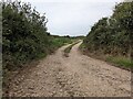
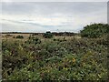
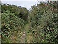
Nearby Images from Geograph Britain and Ireland:
©2024(licence)
©2024(licence)
©2024(licence)
©2024(licence)
©2024(licence)
The above images may not be of the site on this page, they are loaded from Geograph.
Please Submit an Image of this site or go out and take one for us!
Click here to see more info for this site
Nearby sites
Key: Red: member's photo, Blue: 3rd party photo, Yellow: other image, Green: no photo - please go there and take one, Grey: site destroyed
Download sites to:
KML (Google Earth)
GPX (GPS waypoints)
CSV (Garmin/Navman)
CSV (Excel)
To unlock full downloads you need to sign up as a Contributory Member. Otherwise downloads are limited to 50 sites.
Turn off the page maps and other distractions
Nearby sites listing. In the following links * = Image available
248m NE 47° Penhale Barrow 3* Round Barrow(s) (SW69421822)
388m NE 43° Penhale Enclosure Misc. Earthwork (SW69511833)
393m S 170° North Predannack Downs Barrow* Round Barrow(s) (SW69281767)
398m ENE 65° Penhale Barrow 2* Round Barrow(s) (SW69601821)
761m SSE 154° Ponson Joppa Barrow Round Barrow(s) (SW69531736)
1.0km SSE 157° Hayle Kimbro Pool Barrow* Round Barrow(s) (SW69591711)
1.7km SSE 165° Hyrven* Standing Stone (Menhir) (SW696164)
1.7km NW 308° Mullion Cross* Ancient Cross (SW67901919)
1.8km SSE 164° St Helena Barrow Round Barrow(s) (SW69661632)
2.0km N 5° Clahar Tumulus* Cairn (SW69502007)
2.2km WSW 253° The Lizard National Nature Reserve Tumulus* Barrow Cemetery (SW671175)
2.2km NE 45° Carn Maer Tumuli* Barrow Cemetery (SW70861954)
2.4km WSW 242° Predannack Cross* Ancient Cross (SW6705217034)
2.5km SSE 158° Moyle's Burrow* Round Barrow(s) (SW70051569)
2.5km NE 53° Goonhilly Downs Kerb Cairn* Barrow Cemetery (SW71331951)
3.1km WNW 304° Angrouse Fogou Souterrain (Fogou, Earth House) (SW667199)
3.3km SE 124° Treal Barrows* Barrow Cemetery (SW71921605)
3.4km S 182° Kynance Downs Round Barrow(s) (SW68951468)
3.6km NE 43° Bochym Tumuli* Barrow Cemetery (SW71762056)
3.6km NNW 332° Cury Cross* Ancient Cross (SW677213)
3.7km NW 305° Trewoon Barrows* Round Barrow(s) (SW663203)
3.8km ENE 66° Croft Pascoe Forrest Barrows* Barrow Cemetery (SW7273819434)
3.9km SSW 211° Vellon Head* Ancient Village or Settlement (SW67081478)
4.0km E 90° Goonhilly Downs Barrows* Barrow Cemetery (SW73261786)
4.1km NW 304° Gunwalloe Cliff Castle* Promontory Fort / Cliff Castle (SW65952050)
View more nearby sites and additional images


 We would like to know more about this location. Please feel free to add a brief description and any relevant information in your own language.
 Wir möchten mehr über diese Stätte erfahren. Bitte zögern Sie nicht, eine kurze Beschreibung und relevante Informationen in Deutsch hinzuzufügen.
 Nous aimerions en savoir encore un peu sur les lieux. S'il vous plaît n'hesitez pas à ajouter une courte description et tous les renseignements pertinents dans votre propre langue.
 Quisieramos informarnos un poco más de las lugares. No dude en añadir una breve descripción y otros datos relevantes en su propio idioma.