
, Aubrey Burl")
<< Text Pages >> Treloskan Round - Ancient Village or Settlement in England in Cornwall
Submitted by coldrum on Monday, 06 July 2009 Page Views: 2475
Multi-periodSite Name: Treloskan RoundCountry: England County: Cornwall Type: Ancient Village or Settlement
Nearest Village: Garras
Map Ref: SW688230
Latitude: 50.062082N Longitude: 5.231738W
Condition:
| 5 | Perfect |
| 4 | Almost Perfect |
| 3 | Reasonable but with some damage |
| 2 | Ruined but still recognisable as an ancient site |
| 1 | Pretty much destroyed, possibly visible as crop marks |
| 0 | No data. |
| -1 | Completely destroyed |
| 5 | Superb |
| 4 | Good |
| 3 | Ordinary |
| 2 | Not Good |
| 1 | Awful |
| 0 | No data. |
| 5 | Can be driven to, probably with disabled access |
| 4 | Short walk on a footpath |
| 3 | Requiring a bit more of a walk |
| 2 | A long walk |
| 1 | In the middle of nowhere, a nightmare to find |
| 0 | No data. |
| 5 | co-ordinates taken by GPS or official recorded co-ordinates |
| 4 | co-ordinates scaled from a detailed map |
| 3 | co-ordinates scaled from a bad map |
| 2 | co-ordinates of the nearest village |
| 1 | co-ordinates of the nearest town |
| 0 | no data |
Be the first person to rate this site - see the 'Contribute!' box in the right hand menu.
Internal Links:
External Links:
I have visited· I would like to visit
lucasn visited on 15th Apr 2019 - their rating: Cond: 2 Amb: 3 Access: 4
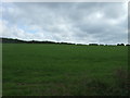
The earthwork remains of an Iron Age round.
Pastscape entry:
http://www.pastscape.org.uk/hob.aspx?hob_id=425575
You may be viewing yesterday's version of this page. To see the most up to date information please register for a free account.
Do not use the above information on other web sites or publications without permission of the contributor.
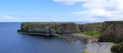
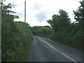
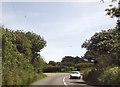
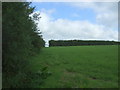
Nearby Images from Geograph Britain and Ireland:
©2017(licence)
©2014(licence)
©2017(licence)
©2017(licence)
©2019(licence)
The above images may not be of the site on this page, they are loaded from Geograph.
Please Submit an Image of this site or go out and take one for us!
Click here to see more info for this site
Nearby sites
Key: Red: member's photo, Blue: 3rd party photo, Yellow: other image, Green: no photo - please go there and take one, Grey: site destroyed
Download sites to:
KML (Google Earth)
GPX (GPS waypoints)
CSV (Garmin/Navman)
CSV (Excel)
To unlock full downloads you need to sign up as a Contributory Member. Otherwise downloads are limited to 50 sites.
Turn off the page maps and other distractions
Nearby sites listing. In the following links * = Image available
726m ENE 72° Kaledna Round Ancient Village or Settlement (SW695232)
847m NE 42° Polwyn Round Ancient Village or Settlement (SW694236)
1.9km W 261° Burnow Round Ancient Village or Settlement (SW669228)
2.0km SSW 210° Cury Cross* Ancient Cross (SW677213)
2.7km NE 43° Mawgan in Meneage* Standing Stone (Menhir) (SW7071524869)
2.7km ENE 67° Halliggye* Souterrain (Fogou, Earth House) (SW71312394)
3.0km SSE 164° Clahar Tumulus* Cairn (SW69502007)
3.7km SW 220° Trewoon Barrows* Round Barrow(s) (SW663203)
3.7km SW 227° Gunwalloe Wayside Cross* Ancient Cross (SW660206)
3.7km SSW 212° Angrouse Fogou Souterrain (Fogou, Earth House) (SW667199)
3.7km ENE 59° Gear Round (Helston)* Hillfort (SW7209324805)
3.8km SW 226° Gunwalloe Cliff Castle* Promontory Fort / Cliff Castle (SW65952050)
3.8km SE 127° Bochym Tumuli* Barrow Cemetery (SW71762056)
3.9km S 191° Mullion Cross* Ancient Cross (SW67901919)
4.0km ESE 110° Goonhilly tumuli* Round Barrow(s) (SW725215)
4.0km WSW 238° Halzephron Barrows* Round Barrow(s) (SW653210)
4.0km SSE 147° Carn Maer Tumuli* Barrow Cemetery (SW70861954)
4.1km ENE 65° Caervallack Fort* Hillfort (SW7261624555)
4.2km ESE 114° Dry Tree Menhir* Standing Stone (Menhir) (SW72562116)
4.3km ENE 67° Caervallack Holy Well Holy Well or Sacred Spring (SW7279724512)
4.3km SE 142° Goonhilly Downs Kerb Cairn* Barrow Cemetery (SW71331951)
4.7km S 169° Penhale Enclosure Misc. Earthwork (SW69511833)
4.8km S 170° Penhale Barrow 3* Round Barrow(s) (SW69421822)
4.9km SSE 168° Penhale Barrow 2* Round Barrow(s) (SW69601821)
5.0km S 173° Penhale Barrow 1* Round Barrow(s) (SW69231806)
View more nearby sites and additional images


 We would like to know more about this location. Please feel free to add a brief description and any relevant information in your own language.
 Wir möchten mehr über diese Stätte erfahren. Bitte zögern Sie nicht, eine kurze Beschreibung und relevante Informationen in Deutsch hinzuzufügen.
 Nous aimerions en savoir encore un peu sur les lieux. S'il vous plaît n'hesitez pas à ajouter une courte description et tous les renseignements pertinents dans votre propre langue.
 Quisieramos informarnos un poco más de las lugares. No dude en añadir una breve descripción y otros datos relevantes en su propio idioma.