<< Our Photo Pages >> Dinas Dinlle - Hillfort in Wales in Gwynedd

Submitted by w650marion on Tuesday, 26 July 2022  Page Views: 26843

Iron Age and Later PrehistorySite Name: Dinas Dinlle
Country: Wales County: Gwynedd Type: Hillfort
Nearest Town: Caernarfon  Nearest Village: Llandwrog
Map Ref: SH437563  Landranger Map Number: 115
Latitude: 53.080982N  Longitude: 4.33493W
Condition:
5Perfect
4Almost Perfect
3Reasonable but with some damage
2Ruined but still recognisable as an ancient site
1Pretty much destroyed, possibly visible as crop marks
0No data.
-1Completely destroyed
3 Ambience:
5Superb
4Good
3Ordinary
2Not Good
1Awful
0No data.
4 Access:
5Can be driven to, probably with disabled access
4Short walk on a footpath
3Requiring a bit more of a walk
2A long walk
1In the middle of nowhere, a nightmare to find
0No data.
5 Accuracy:
5co-ordinates taken by GPS or official recorded co-ordinates
4co-ordinates scaled from a detailed map
3co-ordinates scaled from a bad map
2co-ordinates of the nearest village
1co-ordinates of the nearest town
0no data
4

Internal Links:
External Links:

I have visited· I would like to visit

bishop_pam visited on 4th Sep 2022 - their rating: Cond: 4 Amb: 5 Access: 3

cactus_chris visited on 9th Aug 2022 - their rating: Cond: 4 Amb: 5 Access: 3

Letsleap visited on 23rd Jul 2017 - their rating: Cond: 3 Amb: 4 Access: 4 Members of my family have lived here, at the foot of the northern most access point for the past 35 years. I now live here.

w650marion h_fenton TimPrevett AngieLake nicoladidsbury MartinRS have visited here

Average ratings for this site from all visit loggers: Condition: 3.67 Ambience: 4.67 Access: 3.33

Dinas Dinlle
Dinas Dinlle submitted by Postman : Looking over the ramparts (Vote or comment on this photo)
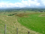
This fort next to the sea was originally defended by a double bank with an entrance to the south-east. There are a number of depressions in the interior where huts once stood as well as a badly damaged mound which could be the remains of a round barrow.

Page originally by Vicky

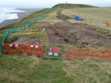
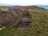
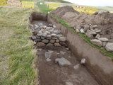
Note: Dinas Dinlle Hillfort Open Day, Saturday July 30th, photos are from last year's excavation showing opposing massive walls of the huge roundhouse there
You may be viewing yesterday's version of this page. To see the most up to date information please register for a free account.

Dinas Dinlle
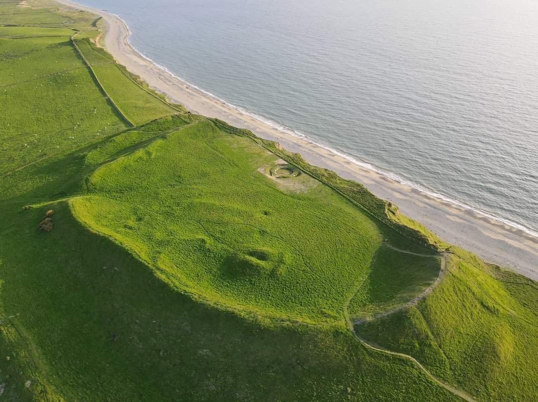
Dinas Dinlle submitted by TAlanJones : Dinas Dinlle from above following the Gwynedd Archaeological Trust dig in 2022. Note the large round house excavated. Photo by Paul Davies. (Vote or comment on this photo)

Dinas Dinlle
Dinas Dinlle submitted by Postman : Coastal erosion (Vote or comment on this photo)

Dinas Dinlle
Dinas Dinlle submitted by h_fenton : A Kite Aerial Photograph of Dinas Dinlle., viewed from the north. There was very little wind and it was difficult to get the camera into the air. The kite was flown here outside the operating hours of nearby Caernarfon Airport. 30 May 2010 @ 7.52pm (Vote or comment on this photo)

Dinas Dinlle
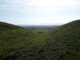
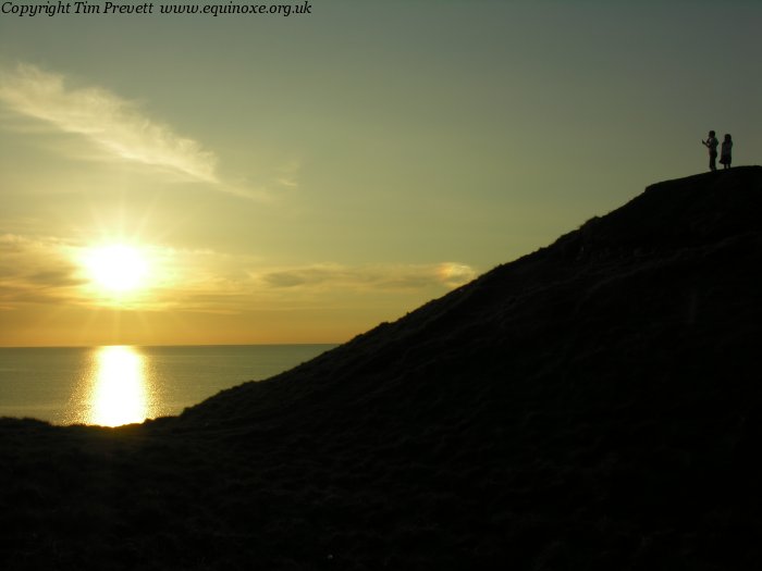
Dinas Dinlle submitted by TimPrevett : Looking west, between the southern ramparts. Notice also the refraction of the sunlight in the cloud to the right. (Vote or comment on this photo)

Dinas Dinlle
Dinas Dinlle submitted by Antonine : The fort is on the left, 2008 (1 comment - Vote or comment on this photo)

Dinas Dinlle
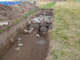
Dinas Dinlle submitted by w650marion : Looking along the northern trench from the north. This shows the two opposing massive walls of the huge roundhouse. (1 comment)

Dinas Dinlle
Dinas Dinlle submitted by Bladup : Dinas Dinlle, Showing the large ditch on the South side of the fort.

Dinas Dinlle
Dinas Dinlle submitted by raythemapman : The northern slope of the Fort from the beach.08/04/09.

Dinas Dinlle
Dinas Dinlle submitted by TimPrevett : Erosion on what is left of the western side. If you look higher up, some stratigraphy of the rampart is visible. Looking north.

Dinas Dinlle
Dinas Dinlle submitted by TimPrevett : The coastal fort of Dinas Dinlle. The western edge is steadily eroding into the sea - trying to peer at the exposed stratigraphy is a somewhat perilous pursuit! In other places, the beach pebbles making the core of the ramparts are visible. The site is a victim of its favourable position. Adjacent a family beach, a chip shop at its northern edge, and a pub or two not far away make it a very a... (1 comment)

Dinas Dinlle
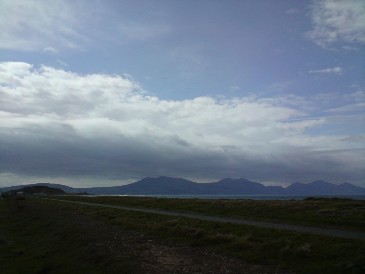
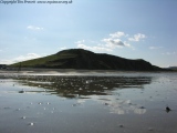
Dinas Dinlle submitted by nicoladidsbury : Dinas Dinlle Hillfort from the beach. It had rained all morning, and the clouds were just beginning to move away inland. The clouds on the horizon of the picture covered the tops of the hills Yr Efil, (the Rivals)

Dinas Dinlle
Dinas Dinlle submitted by gautrek : Looking across the fort on a baking hot summers day.

Dinas Dinlle
Dinas Dinlle submitted by gautrek : Looking across the fort on a baking hot summers day. Note the erosion on the right hand side.

Dinas Dinlle
Dinas Dinlle submitted by cactus_chris : 20220809--Hill Fort, Dinas Dinlle, Llyn Peninsuala

Dinas Dinlle
Dinas Dinlle submitted by Justfrank : Iron age /Roman round house.open day 30/07/22

Dinas Dinlle
Dinas Dinlle submitted by Antonine : The fort is on the right, through the mist, 2008

Dinas Dinlle
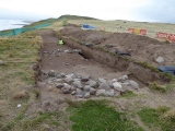
Dinas Dinlle submitted by w650marion : Overview of the excavation site on the evening of the end of the dig. Two massive trenches, and researchers from Aberystwyth Luminescence Research Laboratory are hard at work collecting sand core samples for dating, before the covering up of the stones and backfilling the following day.

Dinas Dinlle
Dinas Dinlle submitted by w650marion : Roundhouse excavation in the northern trench. Massive walls, impressively flat surface to the interior.

Dinas Dinlle
Dinas Dinlle submitted by w650marion : Northern wall of the roundhouse. Very wide (up to 2.5 meters), with a very neat interior facing.

Dinas Dinlle
Dinas Dinlle submitted by w650marion : The opposite side of the roundhouse circle wall. The stones are aligned to form a flat interior surface.

Dinas Dinlle
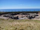
Dinas Dinlle submitted by w650marion : Southern trench. They said that the archaeologists had no idea what the stones here represent yet!

Dinas Dinlle
Dinas Dinlle submitted by Postman : A cairn in the fort?

Dinas Dinlle
Dinas Dinlle submitted by Postman : Looking through the entrance

Dinas Dinlle
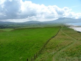
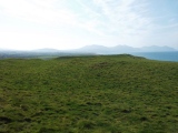
Dinas Dinlle submitted by Postman : Looking across the fort to the Rivals and the Lleyn Peninsula.

These are just the first 25 photos of Dinas Dinlle. If you log in with a free user account you will be able to see our entire collection.

Do not use the above information on other web sites or publications without permission of the contributor.
Click here to see more info for this site

Nearby sites

Click here to view sites on an interactive OS map

Key: Red: member's photo, Blue: 3rd party photo, Yellow: other image, Green: no photo - please go there and take one, Grey: site destroyed

Download sites to:
KML (Google Earth)
GPX (GPS waypoints)
CSV (Garmin/Navman)
CSV (Excel)

To unlock full downloads you need to sign up as a Contributory Member. Otherwise downloads are limited to 50 sites.


Turn off the page maps and other distractions

Nearby sites listing. In the following links * = Image available
 1.1km SSE 151° Bodfan Standing Stone* Standing Stone (Menhir) (SH4420555327)
 1.5km SE 126° Ffynnon Adliw Holy Well or Sacred Spring (SH4490155385)
 2.2km ESE 107° Glynllifon Monolith Standing Stone (Menhir) (SH4577055574)
 2.3km SSE 158° Maen Llwyd (Gwynedd)* Standing Stone (Menhir) (SH4449554155)
 2.5km SE 145° Plas Newydd Ancient Village or Settlement (SH4507954192)
 2.9km SE 143° Penbryn Mawr Standing Stone* Standing Stone (Menhir) (SH4537253927)
 3.0km ENE 59° Dinas y Prif Camp* Ancient Village or Settlement (SH4633957760)
 4.5km SSE 164° Craig-y-Dinas (Penygroes)* Hillfort (SH44825198)
 4.8km NNE 20° St Baglan's Church (Llanfaglan)* Early Christian Sculptured Stone (SH4550660714)
 4.8km SE 134° Penygroes Modern Cromlech* Burial Chamber or Dolmen (SH4708852838)
 5.1km NNE 25° Ffynnon Faglan* Holy Well or Sacred Spring (SH46016085)
 5.1km ESE 110° Pen Llwyn Farm Hut Circle Settlement* Ancient Village or Settlement (SH485544)
 5.3km ESE 107° Cae Forgan Cairn* Cairn (SH487546)
 5.3km S 186° Penarth* Chambered Tomb (SH42995107)
 5.4km SE 132° Carreg Caer Engan* Standing Stone (Menhir) (SH4762352591)
 5.4km SE 131° Caer Engan* Hillfort (SH4767052590)
 5.5km ESE 105° Cae Forgan Standing Stone* Standing Stone (Menhir) (SH490547)
 6.3km ESE 107° Mynydd Y Cilgwyn Cairn* Cairn (SH497543)
 6.5km S 184° Capel Uchaf* Early Christian Sculptured Stone (SH43044987)
 6.7km S 188° Pen y Garreg* Ancient Village or Settlement (SH426497)
 6.7km ENE 71° Gaerwen Ancient Village or Settlement (SH501583)
 7.0km SSW 197° Church of Saint Beuno (Clynnog Fawr)* Carving (SH414497)
 7.1km SSE 162° Graianog Long Mound* Misc. Earthwork (SH45634951)
 7.3km SSE 164° Graianog Standing Stone* Standing Stone (Menhir) (SH45524918)
 7.4km SSW 201° Bachwen* Burial Chamber or Dolmen (SH40774948)
View more nearby sites and additional images

<< Scorne Well

Babylon Down Tumuli >>

Please add your thoughts on this site

Neolithic Britain And Ireland

Neolithic Britain And Ireland

Sponsors

Auto-Translation (Google)

Translate from English into:

"Dinas Dinlle" | Login/Create an Account | 7 News and Comments
  
Go back to top of page    Comments are owned by the poster. We aren't responsible for their content.
Dinas Dinlle Hillfort Open Day, Saturday July 30th 2022, 10:00am - 4:00pm by Andy B on Wednesday, 13 July 2022
(User Info | Send a Message)
Dinas Dinlle Hillfort Open Day, Saturday July 30th 2022, 10:00am - 4:00pm

Come along to our open day, Saturday July 30th, 10.00am – 4.00pm. Enjoy guided tours of the site and find out about this year’s excavations.

Park at Dinas Dinlle public car park, Dinas Dinlle, Gwynedd, LL54 5TW, (free) next to beach, meeting point: behind play area. Car park is free. Guided tours involve a steep walk up the hillfort.

https://www.archaeologyuk.org/festival/festival-event-listing/diwrnod-agored-bryngaer-dinas-dinlle-dinas-dinlle-hillfort-open-day.html

#FestivalofArchaeology 2022
[ Reply to This ]

Re: Dinas Dinlle by w650marion on Wednesday, 28 August 2019
(User Info | Send a Message)
On the last evening of the 2019 dig (part of the CHERISH project) the researchers from Aberystwyth Luminescence Research Laboratory were taking core samples of sand from around the exposed stonework for luminescence dating, before the backfilling of the trenches.

They allowed us entry into the dig perimeter to photograph the trenches, and explained that the only reason that permission was given to dig the trenches, was due to the rapid erosion of this side of the fort. Not just coastal erosion, but heavy rain percolating through the sand down onto the clay layer beneath allows the fort to slide away onto the beach. It has been estimated that 30% of the fort is gone.

Permission to excavate elsewhere in the fort was not given, despite many interesting features. The mound on the north eastern part of the interior was thought to be possible Roman signal tower.

The excavated stonework was very impressive. The northern trench contained a massive iron age roundhouse, 13m diameter with 2m wide walls. The interior surface of the roundhouse walls was carefully faced with a very flat alignment of stones to make a neat vertical surface.
[ Reply to This ]

A new study of the Dinas Dinlle Coastal Fort in Gwynedd by Andy B on Wednesday, 26 September 2018
(User Info | Send a Message)
An exciting new archaeological project has begun on the impressive coastal fort of Dinas Dinlle near Caernarfon in north Wales. Early maps and the curve of the defences suggest the fort was once entirely enclosed but today part of the western defences have been lost to the sea following thousands of years of coastal erosion.

Little is known about the monument. It is thought to be late prehistoric in date and chance finds also suggest occupation in the Roman period. In the early 20th century it formed part of a golf course, whilst during the Second World War a pill box, seagull trench and observation post were constructed on the northern slopes to protect nearby RAF Llandwrog – now Caernarfon airport.

Dinas Dinlle coastal fort is owned by the National Trust. It is set on a hill of glacial drift sediments overlooking the sea and Caernarfonshire coastal plain The fort is Royal Commission’s CHERISH project starts exciting new study of the Dinas Dinlle Coastal Fort in Gwynedd Exciting new study of the Dinas Dinlle Coastal Fort in Gwynedd begins CHERISH starts exciting new study of the Dinas Dinlle Coastal Fort in Gwynedd

An exciting new archaeological project has begun on the impressive coastal fort of Dinas Dinlle near Caernarfon in north Wales. Early maps and the curve of the defences suggest the fort was once entirely enclosed but today part of the western defences have been lost to the sea following thousands of years of coastal erosion. Little is known about the monument. It is thought to be late prehistoric in date and chance finds also suggest occupation in the Roman period. In the early 20th century it formed part of a golf course, whilst during the Second World War a pill box, seagull trench and observation post were constructed on the northern slopes to protect nearby RAF Llandwrog – now Caernarfon airport.

The new research is being led by a team of archaeologists, surveyors, geographers and scientists from the European funded CHERISH - climate change and cultural heritage project. Over the next 4 years the CHERISH team will be undertaking a number of studies to record and monitor the impact of the coastal erosion and also provide a greater understanding of the fort and its environs.

Louise Barker, a senior archaeologist on the CHERISH Project said: ‘this is one of the finest coastal heritage sites in north Wales, but is threatened by active erosion. Through our work we hope to gain a better understanding of when Dinas Dinlle was built and occupied, and how much has been lost to the sea’

New survey in progress. Detailed survey using a global navigation satellite system and geophysical gradiometer survey which can detect archaeological features such as ditches and hearths to a depth of approximately 1 metre below the surface.New survey in progress. Detailed survey using a global navigation satellite system and geophysical gradiometer survey which can detect archaeological features such as ditches and hearths to a depth of approximately 1 metre below the surface.

Initial work by the CHERISH team has included new aerial photography from which it has been possible to create a 3D model of the monument and a new detailed survey to assist in the interpretation of the site by providing a greater understanding of the forts development, form and condition. CHERISH has also funded a new geophysical survey to see beneath the soil, carried out by the Gwynedd Archaeological Trust.

A 3D computer model of the eroding fort generated from aerial photography will allow archaeologists to measure the rate of coastal erosion.

A 3D computer model of the eroding fort generated from aerial photography will allow archaeologists to measure the rate of coastal erosion.

Future work will include gathering highly accurate (centimetre and sub-centimetre) 3D data to monitor the eroding cliff edge using techniques such as terrestrial laser scanning and drone survey. This will provide an

Read the rest of this post...
[ Reply to This ]

Re: Dinas Dinlle by sem on Friday, 02 June 2017
(User Info | Send a Message)
OS grid ref (Coflein) SH43705635
[ Reply to This ]

Street View by coldrum on Sunday, 21 March 2010
(User Info | Send a Message)

View Larger Map
[ Reply to This ]

Dinas Dinlle by TimPrevett on Tuesday, 01 May 2007
(User Info | Send a Message)
Spotted this aerial shot on the BBC Wales website last week

http://news.bbc.co.uk/1/hi/wales/6588835.stm
[ Reply to This ]

Re: Dinas Dinlle YouTube clip by TimPrevett on Saturday, 14 April 2007
(User Info | Send a Message)
A short clip on the beach, from last Wednesday Morning.

[ Reply to This ]

Your Name: Anonymous [ Register Now ]
Subject:


Add your comment or contribution to this page. Spam or offensive posts are deleted immediately, don't even bother

<<< What is five plus one as a number? (Please type the answer to this question in the little box on the left)
You can also embed videos and other things. For Youtube please copy and paste the 'embed code'.
For Google Street View please include Street View in the text.
Create a web link like this: <a href="https://www.megalithic.co.uk">This is a link</a>  

Allowed HTML is:
<p> <b> <i> <a> <img> <em> <br> <strong> <blockquote> <tt> <li> <ol> <ul> <object> <param> <embed> <iframe>

We would like to know more about this location. Please feel free to add a brief description and any relevant information in your own language.
Wir möchten mehr über diese Stätte erfahren. Bitte zögern Sie nicht, eine kurze Beschreibung und relevante Informationen in Deutsch hinzuzufügen.
Nous aimerions en savoir encore un peu sur les lieux. S'il vous plaît n'hesitez pas à ajouter une courte description et tous les renseignements pertinents dans votre propre langue.
Quisieramos informarnos un poco más de las lugares. No dude en añadir una breve descripción y otros datos relevantes en su propio idioma.