<< Our Photo Pages >> St. Conal's Well - Holy Well or Sacred Spring in Scotland in Dumfries and Galloway
Submitted by Enki on Monday, 05 September 2016 Page Views: 3325
Springs and Holy WellsSite Name: St. Conal's Well Alternative Name: St. Connel's WellCountry: Scotland
NOTE: This site is 3.864 km away from the location you searched for.
County: Dumfries and Galloway Type: Holy Well or Sacred Spring
Nearest Town: Kirkconnel
Map Ref: NX75399508
Latitude: 55.234143N Longitude: 3.961035W
Condition:
| 5 | Perfect |
| 4 | Almost Perfect |
| 3 | Reasonable but with some damage |
| 2 | Ruined but still recognisable as an ancient site |
| 1 | Pretty much destroyed, possibly visible as crop marks |
| 0 | No data. |
| -1 | Completely destroyed |
| 5 | Superb |
| 4 | Good |
| 3 | Ordinary |
| 2 | Not Good |
| 1 | Awful |
| 0 | No data. |
| 5 | Can be driven to, probably with disabled access |
| 4 | Short walk on a footpath |
| 3 | Requiring a bit more of a walk |
| 2 | A long walk |
| 1 | In the middle of nowhere, a nightmare to find |
| 0 | No data. |
| 5 | co-ordinates taken by GPS or official recorded co-ordinates |
| 4 | co-ordinates scaled from a detailed map |
| 3 | co-ordinates scaled from a bad map |
| 2 | co-ordinates of the nearest village |
| 1 | co-ordinates of the nearest town |
| 0 | no data |
Internal Links:
External Links:
I have visited· I would like to visit
Enki has visited here
")
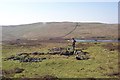
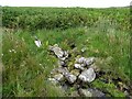
St. Conal/Connel's well. A lovely sacred spring at the foot of the Nithsdale hills above Kirkconnel. The well overlooks the ruinous site of St. Connel's Kirk and has a bas-relief sculpture of the saint that was added in recent times.
Take the minor single-track road just west of the church north towards Kirkland. There is a small parking area on the right at the start of a wooded area. Walk along track from there to Vennel Farm following signposts for St. Connel's Kirk. When the path crosses a burn, follow the west bank northwards and turn west at the end of the enclosed field. The well is marked by a rock outcropping above the well-head.
For more information see Canmore ID 64793 which records the chapel as originally consisting of two enclosures separated by a track; by 1977 there was only one enclosure, with the well being 'a prolific spring', 50 metres from the chapel enclosure and with no obvious association.
You may be viewing yesterday's version of this page. To see the most up to date information please register for a free account.
Do not use the above information on other web sites or publications without permission of the contributor.
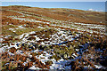
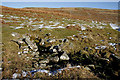
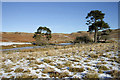
Nearby Images from Geograph Britain and Ireland:
©2007(licence)
©2010(licence)
©2023(licence)
©2010(licence)
©2010(licence)
The above images may not be of the site on this page, they are loaded from Geograph.
Please Submit an Image of this site or go out and take one for us!
Click here to see more info for this site
Nearby sites
Key: Red: member's photo, Blue: 3rd party photo, Yellow: other image, Green: no photo - please go there and take one, Grey: site destroyed
Download sites to:
KML (Google Earth)
GPX (GPS waypoints)
CSV (Garmin/Navman)
CSV (Excel)
To unlock full downloads you need to sign up as a Contributory Member. Otherwise downloads are limited to 50 sites.
Turn off the page maps and other distractions
Nearby sites listing. In the following links * = Image available
6.7km E 98° Tynron Doon* Hillfort (NX8197093927)
7.1km E 88° Grennan Hill Hillfort (NX82549507)
7.4km ENE 69° Honeyhole White Cairn* Cairn (NX82389757)
7.6km SE 131° Glencairn Cursus Cursus (NX80948993)
8.6km SSW 198° Hole Stone (Blackmark)* Standing Stone (Menhir) (NX72568698)
8.6km S 184° Physic Well (Balmaclellan) Holy Well or Sacred Spring (NX7452586502)
8.8km ESE 105° Capenoch Cairn (NX8385092608)
9.5km WSW 256° Stellhead N* Cairn (NX66089297)
9.6km WSW 255° Stellhead S* Cairn (NX66059285)
10.7km WSW 256° Chalybeate Well (Dalry)* Holy Well or Sacred Spring (NX6488792815)
11.0km W 260° Round Craigs* Cairn (NX64519355)
11.1km E 81° Penpont Cursus Cursus (NX86409658)
11.3km SSW 206° Spa Well (Dalry) Holy Well or Sacred Spring (NX7009385098)
11.3km WNW 292° Mungo's Well (Carsphairn) Holy Well or Sacred Spring (NX6492799555)
11.5km E 86° Nith Bridge Cross* Ancient Cross (NX8689095471)
11.8km SE 142° West Skelston White Cairn* Cairn (NX82358551)
11.9km WSW 251° Stroanfreggan Cairn* Cairn (NX64019142)
12.0km WSW 254° Stroanfreggan Craig* Hillfort (NX63709206)
12.3km E 94° Templand Mains* Standing Stone (Menhir) (NX87719396)
12.4km WSW 253° Smittons Bridge* Cairn (NX63409188)
12.6km SE 126° Fleuchlarg White Cairn* Chambered Cairn (NX85438734)
13.4km SE 141° Glenesslin Schoolhouse* Cairn (NX83488433)
13.8km SSW 210° Corriedoo* Cairn (NX6814083327)
14.3km SE 135° White Cairn, Gilmerston Cairn (NX853847)
14.8km ENE 64° Mary's Well (East Morton) Holy Well or Sacred Spring (NS88870123)
View more nearby sites and additional images


 We would like to know more about this location. Please feel free to add a brief description and any relevant information in your own language.
 Wir möchten mehr über diese Stätte erfahren. Bitte zögern Sie nicht, eine kurze Beschreibung und relevante Informationen in Deutsch hinzuzufügen.
 Nous aimerions en savoir encore un peu sur les lieux. S'il vous plaît n'hesitez pas à ajouter une courte description et tous les renseignements pertinents dans votre propre langue.
 Quisieramos informarnos un poco más de las lugares. No dude en añadir una breve descripción y otros datos relevantes en su propio idioma.