<< Our Photo Pages >> Fleuchlarg White Cairn - Chambered Cairn in Scotland in Dumfries and Galloway
Submitted by markj99 on Monday, 06 April 2020 Page Views: 900
Neolithic and Bronze AgeSite Name: Fleuchlarg White CairnCountry: Scotland County: Dumfries and Galloway Type: Chambered Cairn
Nearest Town: Dumfries Nearest Village: Dunscore
Map Ref: NX85438734
Latitude: 55.167061N Longitude: 3.800107W
Condition:
| 5 | Perfect |
| 4 | Almost Perfect |
| 3 | Reasonable but with some damage |
| 2 | Ruined but still recognisable as an ancient site |
| 1 | Pretty much destroyed, possibly visible as crop marks |
| 0 | No data. |
| -1 | Completely destroyed |
| 5 | Superb |
| 4 | Good |
| 3 | Ordinary |
| 2 | Not Good |
| 1 | Awful |
| 0 | No data. |
| 5 | Can be driven to, probably with disabled access |
| 4 | Short walk on a footpath |
| 3 | Requiring a bit more of a walk |
| 2 | A long walk |
| 1 | In the middle of nowhere, a nightmare to find |
| 0 | No data. |
| 5 | co-ordinates taken by GPS or official recorded co-ordinates |
| 4 | co-ordinates scaled from a detailed map |
| 3 | co-ordinates scaled from a bad map |
| 2 | co-ordinates of the nearest village |
| 1 | co-ordinates of the nearest town |
| 0 | no data |
Internal Links:
External Links:
")
Fleucharg Long Cairn has certainly been abused over the millennia, most probably in the last centuries. However, it is still a significant presence in the landscape worth visiting.
It was archaeologically excavated in 1937. Canmore ID 65063 states it "measures 150 ft NNE-SSW by 44 ft across the N end and 85 ft some 25 ft from the S end, and has a maximum height of 14 ft."
Of particular note was "a setting of three boulders, possibly part of a kerb" according to Canmore ID 65063.
There are also large voids in the cairn due to stone robbing.
It is identified as a White Cairn in OS 1:50k maps.
You may be viewing yesterday's version of this page. To see the most up to date information please register for a free account.
")
")
")
Do not use the above information on other web sites or publications without permission of the contributor.
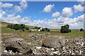
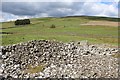
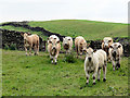
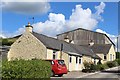
Nearby Images from Geograph Britain and Ireland:
©2014(licence)
©2014(licence)

©2007(licence)
©2007(licence)
©2014(licence)
The above images may not be of the site on this page, they are loaded from Geograph.
Please Submit an Image of this site or go out and take one for us!
Click here to see more info for this site
Nearby sites
Key: Red: member's photo, Blue: 3rd party photo, Yellow: other image, Green: no photo - please go there and take one, Grey: site destroyed
Download sites to:
KML (Google Earth)
GPX (GPS waypoints)
CSV (Garmin/Navman)
CSV (Excel)
To unlock full downloads you need to sign up as a Contributory Member. Otherwise downloads are limited to 50 sites.
Turn off the page maps and other distractions
Nearby sites listing. In the following links * = Image available
2.6km S 181° White Cairn, Gilmerston Cairn (NX853847)
3.6km WSW 238° West Skelston White Cairn* Cairn (NX82358551)
3.6km SSW 211° Glenesslin Schoolhouse* Cairn (NX83488433)
5.0km SE 126° Springfield Hill Hillfort (NX89448431)
5.2km WNW 299° Glencairn Cursus Cursus (NX80948993)
5.3km NE 50° Kirkpatrick Hill (Closeburn) Holy Well or Sacred Spring (NX896906)
5.5km NNW 342° Capenoch Cairn (NX8385092608)
6.1km NE 51° My Lady's Well (Brownhill) Holy Well or Sacred Spring (NX90279100)
6.7km ESE 107° Temple Wood (Dunscore)* Modern Stone Circle etc (NX91848522)
7.0km NNE 17° Templand Mains* Standing Stone (Menhir) (NX87719396)
7.4km NNW 331° Tynron Doon* Hillfort (NX8197093927)
8.2km NNW 338° Grennan Hill Hillfort (NX82549507)
8.3km N 9° Nith Bridge Cross* Ancient Cross (NX8689095471)
9.3km N 5° Penpont Cursus Cursus (NX86409658)
9.4km SE 145° Hall Hill* Hillfort (NX90597949)
9.5km SE 139° Holywood Cursus Cursus (NX91558004)
9.8km SSE 167° Angel Well (Barnsoul) Holy Well or Sacred Spring (NX87337770)
10.5km S 170° The Doons* Hillfort (NX86987699)
10.6km E 94° Clonfeckle Cairn (NX960863)
10.7km NNW 342° Honeyhole White Cairn* Cairn (NX82389757)
10.9km W 264° Physic Well (Balmaclellan) Holy Well or Sacred Spring (NX7452586502)
11.9km ESE 111° Kirkmahoe Cursus Cursus (NX96508286)
12.0km SE 125° Holywood B Cursus Cursus (NX951802)
12.0km SE 127° Holywood B Cursus Cursus (NX949799)
12.0km SE 127° Holywood A Cursus Cursus (NX94857979)
View more nearby sites and additional images


 We would like to know more about this location. Please feel free to add a brief description and any relevant information in your own language.
 Wir möchten mehr über diese Stätte erfahren. Bitte zögern Sie nicht, eine kurze Beschreibung und relevante Informationen in Deutsch hinzuzufügen.
 Nous aimerions en savoir encore un peu sur les lieux. S'il vous plaît n'hesitez pas à ajouter une courte description et tous les renseignements pertinents dans votre propre langue.
 Quisieramos informarnos un poco más de las lugares. No dude en añadir una breve descripción y otros datos relevantes en su propio idioma.