<< Our Photo Pages >> Glenesslin Schoolhouse - Cairn in Scotland in Dumfries and Galloway
Submitted by markj99 on Thursday, 19 November 2020 Page Views: 613
Neolithic and Bronze AgeSite Name: Glenesslin SchoolhouseCountry: Scotland County: Dumfries and Galloway Type: Cairn
Nearest Town: Dumfries Nearest Village: Dunscore
Map Ref: NX83488433
Latitude: 55.139572N Longitude: 3.829464W
Condition:
| 5 | Perfect |
| 4 | Almost Perfect |
| 3 | Reasonable but with some damage |
| 2 | Ruined but still recognisable as an ancient site |
| 1 | Pretty much destroyed, possibly visible as crop marks |
| 0 | No data. |
| -1 | Completely destroyed |
| 5 | Superb |
| 4 | Good |
| 3 | Ordinary |
| 2 | Not Good |
| 1 | Awful |
| 0 | No data. |
| 5 | Can be driven to, probably with disabled access |
| 4 | Short walk on a footpath |
| 3 | Requiring a bit more of a walk |
| 2 | A long walk |
| 1 | In the middle of nowhere, a nightmare to find |
| 0 | No data. |
| 5 | co-ordinates taken by GPS or official recorded co-ordinates |
| 4 | co-ordinates scaled from a detailed map |
| 3 | co-ordinates scaled from a bad map |
| 2 | co-ordinates of the nearest village |
| 1 | co-ordinates of the nearest town |
| 0 | no data |
Internal Links:
External Links:
")
The cairn is listed as Canmore ID 74892.
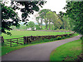
Directions: From the centre of Dunscore take Kirkgate which leads onto Black Brae at the outskirts of Dunscore. Keep on Black Brae for 1.5 miles then take a R turn to Corsock after a row of cottages. Go through a crossroads after 0.6 miles, continue straight for 500 yards until there is a narrow wood on your L just before a dead end R turn at Glenesslin Schoolhouse. The cairn is in the wood 50 yards back from the junction.
You may be viewing yesterday's version of this page. To see the most up to date information please register for a free account.
")
Do not use the above information on other web sites or publications without permission of the contributor.
Nearby Images from Geograph Britain and Ireland:
©2005(licence)
©2017(licence)
©2018(licence)
©2013(licence)
©2007(licence)
The above images may not be of the site on this page, they are loaded from Geograph.
Please Submit an Image of this site or go out and take one for us!
Click here to see more info for this site
Nearby sites
Key: Red: member's photo, Blue: 3rd party photo, Yellow: other image, Green: no photo - please go there and take one, Grey: site destroyed
Download sites to:
KML (Google Earth)
GPX (GPS waypoints)
CSV (Garmin/Navman)
CSV (Excel)
To unlock full downloads you need to sign up as a Contributory Member. Otherwise downloads are limited to 50 sites.
Turn off the page maps and other distractions
Nearby sites listing. In the following links * = Image available
1.6km NW 315° West Skelston White Cairn* Cairn (NX82358551)
1.9km ENE 77° White Cairn, Gilmerston Cairn (NX853847)
3.6km NNE 31° Fleuchlarg White Cairn* Chambered Cairn (NX85438734)
5.9km E 89° Springfield Hill Hillfort (NX89448431)
6.1km NNW 334° Glencairn Cursus Cursus (NX80948993)
7.7km SSE 148° Angel Well (Barnsoul) Holy Well or Sacred Spring (NX87337770)
8.1km SSE 153° The Doons* Hillfort (NX86987699)
8.3km N 1° Capenoch Cairn (NX8385092608)
8.4km E 82° Temple Wood (Dunscore)* Modern Stone Circle etc (NX91848522)
8.6km ESE 123° Hall Hill* Hillfort (NX90597949)
8.7km NE 43° Kirkpatrick Hill (Closeburn) Holy Well or Sacred Spring (NX896906)
9.1km ESE 117° Holywood Cursus Cursus (NX91558004)
9.2km WNW 282° Physic Well (Balmaclellan) Holy Well or Sacred Spring (NX7452586502)
9.5km NE 44° My Lady's Well (Brownhill) Holy Well or Sacred Spring (NX90279100)
9.7km N 350° Tynron Doon* Hillfort (NX8197093927)
10.5km NNE 22° Templand Mains* Standing Stone (Menhir) (NX87719396)
10.8km N 354° Grennan Hill Hillfort (NX82549507)
11.2km SE 134° Beacon Hill (Dumfries and Galloway)* Hillfort (NX91397643)
11.2km WNW 282° Hole Stone (Blackmark)* Standing Stone (Menhir) (NX72568698)
11.5km SE 125° Ladye Well (Terregles) Holy Well or Sacred Spring (NX92767744)
11.6km NNE 15° Nith Bridge Cross* Ancient Cross (NX8689095471)
12.2km ESE 110° Holywood A Cursus Cursus (NX94857979)
12.2km ESE 110° Holywood B Cursus Cursus (NX949799)
12.2km ESE 112° Twelve Apostles (Dumfries)* Stone Circle (NX9470079400)
12.3km ESE 108° Holywood B Cursus Cursus (NX951802)
View more nearby sites and additional images


 We would like to know more about this location. Please feel free to add a brief description and any relevant information in your own language.
 Wir möchten mehr über diese Stätte erfahren. Bitte zögern Sie nicht, eine kurze Beschreibung und relevante Informationen in Deutsch hinzuzufügen.
 Nous aimerions en savoir encore un peu sur les lieux. S'il vous plaît n'hesitez pas à ajouter une courte description et tous les renseignements pertinents dans votre propre langue.
 Quisieramos informarnos un poco más de las lugares. No dude en añadir una breve descripción y otros datos relevantes en su propio idioma.