<< Our Photo Pages >> Drum Divan - Stone Circle in Scotland in Moray
Submitted by lenny on Sunday, 18 July 2004 Page Views: 7255
Neolithic and Bronze AgeSite Name: Drum DivanCountry: Scotland
NOTE: This site is 3.734 km away from the location you searched for.
County: Moray Type: Stone Circle
Map Ref: NJ192431 Landranger Map Number: 28
Latitude: 57.470937N Longitude: 3.348815W
Condition:
| 5 | Perfect |
| 4 | Almost Perfect |
| 3 | Reasonable but with some damage |
| 2 | Ruined but still recognisable as an ancient site |
| 1 | Pretty much destroyed, possibly visible as crop marks |
| 0 | No data. |
| -1 | Completely destroyed |
| 5 | Superb |
| 4 | Good |
| 3 | Ordinary |
| 2 | Not Good |
| 1 | Awful |
| 0 | No data. |
| 5 | Can be driven to, probably with disabled access |
| 4 | Short walk on a footpath |
| 3 | Requiring a bit more of a walk |
| 2 | A long walk |
| 1 | In the middle of nowhere, a nightmare to find |
| 0 | No data. |
| 5 | co-ordinates taken by GPS or official recorded co-ordinates |
| 4 | co-ordinates scaled from a detailed map |
| 3 | co-ordinates scaled from a bad map |
| 2 | co-ordinates of the nearest village |
| 1 | co-ordinates of the nearest town |
| 0 | no data |
Internal Links:
External Links:
")
It would have been imposing looking down towards the Spey valley and Beinn Rinnes beyond. To the east approximately 150 meters are the remains of several areas of stone clearance, normally associated with Bronze age round houses. The site was inspected by RCHAMS in 1971.
To the west is an area known as the Chapple, the site of at least three Cairns. Three of the original stones can still be seen in the area. Two with a possible third are found in the Knockando Church. They are now used as head stones, one being dated 1940 the other 1934. There is a third one also in the grave yard although the exact area this one came from is uncertain.
The forth stone lies silently by a track way about 100 meters from the original site to the north east. It seems to have been dragged down the slope by ploughing. The stone has been forcibly destroyed and only the top metre and a half remain. If you plan to visit the site then do look out for the Pictish stones in Knockando Churchyard, brought there in the 1920's from nearby Carron. They are very faded but the runic inscriptions can still be seen.
See also the remains of Pitchroy Stone Circle.
Note: A fantastic bit of detective work by Lenny. One of the Portal's missions is to track down and investigate the locations of lost prehistoric sites.
You may be viewing yesterday's version of this page. To see the most up to date information please register for a free account.
")
")
")
Do not use the above information on other web sites or publications without permission of the contributor.
Nearby Images from Geograph Britain and Ireland:
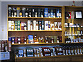
©2018(licence)
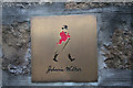
©2007(licence)
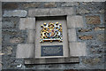
©2007(licence)
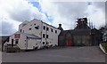
©2015(licence)
©2018(licence)
The above images may not be of the site on this page, they are loaded from Geograph.
Please Submit an Image of this site or go out and take one for us!
Click here to see more info for this site
Nearby sites
Key: Red: member's photo, Blue: 3rd party photo, Yellow: other image, Green: no photo - please go there and take one, Grey: site destroyed
Download sites to:
KML (Google Earth)
GPX (GPS waypoints)
CSV (Garmin/Navman)
CSV (Excel)
To unlock full downloads you need to sign up as a Contributory Member. Otherwise downloads are limited to 50 sites.
Turn off the page maps and other distractions
Nearby sites listing. In the following links * = Image available
669m WSW 242° Knockando 1* Class I Pictish Symbol Stone (NJ186428)
669m WSW 242° Knockando 2* Class I Pictish Symbol Stone (NJ186428)
3.0km WSW 247° Leakin* Round Cairn (NJ164420)
3.9km SSW 205° Mains of Kirdells* Round Cairn (NJ175396)
5.0km SSW 195° Pitchroy* Stone Circle (NJ17823826)
5.6km S 188° Inveravon (4)* Class I Pictish Symbol Stone (NJ1828737599)
5.6km S 188° Inveravon (1)* Class I Pictish Symbol Stone (NJ1828737599)
5.6km S 188° Inveravon (2)* Class I Pictish Symbol Stone (NJ1828737599)
5.6km S 188° Inveravon (3)* Class I Pictish Symbol Stone (NJ1828737599)
5.6km S 188° Inveravon* Class I Pictish Symbol Stone (NJ1828737599)
6.8km S 187° Marionburgh* Stone Circle (NJ183364)
7.3km S 188° Lower Lagmore* Stone Circle (NJ180359)
7.5km S 191° Upper Lagmore* Stone Circle (NJ176358)
7.5km E 96° The Fairy Knowe* Misc. Earthwork (NJ267422)
7.9km E 98° Hatton Circle (Moray)* Stone Circle (NJ270418)
10.6km ENE 67° Arndilly* Class I Pictish Symbol Stone (NJ29064707)
11.0km SW 215° Advie* Class I Pictish Symbol Stone (NJ12653426)
12.2km S 171° Tom Na Heron Class I Pictish Symbol Stone (NJ208310)
12.3km S 182° Doune Of Dalmore* Stone Circle (NJ185308)
12.7km NNE 22° Netherglen* Standing Stone (Menhir) (NJ24315476)
13.2km ESE 111° Nether Cluny* Stone Circle (NJ315381)
13.5km S 177° Glenlivet Standing Stone* Standing Stone (Menhir) (NJ19732963)
13.6km ESE 105° Mortlach 2* Class I Pictish Symbol Stone (NJ323392)
13.7km ESE 105° Mortlach 1* Class II Pictish Symbol Stone (NJ32413924)
14.0km S 182° Nethertown Stone Circle (NJ185291)
View more nearby sites and additional images


 We would like to know more about this location. Please feel free to add a brief description and any relevant information in your own language.
 Wir möchten mehr über diese Stätte erfahren. Bitte zögern Sie nicht, eine kurze Beschreibung und relevante Informationen in Deutsch hinzuzufügen.
 Nous aimerions en savoir encore un peu sur les lieux. S'il vous plaît n'hesitez pas à ajouter une courte description et tous les renseignements pertinents dans votre propre langue.
 Quisieramos informarnos un poco más de las lugares. No dude en añadir una breve descripción y otros datos relevantes en su propio idioma.