<< Our Photo Pages >> Picts House - Misc. Earthwork in Scotland in Aberdeenshire
Submitted by tyrianterror on Monday, 25 June 2007 Page Views: 6237
Multi-periodSite Name: Picts HouseCountry: Scotland
NOTE: This site is 2.348 km away from the location you searched for.
County: Aberdeenshire Type: Misc. Earthwork
Nearest Town: Fraserburgh Nearest Village: Strichen
Map Ref: NJ92365963
Latitude: 57.626565N Longitude: 2.12958W
Condition:
| 5 | Perfect |
| 4 | Almost Perfect |
| 3 | Reasonable but with some damage |
| 2 | Ruined but still recognisable as an ancient site |
| 1 | Pretty much destroyed, possibly visible as crop marks |
| 0 | No data. |
| -1 | Completely destroyed |
| 5 | Superb |
| 4 | Good |
| 3 | Ordinary |
| 2 | Not Good |
| 1 | Awful |
| 0 | No data. |
| 5 | Can be driven to, probably with disabled access |
| 4 | Short walk on a footpath |
| 3 | Requiring a bit more of a walk |
| 2 | A long walk |
| 1 | In the middle of nowhere, a nightmare to find |
| 0 | No data. |
| 5 | co-ordinates taken by GPS or official recorded co-ordinates |
| 4 | co-ordinates scaled from a detailed map |
| 3 | co-ordinates scaled from a bad map |
| 2 | co-ordinates of the nearest village |
| 1 | co-ordinates of the nearest town |
| 0 | no data |
Internal Links:
External Links:
I have visited· I would like to visit
tyrianterror has visited here
")
Though location would be suitable for a cairn there is nothing on surface to indicate any surviving remains. Its description suggests that it may have been similar to the cairn OS NJ85NE005. However on a vertical aerial photographs taken in 1977 there appears to be a very low, slightly raised bank of a circular feature visible. On an other photo taken in 1988 there also appears to be a very faint trace of a circular feature still surviving at this location though more as a crop mark.
References
ORDNANCE SURVEY, (1866) Ordnance Name Book
EDINBURGH, No90(1870) 53
I would add on an old map I/we have there is location details of there having been an 'earth-house' on or near this site. The general site now is grown up in an accursed conifer plantation.
I have one photograph of what I believe may be close to the site of the Earthhouse.
I can remember years ago before the trees of there being a stone feature on the surface, similar to a topless cist but larger.
You may be viewing yesterday's version of this page. To see the most up to date information please register for a free account.
")
Do not use the above information on other web sites or publications without permission of the contributor.
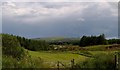
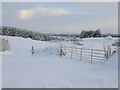
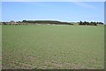
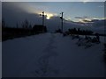
Nearby Images from Geograph Britain and Ireland:
©2012(licence)
©2012(licence)
©2009(licence)
©2012(licence)
©2007(licence)
The above images may not be of the site on this page, they are loaded from Geograph.
Please Submit an Image of this site or go out and take one for us!
Click here to see more info for this site
Nearby sites
Key: Red: member's photo, Blue: 3rd party photo, Yellow: other image, Green: no photo - please go there and take one, Grey: site destroyed
Download sites to:
KML (Google Earth)
GPX (GPS waypoints)
CSV (Garmin/Navman)
CSV (Excel)
To unlock full downloads you need to sign up as a Contributory Member. Otherwise downloads are limited to 50 sites.
Turn off the page maps and other distractions
Nearby sites listing. In the following links * = Image available
3.5km N 10° Tyrie Class I Pictish Symbol Stone (NJ93006310)
4.2km W 263° Law Cairn* Cairn (NJ88205911)
5.3km SSE 166° Strichen House* Stone Circle (NJ93675449)
5.8km ENE 65° Memsie Burial Cairn* Cairn (NJ97666205)
5.9km NNW 331° Dundarg Castle* Hillfort (NJ895648)
5.9km N 358° Gallows Hill (The Hanging Stone) Standing Stone (Menhir) (NJ9211465539)
6.2km NW 324° St Drostan's Well* Holy Well or Sacred Spring (NJ887646)
6.6km NW 321° Mess John's Well Holy Well or Sacred Spring (NJ882648)
8.1km SSE 163° White Cow Wood* Chambered Cairn (NJ947519)
8.3km WNW 282° Strath Howe Hillfort (NJ842614)
8.4km W 278° Glenhouses Hut Circles Ancient Village or Settlement (NJ840608)
8.6km E 92° Cortie Brae* Stone Circle (NK01015924)
9.0km WNW 298° Cummerton Cairn (NJ844638)
9.1km WSW 248° Upper Auchnagorth* Stone Circle (NJ8391156272)
9.3km WNW 296° Litterty Hill* Cairn (NJ840638)
9.6km SSE 166° Auchmachar Long Cairn* Cairn (NJ9461850314)
9.6km SSE 166° Knapperty Hill* Chambered Cairn (NJ946503)
9.6km SSE 165° Auchmachar* Stone Circle (NJ948503)
9.9km SE 145° Gaval Standing Stone* Standing Stone (Menhir) (NJ9805651504)
10.2km SSE 165° Auchmachar Clump Ancient Village or Settlement (NJ950498)
10.6km SSE 159° Loudon Wood* Stone Circle (NJ96104974)
10.7km ESE 103° Berrybrae* Stone Circle (NK02765716)
10.7km SSE 147° Fetterangus* Class I Pictish Symbol Stone (NJ98135056)
10.8km NW 307° Cullykhan * Promontory Fort / Cliff Castle (NJ83756618)
12.2km ESE 101° Netherton* Stone Circle (NK04335722)
View more nearby sites and additional images


 We would like to know more about this location. Please feel free to add a brief description and any relevant information in your own language.
 Wir möchten mehr über diese Stätte erfahren. Bitte zögern Sie nicht, eine kurze Beschreibung und relevante Informationen in Deutsch hinzuzufügen.
 Nous aimerions en savoir encore un peu sur les lieux. S'il vous plaît n'hesitez pas à ajouter une courte description et tous les renseignements pertinents dans votre propre langue.
 Quisieramos informarnos un poco más de las lugares. No dude en añadir una breve descripción y otros datos relevantes en su propio idioma.