<< Our Photo Pages >> Cleaven Dyke - Cursus in Scotland in Perth and Kinross
Submitted by coldrum on Monday, 25 June 2007 Page Views: 10732
Neolithic and Bronze AgeSite Name: Cleaven Dyke Alternative Name: Blairgowrie RoadCountry: Scotland County: Perth and Kinross Type: Cursus
Nearest Town: Meikleour
Map Ref: NO16334049
Latitude: 56.548917N Longitude: 3.362525W
Condition:
| 5 | Perfect |
| 4 | Almost Perfect |
| 3 | Reasonable but with some damage |
| 2 | Ruined but still recognisable as an ancient site |
| 1 | Pretty much destroyed, possibly visible as crop marks |
| 0 | No data. |
| -1 | Completely destroyed |
| 5 | Superb |
| 4 | Good |
| 3 | Ordinary |
| 2 | Not Good |
| 1 | Awful |
| 0 | No data. |
| 5 | Can be driven to, probably with disabled access |
| 4 | Short walk on a footpath |
| 3 | Requiring a bit more of a walk |
| 2 | A long walk |
| 1 | In the middle of nowhere, a nightmare to find |
| 0 | No data. |
| 5 | co-ordinates taken by GPS or official recorded co-ordinates |
| 4 | co-ordinates scaled from a detailed map |
| 3 | co-ordinates scaled from a bad map |
| 2 | co-ordinates of the nearest village |
| 1 | co-ordinates of the nearest town |
| 0 | no data |
Internal Links:
External Links:
I have visited· I would like to visit
SumDoood would like to visit
")
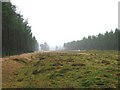
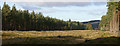
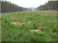
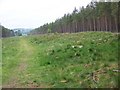
Once thought to have been a Roman defensive earthwork, excavation of the site revealed it to be a cursus monument and it has been dated to 3600 BC.
Monument is about 1.8km long.
Site at RCAHMS
You may be viewing yesterday's version of this page. To see the most up to date information please register for a free account.
Do not use the above information on other web sites or publications without permission of the contributor.
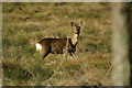
Nearby Images from Geograph Britain and Ireland:
©2007(licence)
©2008(licence)
©2008(licence)
©2008(licence)
©2008(licence)
The above images may not be of the site on this page, they are loaded from Geograph.
Please Submit an Image of this site or go out and take one for us!
Click here to see more info for this site
Nearby sites
Key: Red: member's photo, Blue: 3rd party photo, Yellow: other image, Green: no photo - please go there and take one, Grey: site destroyed
Download sites to:
KML (Google Earth)
GPX (GPS waypoints)
CSV (Garmin/Navman)
CSV (Excel)
To unlock full downloads you need to sign up as a Contributory Member. Otherwise downloads are limited to 50 sites.
Turn off the page maps and other distractions
Nearby sites listing. In the following links * = Image available
773m WNW 299° Caputh Cursus Cursus (NO15664088)
963m ESE 121° Caputh Cursus Cursus (NO17153998)
1.2km SSW 209° The Tron* Modern Stone Circle etc (NO1575439489)
2.0km S 188° Meikleour Natural Stone / Erratic / Other Natural Feature (NO15993849)
2.6km WNW 296° Tower of Lethendy Class III Pictish Cross Slab (NO140417)
3.2km NW 320° Aikenhead Farm (Blairgowrie) Rock Art (NO143430)
3.4km N 353° Ardblair* Stone Circle (NO1598943883)
4.5km S 173° Gallow Hill Wood* Rock Art (NO16803605)
4.5km NE 42° The Welton Stone Circle (NO1937243766)
4.5km S 173° Gallowhill Wood* Stone Row / Alignment (NO16813604)
4.5km SSW 199° Cargill Symbol Stone Class I Pictish Symbol Stone (NO14773623)
4.7km S 181° Moonshade Standing Stones (NO16153576)
4.9km NNW 332° Kinloch Cairn* Cairn (NO14074485)
4.9km S 186° Hangie's Stone Standing Stone (Menhir) (NO15753557)
5.4km SSE 169° East Whitefield Stone Circle (NO17293514)
5.5km NE 37° Rattray Cursus Cursus (NO19744479)
5.5km S 182° Gallowhill Stone Circle (NO1635)
6.1km N 354° Milton of Drumlochy Round Barrow(s) (NO15834662)
6.4km WSW 251° Murthly* Stone Circle (NO10273852)
6.4km W 276° Glendelvine House Standing Stone (Menhir) (NO09954130)
6.6km NE 35° Drumend* Holy Well or Sacred Spring (NO202458)
6.6km NE 35° Drumend* Standing Stone (Menhir) (NO20184582)
7.6km E 100° Kettins Burn* Class II Pictish Symbol Stone (NO23783906)
7.8km S 190° Craigmakerran* Standing Stones (NO1477832850)
7.8km NNE 25° Broadmoss Standing Stones (NO198475)
View more nearby sites and additional images


 We would like to know more about this location. Please feel free to add a brief description and any relevant information in your own language.
 Wir möchten mehr über diese Stätte erfahren. Bitte zögern Sie nicht, eine kurze Beschreibung und relevante Informationen in Deutsch hinzuzufügen.
 Nous aimerions en savoir encore un peu sur les lieux. S'il vous plaît n'hesitez pas à ajouter une courte description et tous les renseignements pertinents dans votre propre langue.
 Quisieramos informarnos un poco más de las lugares. No dude en añadir una breve descripción y otros datos relevantes en su propio idioma.