<< Our Photo Pages >> Lady Well Wall - Holy Well or Sacred Spring in England in Derbyshire
Submitted by HOLYWELL on Sunday, 27 August 2006 Page Views: 7982
Springs and Holy WellsSite Name: Lady Well WallCountry: England
NOTE: This site is 1.335 km away from the location you searched for.
County: Derbyshire Type: Holy Well or Sacred Spring
Nearest Town: Bakewell Nearest Village: Baslow
Map Ref: SK258728
Latitude: 53.251590N Longitude: 1.614777W
Condition:
| 5 | Perfect |
| 4 | Almost Perfect |
| 3 | Reasonable but with some damage |
| 2 | Ruined but still recognisable as an ancient site |
| 1 | Pretty much destroyed, possibly visible as crop marks |
| 0 | No data. |
| -1 | Completely destroyed |
| 5 | Superb |
| 4 | Good |
| 3 | Ordinary |
| 2 | Not Good |
| 1 | Awful |
| 0 | No data. |
| 5 | Can be driven to, probably with disabled access |
| 4 | Short walk on a footpath |
| 3 | Requiring a bit more of a walk |
| 2 | A long walk |
| 1 | In the middle of nowhere, a nightmare to find |
| 0 | No data. |
| 5 | co-ordinates taken by GPS or official recorded co-ordinates |
| 4 | co-ordinates scaled from a detailed map |
| 3 | co-ordinates scaled from a bad map |
| 2 | co-ordinates of the nearest village |
| 1 | co-ordinates of the nearest town |
| 0 | no data |
Internal Links:
External Links:
I have visited· I would like to visit
stretchyboy visited on 21st Jun 2020 - their rating: Cond: 4 Amb: 4 Access: 5 Lovely little walk up the old road.
")
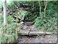
A delightful find just beyond the village off Bar Lane. It has an old dedication the later bit refering to the fact it arises at the base of a wall, but many wells do! I don't know much of its history but Baslow did attempt a spa, nearny Hydro lane commemorates it. To find the site look for Bar Lane which peters out as a path.
You may be viewing yesterday's version of this page. To see the most up to date information please register for a free account.
Do not use the above information on other web sites or publications without permission of the contributor.
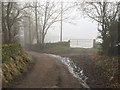
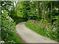
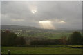
Nearby Images from Geograph Britain and Ireland:
©2017(licence)

©2017(licence)
©2010(licence)
©2010(licence)
©2021(licence)
The above images may not be of the site on this page, they are loaded from Geograph.
Please Submit an Image of this site or go out and take one for us!
Click here to see more info for this site
Nearby sites
Key: Red: member's photo, Blue: 3rd party photo, Yellow: other image, Green: no photo - please go there and take one, Grey: site destroyed
Download sites to:
KML (Google Earth)
GPX (GPS waypoints)
CSV (Garmin/Navman)
CSV (Excel)
To unlock full downloads you need to sign up as a Contributory Member. Otherwise downloads are limited to 50 sites.
Turn off the page maps and other distractions
Nearby sites listing. In the following links * = Image available
1.4km E 91° Three Men of Gardoms* Round Barrow(s) (SK2716172774)
1.4km ENE 74° Gardoms Edge Enclosure* Causewayed Enclosure (SK2716473201)
1.5km E 81° Gardoms Edge 1* Rock Art (SK2728573037)
1.5km ENE 74° Gardoms Edge Stone* Standing Stone (Menhir) (SK2725273225)
1.6km SE 143° Dobb Edge Cup and Ring* Rock Art (SK268715)
1.6km ESE 104° Gardoms Edge Ringcairn* Ring Cairn (SK274724)
1.7km ENE 73° Gardoms Edge Cairns* Barrow Cemetery (SK27407330)
1.8km ENE 75° Gardoms Edge 02 (Baslow) Rock Art (SK27527328)
1.9km ENE 74° Gardoms Edge 2 (Baslow)* Rock Art (SK2761773339)
2.4km E 96° Birchen Edge Stone* Natural Stone / Erratic / Other Natural Feature (SK28207256)
2.4km E 100° Birchen Edge 2 Ring Cairn (SK282724)
2.6km NNE 33° Swine Sty* Ancient Village or Settlement (SK272750)
2.7km NNE 27° Barbrook 5* Ring Cairn (SK270752)
2.8km ENE 76° Birchen Edge 1* Ring Cairn (SK285735)
3.0km SE 135° Gibbet Moor 1 Cairn (SK279707)
3.0km SE 134° Gibbet Moor 2 Cairn (SK280707)
3.0km SE 134° Gibbet Moor 3 Cairn (SK280707)
3.1km SE 129° Gibbet Moor South* Ancient Village or Settlement (SK282709)
3.1km NNE 33° Big Moor* Ancient Village or Settlement (SK275754)
3.3km NNE 34° Barbrook Cupmarked Stone* Standing Stone (Menhir) (SK27647560)
3.4km SE 138° Gibbet Moor North* Stone Circle (SK281703)
3.4km NE 37° Barbrook 1* Stone Circle (SK27857558)
3.5km NNE 31° Big Moor Cairns SW* Barrow Cemetery (SK27587579)
3.5km NE 37° Barbrook cairn* Cairn (SK27917561)
3.5km NE 35° Big Moor Cairn Field* Barrow Cemetery (SK278757)
View more nearby sites and additional images


 We would like to know more about this location. Please feel free to add a brief description and any relevant information in your own language.
 Wir möchten mehr über diese Stätte erfahren. Bitte zögern Sie nicht, eine kurze Beschreibung und relevante Informationen in Deutsch hinzuzufügen.
 Nous aimerions en savoir encore un peu sur les lieux. S'il vous plaît n'hesitez pas à ajouter une courte description et tous les renseignements pertinents dans votre propre langue.
 Quisieramos informarnos un poco más de las lugares. No dude en añadir una breve descripción y otros datos relevantes en su propio idioma.