<< Our Photo Pages >> Leptis Magna (Virginia Waters) - Ancient Temple in England in Surrey
Submitted by HOLYWELL on Wednesday, 27 February 2008 Page Views: 12136
Multi-periodSite Name: Leptis Magna (Virginia Waters)Country: England County: Surrey Type: Ancient Temple
Nearest Village: Virginia Waters
Map Ref: SU980680
Latitude: 51.402574N Longitude: 0.592556W
Condition:
| 5 | Perfect |
| 4 | Almost Perfect |
| 3 | Reasonable but with some damage |
| 2 | Ruined but still recognisable as an ancient site |
| 1 | Pretty much destroyed, possibly visible as crop marks |
| 0 | No data. |
| -1 | Completely destroyed |
| 5 | Superb |
| 4 | Good |
| 3 | Ordinary |
| 2 | Not Good |
| 1 | Awful |
| 0 | No data. |
| 5 | Can be driven to, probably with disabled access |
| 4 | Short walk on a footpath |
| 3 | Requiring a bit more of a walk |
| 2 | A long walk |
| 1 | In the middle of nowhere, a nightmare to find |
| 0 | No data. |
| 5 | co-ordinates taken by GPS or official recorded co-ordinates |
| 4 | co-ordinates scaled from a detailed map |
| 3 | co-ordinates scaled from a bad map |
| 2 | co-ordinates of the nearest village |
| 1 | co-ordinates of the nearest town |
| 0 | no data |
Internal Links:
External Links:
I have visited· I would like to visit
graemefield visited on 1st Jan 1982 - their rating: Cond: 4 Amb: 4 Access: 2
myf have visited here
 (PID:37030)")
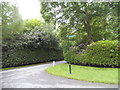
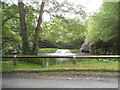
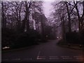
This was relocated from Tripoli by Sir Jeffrey Wyatville for George IV in 1826 as a folly. The site is set up with triumphal arches and ruined columns
You may be viewing yesterday's version of this page. To see the most up to date information please register for a free account.
Do not use the above information on other web sites or publications without permission of the contributor.
Nearby Images from Geograph Britain and Ireland:
©2015(licence)
©2015(licence)
©2015(licence)
©2011(licence)
©2015(licence)
The above images may not be of the site on this page, they are loaded from Geograph.
Please Submit an Image of this site or go out and take one for us!
Click here to see more info for this site
Nearby sites
Key: Red: member's photo, Blue: 3rd party photo, Yellow: other image, Green: no photo - please go there and take one, Grey: site destroyed
Download sites to:
KML (Google Earth)
GPX (GPS waypoints)
CSV (Garmin/Navman)
CSV (Excel)
To unlock full downloads you need to sign up as a Contributory Member. Otherwise downloads are limited to 50 sites.
Turn off the page maps and other distractions
Nearby sites listing. In the following links * = Image available
2.5km SSE 161° Barrowhills Round Barrow(s) (SU98866567)
3.1km SSE 158° Flutters Hill Barrow* Round Barrow(s) (SU99206516)
3.2km WSW 241° Sunningdale Barrows Round Barrow(s) (SU952664)
3.5km SSE 163° Longcross Barrow* Round Barrow(s) (SU99126466)
3.7km S 190° Albury Bottom Enclosure* Misc. Earthwork (SU97426430)
4.3km SSE 162° Chobham Common (1)* Misc. Earthwork (SU994639)
4.5km E 94° The Nun's Well (Surrey)* Holy Well or Sacred Spring (TQ0247767756)
4.6km E 96° St Ann's Hill* Hillfort (TQ026676)
6.0km ENE 57° Negen Stones Standing Stones (TQ030714)
6.1km E 101° Chertsey Museum Museum (TQ040670)
6.4km NE 45° Staines Enclosure* Causewayed Enclosure (TQ024726)
6.7km W 277° Bowledge Hill Bell Barrow* Round Barrow(s) (SU91336872)
8.0km SW 214° New England Barrow Round Barrow(s) (SU93616129)
8.1km NNE 28° Kingsmead Quarry* Ancient Village or Settlement (TQ01707520)
8.2km ENE 66° Ashford Henge* Henge (TQ054715)
8.2km SW 218° West End Common Barrows* Barrow Cemetery (SU931614)
8.5km S 176° Horsell Birch Natural Stone / Erratic / Other Natural Feature (SU98805956)
8.5km NNE 24° Kingsmead Quarry Ancient Village or Settlement (TQ01307588)
8.8km SSW 197° St John the Baptist's Well* Holy Well or Sacred Spring (SU956595)
8.9km SSE 159° Horsell Common W* Barrow Cemetery (TQ01405980)
8.9km W 268° Swinley Park Barrow* Round Barrow(s) (SU89106754)
9.0km SSE 157° Horsell Common E* Round Barrow(s) (TQ01615977)
9.7km E 89° Shepperton Henge* Henge (TQ07686832)
9.8km NE 52° St. Anne's Well (Stanwell)* Holy Well or Sacred Spring (TQ056742)
9.8km NE 49° Stanwell Cursus* Cursus (TQ053746)
View more nearby sites and additional images


 We would like to know more about this location. Please feel free to add a brief description and any relevant information in your own language.
 Wir möchten mehr über diese Stätte erfahren. Bitte zögern Sie nicht, eine kurze Beschreibung und relevante Informationen in Deutsch hinzuzufügen.
 Nous aimerions en savoir encore un peu sur les lieux. S'il vous plaît n'hesitez pas à ajouter une courte description et tous les renseignements pertinents dans votre propre langue.
 Quisieramos informarnos un poco más de las lugares. No dude en añadir una breve descripción y otros datos relevantes en su propio idioma.