 with our Megalithic Portal iPhone app")


<< Text Pages >> Sunningdale Barrows - Round Barrow(s) in England in Surrey
Submitted by Andy B on Friday, 21 January 2005 Page Views: 6179
Neolithic and Bronze AgeSite Name: Sunningdale BarrowsCountry: England County: Surrey Type: Round Barrow(s)
Nearest Village: Sunningdale
Map Ref: SU952664
Latitude: 51.388668N Longitude: 0.633224W
Condition:
| 5 | Perfect |
| 4 | Almost Perfect |
| 3 | Reasonable but with some damage |
| 2 | Ruined but still recognisable as an ancient site |
| 1 | Pretty much destroyed, possibly visible as crop marks |
| 0 | No data. |
| -1 | Completely destroyed |
| 5 | Superb |
| 4 | Good |
| 3 | Ordinary |
| 2 | Not Good |
| 1 | Awful |
| 0 | No data. |
| 5 | Can be driven to, probably with disabled access |
| 4 | Short walk on a footpath |
| 3 | Requiring a bit more of a walk |
| 2 | A long walk |
| 1 | In the middle of nowhere, a nightmare to find |
| 0 | No data. |
| 5 | co-ordinates taken by GPS or official recorded co-ordinates |
| 4 | co-ordinates scaled from a detailed map |
| 3 | co-ordinates scaled from a bad map |
| 2 | co-ordinates of the nearest village |
| 1 | co-ordinates of the nearest town |
| 0 | no data |
Internal Links:
External Links:
Round Barrow(s) in Surrey. Just on the Chobham - Sunningdale parish boundary lie several bronze-age barrows.
The OS map shows one small barrow in the garden of Heatherside / Round Barrow House in the Ridgemount Rd. This has not been excavated.
The major barrow lay just inside the Chobham parish border south of the clubhouse of Sunningdale Golf Course. It does not seem to have survived - except maybe as a raised tee. When it was opened in December, 1901, it contained twenty-three cinerary urns and two cremated interments without urns. Of these seven urns are in Reading Museum; one and fragments in Guildford Museum; one in private hands at Sunningdale. The Surrey Heath Museum has reproductions and a fragment.
More details at: http://www.chobham.info/sunningdale_barrow.htm
The EH record is http://www.magic.gov.uk/rsm/23004.pdf
You may be viewing yesterday's version of this page. To see the most up to date information please register for a free account.
Do not use the above information on other web sites or publications without permission of the contributor.
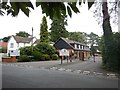
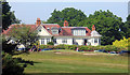
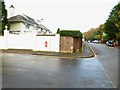
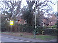
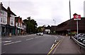
Nearby Images from Geograph Britain and Ireland:
©2017(licence)
©2018(licence)
©2014(licence)
©2012(licence)
©2009(licence)
The above images may not be of the site on this page, they are loaded from Geograph.
Please Submit an Image of this site or go out and take one for us!
Click here to see more info for this site
Nearby sites
Key: Red: member's photo, Blue: 3rd party photo, Yellow: other image, Green: no photo - please go there and take one, Grey: site destroyed
Download sites to:
KML (Google Earth)
GPX (GPS waypoints)
CSV (Garmin/Navman)
CSV (Excel)
To unlock full downloads you need to sign up as a Contributory Member. Otherwise downloads are limited to 50 sites.
Turn off the page maps and other distractions
Nearby sites listing. In the following links * = Image available
3.1km SE 135° Albury Bottom Enclosure* Misc. Earthwork (SU97426430)
3.2km ENE 61° Leptis Magna (Virginia Waters)* Ancient Temple (SU980680)
3.7km ESE 102° Barrowhills Round Barrow(s) (SU98866567)
4.2km ESE 108° Flutters Hill Barrow* Round Barrow(s) (SU99206516)
4.3km ESE 115° Longcross Barrow* Round Barrow(s) (SU99126466)
4.5km WNW 302° Bowledge Hill Bell Barrow* Round Barrow(s) (SU91336872)
4.9km ESE 122° Chobham Common (1)* Misc. Earthwork (SU994639)
5.3km SSW 198° New England Barrow Round Barrow(s) (SU93616129)
5.4km SSW 204° West End Common Barrows* Barrow Cemetery (SU931614)
6.2km WNW 282° Swinley Park Barrow* Round Barrow(s) (SU89106754)
6.9km S 178° St John the Baptist's Well* Holy Well or Sacred Spring (SU956595)
7.4km E 80° The Nun's Well (Surrey)* Holy Well or Sacred Spring (TQ0247767756)
7.5km E 82° St Ann's Hill* Hillfort (TQ026676)
7.7km SSE 153° Horsell Birch Natural Stone / Erratic / Other Natural Feature (SU98805956)
8.6km WNW 284° Bill Hill (Berkshire)* Round Barrow(s) (SU868683)
8.8km E 87° Chertsey Museum Museum (TQ040670)
8.9km NW 318° Holyport Modern Stone Circle Modern Stone Circle etc (SU8908672865)
8.9km W 267° Caesar's Camp (Berkshire)* Hillfort (SU863657)
9.0km SE 138° Horsell Common W* Barrow Cemetery (TQ01405980)
9.2km SE 137° Horsell Common E* Round Barrow(s) (TQ01615977)
9.2km ENE 58° Negen Stones Standing Stones (TQ030714)
9.3km WNW 299° The Quelm Stone* Natural Stone / Erratic / Other Natural Feature (SU870708)
9.5km NE 50° Staines Enclosure* Causewayed Enclosure (TQ024726)
9.7km W 272° Woodenhill Plantation Barrow Round Barrow(s) (SU85496656)
10.9km NE 37° Kingsmead Quarry* Ancient Village or Settlement (TQ01707520)
View more nearby sites and additional images


 We would like to know more about this location. Please feel free to add a brief description and any relevant information in your own language.
 Wir möchten mehr über diese Stätte erfahren. Bitte zögern Sie nicht, eine kurze Beschreibung und relevante Informationen in Deutsch hinzuzufügen.
 Nous aimerions en savoir encore un peu sur les lieux. S'il vous plaît n'hesitez pas à ajouter une courte description et tous les renseignements pertinents dans votre propre langue.
 Quisieramos informarnos un poco más de las lugares. No dude en añadir una breve descripción y otros datos relevantes en su propio idioma.