<< Text Pages >> Cuparlaw Wood (Bridge of Allan) - Cairn in Scotland in Stirling
Submitted by Anne T on Wednesday, 02 August 2017 Page Views: 1001
Neolithic and Bronze AgeSite Name: Cuparlaw Wood (Bridge of Allan) Alternative Name: Pendreich (Bridge of Allan)Country: Scotland
NOTE: This site is 1.184 km away from the location you searched for.
County: Stirling Type: Cairn
Nearest Town: Bridge of Allan Nearest Village: Sunnylaw
Map Ref: NS80469916
Latitude: 56.170052N Longitude: 3.926823W
Condition:
| 5 | Perfect |
| 4 | Almost Perfect |
| 3 | Reasonable but with some damage |
| 2 | Ruined but still recognisable as an ancient site |
| 1 | Pretty much destroyed, possibly visible as crop marks |
| 0 | No data. |
| -1 | Completely destroyed |
| 5 | Superb |
| 4 | Good |
| 3 | Ordinary |
| 2 | Not Good |
| 1 | Awful |
| 0 | No data. |
| 5 | Can be driven to, probably with disabled access |
| 4 | Short walk on a footpath |
| 3 | Requiring a bit more of a walk |
| 2 | A long walk |
| 1 | In the middle of nowhere, a nightmare to find |
| 0 | No data. |
| 5 | co-ordinates taken by GPS or official recorded co-ordinates |
| 4 | co-ordinates scaled from a detailed map |
| 3 | co-ordinates scaled from a bad map |
| 2 | co-ordinates of the nearest village |
| 1 | co-ordinates of the nearest town |
| 0 | no data |
Be the first person to rate this site - see the 'Contribute!' box in the right hand menu.
Internal Links:
External Links:
Cairn in Stirling
This cairn is recorded on Canmore ID 47128 which tells us: "When this cairn, which measures 12m in diameter and 0.5m in height, was opened in 1926, three cists were found, one of which contained a Beaker (SAGMS A3999) and some fragments of bone." They add that the cairn is "situated on the summit of a low knoll within a wood, 170 yards ENE of Pendreich farmhouse and at a height of 600ft OD. It consists of a low, grass-covered mound."
The Northern Antiquarian (TNA) also has a page for this cairn - see their entry for Cuparlaw Wood, Bridge of Allan, Stirlingshire, which has directions for finding the cairn, photographs and a brief archaeology and history.
Note: Have you visited this site? Do you have any comments or photographs to add?
You may be viewing yesterday's version of this page. To see the most up to date information please register for a free account.
Do not use the above information on other web sites or publications without permission of the contributor.
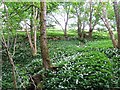
Nearby Images from Geograph Britain and Ireland:
©2007(licence)
©2007(licence)
©2007(licence)
©2006(licence)
©2011(licence)
The above images may not be of the site on this page, they are loaded from Geograph.
Please Submit an Image of this site or go out and take one for us!
Click here to see more info for this site
Nearby sites
Key: Red: member's photo, Blue: 3rd party photo, Yellow: other image, Green: no photo - please go there and take one, Grey: site destroyed
Download sites to:
KML (Google Earth)
GPX (GPS waypoints)
CSV (Garmin/Navman)
CSV (Excel)
To unlock full downloads you need to sign up as a Contributory Member. Otherwise downloads are limited to 50 sites.
Turn off the page maps and other distractions
Nearby sites listing. In the following links * = Image available
671m ENE 75° Split Stone (Bridge of Allan) Standing Stone (Menhir) (NS8111699311)
785m E 83° Pendreich 1 (Bridge of Allan) Cairn (NS8124499236)
790m E 84° Pendreich 3 (Bridge of Allan) Cairn (NS81259922)
798m ENE 72° Pendreich 2 (Bridge of Allan) Cairn (NS81239938)
1.1km ENE 59° The Great Stane O' Pendreigh* Standing Stone (Menhir) (NS8138299686)
1.3km SW 219° Fairy Knowe (Bridge of Allan)* Cairn (NS79619818)
1.4km SE 140° Fairy Well (Logie)* Holy Well or Sacred Spring (NS81359804)
2.0km S 191° Lentran (Bridge of Allan) Cist (NS80039720)
2.3km S 175° Pathfoot Stone* Standing Stone (Menhir) (NS8060496871)
2.4km WNW 298° Kippenross House (Dunblane) Cairn (NN78370036)
2.4km SSE 152° Logie Old Kirk (Stirling)* Early Christian Sculptured Stone (NS81549696)
2.7km SSE 158° The Victoria Stone* Marker Stone (NS8141296608)
2.8km SSE 159° Airthrey Stone* Standing Stone (Menhir) (NS81409650)
3.1km N 10° The Gathering Stone* Standing Stone (Menhir) (NN8105602191)
3.1km NW 312° Dunblane Museum* Museum (NN7819301343)
3.2km NW 313° Dunblane Cathedral* Class III Pictish Cross Slab (NN78170139)
3.4km S 178° Bel Stane (Causewayhead) Standing Stone (Menhir) (NS805958)
3.5km S 171° Abbey Craig Vitrified Fort* Hillfort (NS80949565)
4.2km NE 40° Sheriff Muir Row* Stone Row / Alignment (NN83240226)
4.8km SSW 192° Our Lady's Well (Stirling) Holy Well or Sacred Spring (NS79329454)
5.0km N 0° White Stone* Standing Stones (NN80630420)
5.1km WNW 283° Doune (Glenhead)* Stone Row / Alignment (NN7549300457)
5.2km NE 38° Harperstone (Dunblane) Stone Circle (NN838032)
5.3km WNW 289° Glenhead Standing Stone (Doune)* Standing Stone (Menhir) (NN75520100)
5.5km SSW 194° Butt Well* Holy Well or Sacred Spring (NS78949389)
View more nearby sites and additional images


 We would like to know more about this location. Please feel free to add a brief description and any relevant information in your own language.
 Wir möchten mehr über diese Stätte erfahren. Bitte zögern Sie nicht, eine kurze Beschreibung und relevante Informationen in Deutsch hinzuzufügen.
 Nous aimerions en savoir encore un peu sur les lieux. S'il vous plaît n'hesitez pas à ajouter une courte description et tous les renseignements pertinents dans votre propre langue.
 Quisieramos informarnos un poco más de las lugares. No dude en añadir una breve descripción y otros datos relevantes en su propio idioma.