<< Text Pages >> Île de Brunec Dolmen - Burial Chamber or Dolmen in France in Bretagne:Finistère (29)
Submitted by TheCaptain on Tuesday, 28 December 2004 Page Views: 2515
Neolithic and Bronze AgeSite Name: Île de Brunec DolmenCountry: France
NOTE: This site is 3.59 km away from the location you searched for.
Département: Bretagne:Finistère (29) Type: Burial Chamber or Dolmen
Nearest Town: Concarneau Nearest Village: Îles Glenan
Latitude: 47.729000N Longitude: 3.9996W
Condition:
| 5 | Perfect |
| 4 | Almost Perfect |
| 3 | Reasonable but with some damage |
| 2 | Ruined but still recognisable as an ancient site |
| 1 | Pretty much destroyed, possibly visible as crop marks |
| 0 | No data. |
| -1 | Completely destroyed |
| 5 | Superb |
| 4 | Good |
| 3 | Ordinary |
| 2 | Not Good |
| 1 | Awful |
| 0 | No data. |
| 5 | Can be driven to, probably with disabled access |
| 4 | Short walk on a footpath |
| 3 | Requiring a bit more of a walk |
| 2 | A long walk |
| 1 | In the middle of nowhere, a nightmare to find |
| 0 | No data. |
| 5 | co-ordinates taken by GPS or official recorded co-ordinates |
| 4 | co-ordinates scaled from a detailed map |
| 3 | co-ordinates scaled from a bad map |
| 2 | co-ordinates of the nearest village |
| 1 | co-ordinates of the nearest town |
| 0 | no data |
Be the first person to rate this site - see the 'Contribute!' box in the right hand menu.
Internal Links:
External Links:
Dolmen in Finistère
IMPORTANT NOTE: Positional co-ordinates scaled from a detailed map source
You may be viewing yesterday's version of this page. To see the most up to date information please register for a free account.
Do not use the above information on other web sites or publications without permission of the contributor.
Nearby Images from Flickr

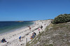
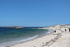


The above images may not be of the site on this page, but were taken nearby. They are loaded from Flickr so please click on them for image credits.
Click here to see more info for this site
Nearby sites
Click here to view sites on an interactive map of the areaKey: Red: member's photo, Blue: 3rd party photo, Yellow: other image, Green: no photo - please go there and take one, Grey: site destroyed
Download sites to:
KML (Google Earth)
GPX (GPS waypoints)
CSV (Garmin/Navman)
CSV (Excel)
To unlock full downloads you need to sign up as a Contributory Member. Otherwise downloads are limited to 50 sites.
Turn off the page maps and other distractions
Nearby sites listing. In the following links * = Image available
5.6km NNW 337° Île aux Moutons menhir Standing Stone (Menhir)
13.2km NE 56° Rocher de Trévignon* Natural Stone / Erratic / Other Natural Feature
13.9km NE 53° Menhir de Loc'h Coziou* Standing Stone (Menhir)
13.9km NNE 32° Pointe de la Jument* Natural Stone / Erratic / Other Natural Feature
14.0km NE 41° Kerdallé menhir Standing Stone (Menhir)
14.1km N 7° Menhir de Beg-Meil Standing Stone (Menhir)
15.1km NE 44° Menhir de Beg Roz Ruat* Standing Stone (Menhir)
15.3km NNE 23° Pointe du Cabellou* Natural Stone / Erratic / Other Natural Feature
15.9km NW 306° Dolmen de Plage d'Ezer Burial Chamber or Dolmen
16.1km ENE 68° Dolmen de l'Île-de-Raguenez Burial Chamber or Dolmen
16.8km NE 43° Menhir de Salut* Modern Stone Circle etc
17.0km N 358° Lanveur menhir* Standing Stone (Menhir)
17.1km ENE 58° Roche de Riel* Rock Outcrop
17.1km NE 55° Kernalec dolmen Burial Chamber or Dolmen
17.2km NNW 335° Menhir de Poulquer* Standing Stone (Menhir)
17.2km NE 55° Kernalec Nevez* Standing Stone (Menhir)
17.3km NE 34° Dolmen de Men Dogan* Burial Chamber or Dolmen
17.4km NE 35° Pierre de Men Dogan* Rock Outcrop
17.4km NW 311° Stèle de L'église* Standing Stone (Menhir)
17.8km WNW 303° Menhir de Kerdalaë-Plonivel* Standing Stone (Menhir)
17.9km NE 42° Roche de Kergleuhan* Rock Outcrop
17.9km WNW 296° Steir-Nibilic menhir Standing Stone (Menhir)
17.9km NE 47° Pierres de Lannenoret* Ancient Mine, Quarry or other Industry
17.9km WNW 297° Dolmen de Menez-Veil 2 Burial Chamber or Dolmen
18.1km WNW 297° Dolmen de Menez-Veil* Burial Chamber or Dolmen
View more nearby sites and additional images

")
 We would like to know more about this location. Please feel free to add a brief description and any relevant information in your own language.
 Wir möchten mehr über diese Stätte erfahren. Bitte zögern Sie nicht, eine kurze Beschreibung und relevante Informationen in Deutsch hinzuzufügen.
 Nous aimerions en savoir encore un peu sur les lieux. S'il vous plaît n'hesitez pas à ajouter une courte description et tous les renseignements pertinents dans votre propre langue.
 Quisieramos informarnos un poco más de las lugares. No dude en añadir una breve descripción y otros datos relevantes en su propio idioma.