
Featured: Exploring Avebury: The Essential Guide - New Expanded Edition!

Exploring Avebury: The Essential Guide - New Expanded Edition!

Ancient Oxfordshire Tea Towel – Hand Painted Design

Ancient Oxfordshire Tea Towel – Hand Painted Design

Login

Register here - as a registered user you get more features and fewer ads.

Who's Online

There are currently, 1188 guests and 4 members online.

Sponsors

<< Feature Articles >> Old Stone Fort

Submitted by Partlow on Friday, 18 March 2005  Page Views: 3768

Iron Age and Later PrehistoryCountry: United States State: Tennessee Type: Hillfort

Internal Links:

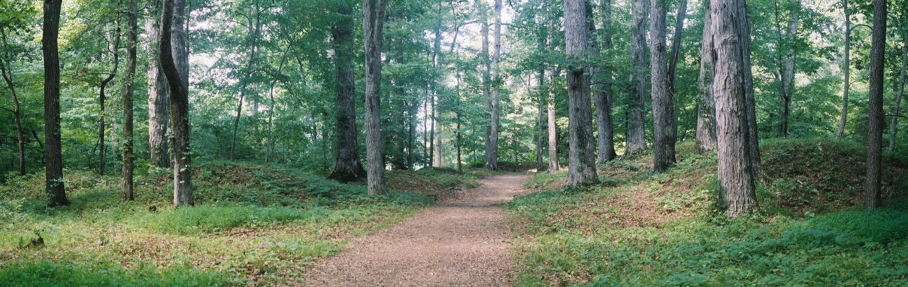
The aboriginal site of Old Stone Fort State Archaeological Park is on a plateau just a couple of miles to the southeast of Manchester, which is to the northwest of Chattanooga, Tennessee. The area is at the western edge of the Cumberland Plateau in the southeastern United States. As one approaches the entrance to the complex from the east, the earth & rock mounds terminating the perimeter walls on either side of the entrance are clearly prominent. Beyond these mounds which flank the entrance, is a 4 foot deep trench which was originally 8 feet deep when the complex was used. Beyond this are the walls of the rectangular structure which run parallel approximately 90 feet and are about 5 feet high now. The entrance ends of these walls turn inward to form a passage narrower than the corridor. At the end of this construction the wall to the north (or right) turns at a right angle to the south, herding you out facing the south. The corridor is aligned so that the summer solstice sunrise shines through the entrance and down the corridor against the wall at the western end of the structure

If you were to continue on this course around the immense oval shaped ceremonial area of 50 acres which is elongated on an East/West orientation, you would be traveling diocel along the stone wall that runs the perimeter from the southern mound of the entrance structure to the cliff that completes it to at the opposite end of the ceremonial field. A large grove of trees blocks any view of this. The field was dowsed and found to be encompassing the intersection of East/West & North/South ley lines and several other variously oriented ley lines. At the base of the southern stone wall, descends a very steep incline down to the Little Duck River. A cave can be seen on the other side of this river. On the other end of the cliff, the wall begins again, running northwest and then northeast to the bluff of Big Falls on the Big Duck River. This wall is surrounded on the outside by a mote dug into the old riverbed. The wall begins again from the other end of the bluff and ends at the north mound of the entrance structure.

The construction itself is found to be 2,000 years old by the archaeological record; but by the same studies, was found to be under development since 7,000 years BP. The Woodland culture, to which the stone construction is connected, is said to have used the site for 500 years. There has been no evidence found of any occupation, which leads to the conclusion that this site was strictly for ceremonial purposes. The walls are of stone inner and outer cores that run parallel throughout. The trench in between the two walls is floored with shale slabs, then filled and capped with earth and rubble. Due to wear and weathering, the walls have diminished and the earth has spilled over to hide any appearance of the stone.

This site is said to be near a capital of the native “province of Chlaca “ recorded by DeSoto’s chronicler during the late Mississippian period in 1540. It is said by some to have not been unique at one time, but is now the only one known due to development over the course of the historic period. There are also stories of the site being haunted, built by Atlanteans, Lemurians, Nightgoers, Mayans, Prince Madoc’s men, and the DeSoto expedition. Though it does resemble a British hill fort in some respects, there is no doubt from the archaeological record that it was used by Native Americans from the Archaic on through the Middle Woodland periods.

For more on this site see our Old Stone Fort site page, and see also pictures of the site at http://www.ghostweb.com

Guide to pictures on linked website: Left top to right bottom: (1) White-tailed deer on Big Duck River at the western base of the complex. (2) Museum/shop. (3) Sign near entrance to structure. (4) Eastward view down the corridor from the entrance. (5) Eastward view of the open ceremonial field from the west end of the rectangular structure. (6) Diagram of site showing the entrance at bottom.

Note: The Portal urgently requires photographs of North American mounds - can you help?

Old Stone Fort
Old Stone Fort submitted by durhamnature : Old plan drawing from "Mound Builders..." via archive.org (Vote or comment on this photo)

Old Stone Fort
Old Stone Fort submitted by bat400 : Entrance to "Old Stone Fort." Twin earthen mounds flanked a rectangular earth and stone work enclosure. This enclosure opened into the interior of the "Fort" to the left at the far end. You can see the back wall of the entry "room." These enclosure walls were much higher when first built. Portions of the ground were paved as for a walkway. Stitched Photo by bat400, 13 Jul 2006. (Vote or comment on this photo)

Old Stone Fort
Old Stone Fort submitted by AKFisher : Photo courtesy Dr Greg Little, author of the Illustrated Encyclopedia of Native American Indian Mounds & Earthworks (2016). Mounds at the entrance to the "Old Stone Fort" near Manchester, Tennessee in 1985 photo. It is a 54-acre Hilltop Fort with stone & earth walls running along the steep ridges on the hillside. It is dated to AD 1 and was abandoned around 400 AD. (Vote or comment on this photo)

Old Stone Fort
Old Stone Fort submitted by bat400 : Southwest wall of the "Old Stone Fort." A 1.5 mile trail leads you around the base of the walls enclosing the 50 acres of space within the "Fort." These are walls of earth capping and surrounding a double stone wall. Given erosion the walls varied from a few feet to 12 feet high when new depending on the lay of the land. Photo by bat400, 13 Jul 2006. (Vote or comment on this photo)

Old Stone Fort
Old Stone Fort submitted by bat400 : Interior of the "Old Stone Fort." The flat expanse enclosed by the earth and stone walls and cliffs dropping down to the Duck River shows no evidence of settlement. Was this a gathering place for government or religion? Was it a place where all those of the society periodically went for celebration or instruction, or a ritual area where a chosen few might commune with the spirit world? ... (Vote or comment on this photo)

<< Cosmic Nuclear Event During the Pleistocene

Stolen Prehistoric Pottery From Museum >>

Please add your thoughts on this site

Avebury Archaeology Map - Worldwide Delivery

Avebury Archaeology Map - Worldwide Delivery

Sponsors

More Feature Articles

See all Feature Articles →

Latest Visit Logs

  • Teos
    “Nicely managed with clear signposts and footpaths, but a rather large site so a bit of walking is re…”
    by longhintim · 13 Jul 2026
  • Tas Kule
    “Easily accessible just beside the road. The outlook reminds me of the tomb of Cyrus in Pasargadae.”
    by longhintim · 13 Jul 2026
  • Neonteikhos
    “This place actually used to be a major Aeolian city state in the region To get to the site, I par…”
    by longhintim · 13 Jul 2026
  • Assos Temple of Athena
    “The temple of Athena is at the acropolis. Apart from the temple of Athena, Assos is a quite large s…”
    by longhintim · 13 Jul 2026
  • Alexandria Troas
    “Alexandria Troas is actually a large and spreadout site. This is only the location of the forum. T…”
    by longhintim · 13 Jul 2026

"Old Stone Fort" | Login/Create an Account | 2 News and Comments
  
Go back to top of page    Comments are owned by the poster. We aren't responsible for their content.
Re: Old Stone Fort by Partlow on Thursday, 24 March 2005
(User Info | Send a Message)
There was a lecture by an anthropologist, given at a Gulf Breeze, Florida MUFON meeting in the mid 90's, dealing with the events of mystical and extraterrestrial experiences at different sacred sites around the world. These sites were at fault lines where, according to him, geomagnetic activity had a good correlation with those experiences. These experiences included Mary(mother of Jesus), Shakti, female ufonauts, etc. giving pretty much the same message. "Stop exploiting people and the earth's resources mindlessly and adopt the standpoint of unconditional love in dealing with all creation". Who is to say from what this comes. We can all theorise, etc.; but, it all boils down to the same sermon we've heard before. Brother Bobby Partlow has spoken.
Cheers.
[ Reply to This ]

Re: Old Stone Fort by Aluta on Sunday, 20 March 2005
(User Info | Send a Message)
Note the mix of mounds and stonework at this site. As sites approach the northeast, they are more likely to have some elements made with stone. Nevertheless, the sites of stonework alone in Pennsylvania and northward are not considered to have been built by indigenous people.
I still believe that at some point people will realize that it is strange that the entire continent is dotted with prehistoric native constructions except for this sector, where, mysteriously, the people built no ritual sites.
The site at Oley Hills is very much like some sites in Ohio, the so-called hill forts, except that the walls are made of stone instead of mounded earth. Oley Hills and similar sites have features that cannot be explained unless we understand them to have had ritual uses. It is excruciating to watch the stone sites being destroyed while archaeology shows no interest, despite the obvious parallels between these sites and those south and west of us.
The mound sites, as well as the others, have this excellent effect on people who visit them: the effort to understand them causes us to become aware of the landscape around us in a new way. In a nation and culture that disregards the living elements of landscape, anything that reconnects people to the land and helps us understand it in a new way performs an invaluable service.
[ Reply to This ]

Your Name: Anonymous [ Register Now ]
Subject:


Add your comment or contribution to this page. Spam or offensive posts are deleted immediately, don't even bother

<<< What is five plus one as a number? (Please type the answer to this question in the little box on the left)
You can also embed videos and other things. For Youtube please copy and paste the 'embed code'.
For Google Street View please include Street View in the text.
Create a web link like this: <a href="https://www.megalithic.co.uk">This is a link</a>  

Allowed HTML is:
<p> <b> <i> <a> <img> <em> <br> <strong> <blockquote> <tt> <li> <ol> <ul> <object> <param> <embed> <iframe>

We would like to know more about this location. Please feel free to add a brief description and any relevant information in your own language.
Wir möchten mehr über diese Stätte erfahren. Bitte zögern Sie nicht, eine kurze Beschreibung und relevante Informationen in Deutsch hinzuzufügen.
Nous aimerions en savoir encore un peu sur les lieux. S'il vous plaît n'hesitez pas à ajouter une courte description et tous les renseignements pertinents dans votre propre langue.
Quisieramos informarnos un poco más de las lugares. No dude en añadir una breve descripción y otros datos relevantes en su propio idioma.