


County Guides No.20 - Argyll
Submitted by Saille on Sunday, 18 July 2004 Page Views: 12985
Multi-periodCountry: Scotland County: ArgyllInternal Links:

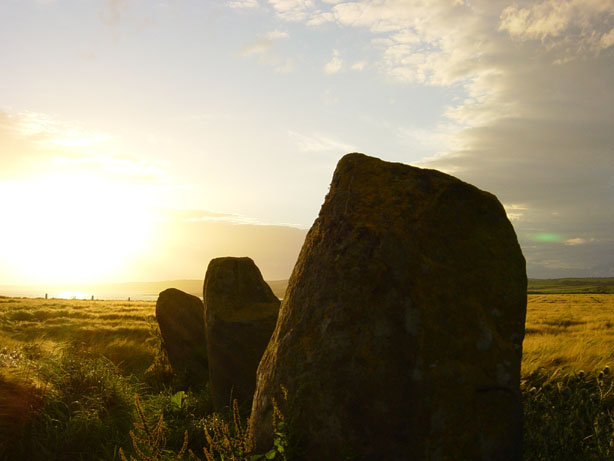
When it comes to historic monuments Argyll is the place to visit. Firstly I would also like to say that Argyll is a very large area to cover, so I apologize in advance for not mentioning all of the sites in this article, apart from a few here and there. I live on Bute so if anyone would like to contact me for more information please do - I will leave my e-mail address at the end.
Overall, the population is tiny, even Oban, Argyll's chief ferry port, has just seven thousand inhabitants, while the prettiest, Inveraray, boasts a mere four hundred.
The main area of man-made sights not to be missed, however, is the cluster of Celtic and prehistoric sites near Kilmartin. The Kilmartin valley is an area of enormous archaeological significance, with more than 350 ancient monuments in a 6 mile radius of Kilmartin, 150 of which are prehistoric. These include standing stones, cairns, and chambered tombs, some of them relics dating back over 5000 years. One of those sites is known as Dunnadd, lying off the A816 road, (OS map 55: NR837936). It is a large hill fort, a stronghold of Dalriada, the early kingdom of the Scots. Occupied from the Iron Age, items of interest include a stone footprint, basin and fork carvings. Dunnadd is possibly one of the most important historic sites in Argyll.
The Western duo of Bute and Arran are Scotland's most popular southerly islands, the latter - now, strictly speaking, part of North Ayrshire - justifiably so, with spectacular scenery ranging from the granite peaks of the north to the lowland pasture of the south. People have been living on Bute for around 5,500 years, attracted to the island and sustained by its fertile slopes and sheltered harbours. During your explorations, you may come across stone circles, burial cairns, cists and cup marks. There are many archaeological finds on display in the Bute Museum including a Bronze Age jet necklace and sword. Bute is certainly rich with archaeology - try Auchagallon Cairn and Stone circle on Arran (NR893346). There is so much I could tell you but I won’t I will leave it to you to contact me for more information.
Of the Hebridean islands covered in this section, mountainous Mull is the most visited, although it is large enough to absorb the crowds, many of whom are only passing through en-route to the tiny isle of Iona, which has been a centre of Christian culture since the sixth century. Places to see include Scotland’s holiest shrine, Iona Abbey (off the A849 road OS map 48: NM287245). Although the present abbey and nunnery date from medieval times, it was here in the year 563 AD/CE that St Columba founded the first monastery bringing Christianity to Scotland. Many Scottish Kings are buried in the graveyard.
Islay, best known for its distinctive malt whiskies, is reasonably quiet even in the height of summer. One place to visit here is Kildalton cross and chapel (located off the A846 road, OS map 60: NR458508). The Celtic cross, which is preserved in the churchyard, is the finest surviving high cross in Scotland. Standing 2.7 metres (9ft) high, it was cut from a single slab of stone. Nearby there are also a number of early grave-slabs, among them a figure of a medieval knight.
The neighbouring Isle of Jura also offers excellent walking opportunities and like Islay has many stone rows doted throughout the countryside. For those seeking further solitude, there are the more remote islands of Tiree Coll, which, although swept by the winds, boast more sunny days than anywhere else in Scotland. The Totronald standing stones on Coll are definitely worth a visit (NR16655594).
Argyll’s name derives from Aragaidheal, which translates as "Boundary of the Gaels" - the Irish Celts who settled here in the fifth century AD/CE, and whose Kingdom of Dalriada embraced much of what is now Argyll. It was known earlier to the Romans as Scotti, hence "Scotland". It was these Irish Celts who promoted Celtic Christianity, and whose Gaelic language eventually became the national tongue. In the twelfth century, the immensely powerful Somerled became King of the Hebrides and Lord of Argyll. His successors, the MacDonalds, established Islay as their headquarters in the 1200s, but were in turn dislodged by Robert the Bruce, whose allies, the Campbells, eventually gained control of the entire area as the Dukes of Argyll - even today, they remain one of the largest landowners in the region.
In the aftermath of the last Jacobite uprising of 1745, Argyll, like the rest of the Highlands, was devastated by the Clearances, with thousands of crofters evicted and brutally butchered at the hand of the Hanoverians to make room for profitable sheep farming - "the white plague" - and cattle-rearing. More recently forestry plantations have dramatically altered the landscape, whilst purpose-built marinas have sprouted up all around the heavily indented coastline. Today the traditional industries of fishing and farming are in deep crisis, leaving the region ever more dependent on tourism, EU grants and a steady influx of new settlers to keep things going. Gaelic, once the language of the majority in Argyll, retains only a tenuous hold on the outlying islands of Islay, Coll and Tiree.
Public transport throughout Argyll is minimal, although buses do serve most major settlements and the train line goes as far as Oban. In the remoter parts of the region and on the islands, you will have to rely on a combination of walking, shared taxis and the post bus. If you're planning to take a car across to one of the islands, it is essential that you book both your outward and return journeys as early as possible, as the ferries do get very booked up
Touring Scotland’s historic islands is much simpler now thanks to Caledonian MacBrayne Island Hopscotch Ticket. With one of these you are free to hop from island to island on a number of different routes- for less than the price of an individual journey. For further information go to www.visitscotland.com or phone 08705 650000/01475 650100. National Rail Enquiries - Tel: 08457 484950, National and international flights to Glasgow Airport (Tel 0141 887 1111) for timetables and price guides.
These sites are also very useful:
www.highlandtraveler.com
www.travelsintime.com
www.aboutargyll.com
www.VisitBute.comf1
Help Conserve our Natural Heritage
Please remember that as well as being a beautiful area to visit, many of the places described here are environmentally sensitive areas and home and work place to the local people. You can help conserve the area and its way of life in many small ways, by observing the Country Codes:
* Use local shops and garages, rather than bringing all your own food and fuel with you
* Look out for local crafts and produce to buy and support local events
* Stay overnight, or have an evening meal before going home
* Park your car responsibly - farm gateways are 'workplace' entrances
*Shut gates - it can take many hours to round up stray animals
* 'Take nothing but photographs, keep nothing but memories, leave nothing but footprints, Kill nothing but time!'
Thank you for taking the time to read this brief but informative description of Argyll, and I look forward to chatting more with you - see you soon.
Saille/Lance


 We would like to know more about this location. Please feel free to add a brief description and any relevant information in your own language.
 Wir möchten mehr über diese Stätte erfahren. Bitte zögern Sie nicht, eine kurze Beschreibung und relevante Informationen in Deutsch hinzuzufügen.
 Nous aimerions en savoir encore un peu sur les lieux. S'il vous plaît n'hesitez pas à ajouter une courte description et tous les renseignements pertinents dans votre propre langue.
 Quisieramos informarnos un poco más de las lugares. No dude en añadir una breve descripción y otros datos relevantes en su propio idioma.