[< Gallery Home | Latest Images | Top 100 | Submit Picture >]
258331 Pictures
|
<< Previous Picture | Next Picture >>
Description
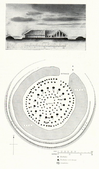
Plans of Woodhenge.
Lower: - Showing the two posts outside the causeway entrance, whose positions seem to be marking the inner and outer edges of the high surrounding bank.
In photos I posted on 31.8.07 there appear to be another two posts at right-angles to these, marking the actual causeway.
(A reconstruction drawing with this plan is the same one as already posted on Meg P site page - I've since noticed the posts are represented there too.)
Top: - A reconstructed elevation showing the possible building's width as 140 ft.
(Taken from 'Stonehenge and Avebury' [Her Majesty's Stationery Office, 1959, 9th Impression, 1973]. Maps and plans by Reitz.)
Posted Comments:
AngieLake (2015-11-15)
Frogcottage - see here for reconstruction drawing inc roof.
To post comments first you must Register!

