[< Gallery Home | Latest Images | Top 100 | Submit Picture >]
259587 Pictures
|
<< Previous Picture | Next Picture >>

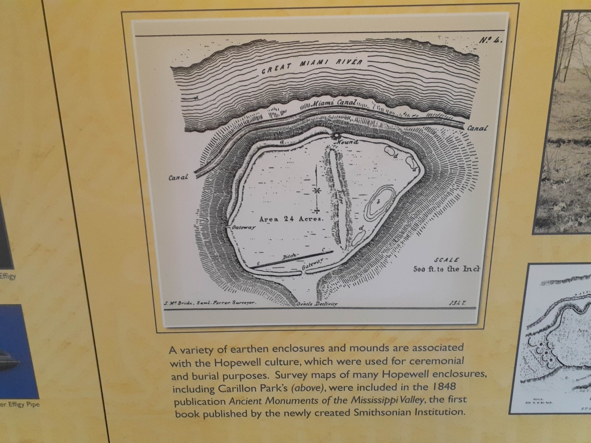
Calvary Cemetery Hilltop Enclosure
[1200 x 900 jpg]
| Submitted by | stonetracker |
| Added | Mar 01 2023 |
| Hits | 150 |
| Votes | 0 |
Description
Squier and Davis's original survey map of the hilltop enclosure from the mid 1800s. Note the long ditch, small mound, and two gateways. The wall circumnavigates the bluff.
Source: A small interpretive kiosk in Carillon Historic Park, adjacent to the cemetery. A very steep trail leads from there to the cemetery.
Source: A small interpretive kiosk in Carillon Historic Park, adjacent to the cemetery. A very steep trail leads from there to the cemetery.
No comments. Why don't you go ahead and post one!
To post comments first you must Register!
