[< Gallery Home | Latest Images | Top 100 | Submit Picture >]
259587 Pictures
|
<< Previous Picture | Next Picture >>
| Submitted by | Flickr |
| Added | Apr 14 2014 |
| Hits | 147 |
| Votes | 1 |
Description
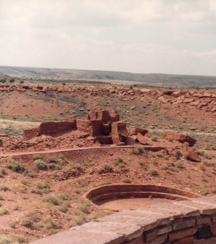
Wupatki National Monument in 1985
The Wupatki National Monument is a National Monument located in north-central Arizona, near Flagstaff. Rich in Native American ruins, the Monument is administered by the National Park Service in close conjunction with the nearby Sunset Crater Volcano National Monument.
Wupatki was listed on the National Register of Historic Places on October 15, 1966.
Wukoki Ruins complex
The many settlement sites scattered throughout the monument were built by the Ancient Pueblo People, more specifically the Sinagua, Cohonina, and Kayenta Anasazi. A major population influx began soon after the eruption of Sunset Crater in the 11th century, which blanketed the area with volcanic ash; this improved agricultural productivity and the soil's ability to retain water. Based on a careful survey of archaeological sites conducted in the 1980s, an estimated 2000 immigrants moved into the area during the century following the eruption. Agriculture was based mainly on corn and squash raised from the arid land without irrigation.
The dwellings, the walls of many of which still stand, were constructed from flat red stones held together with mortar. Each settlement was constructed as a single building, sometimes with scores of rooms. The largest settlement on monument territory is the Wupatki Ruin, "Big House" in the Hopi language, built around a natural rock outcropping. This ruin is believed to be the area's tallest and largest structure for its time period. The monument also contain ruins identified as a ball court, similar to the courts found in Meso-America and in the Hohokam ruins of southern Arizona. This is the northernmost example of this kind of structure. This site also contains a geological blowhole.
Wupatki National Monument ~ District NRHP #66000175
@ Wikipedia
Image copyright: Onasill (Onasill ~ Bill Badzo), hosted on Flickr and displayed under the terms of their API.
No comments. Why don't you go ahead and post one!
To post comments first you must Register!