

<< Our Photo Pages >> Wilmington Hill Staging Tumulus - Round Barrow(s) in England in East Sussex
Submitted by jonm on Friday, 28 September 2012 Page Views: 2329
Neolithic and Bronze AgeSite Name: Wilmington Hill Staging Tumulus Alternative Name: Half way tumulusCountry: England County: East Sussex Type: Round Barrow(s)
Map Ref: TQ5473803388
Latitude: 50.809390N Longitude: 0.194900E
Condition:
| 5 | Perfect |
| 4 | Almost Perfect |
| 3 | Reasonable but with some damage |
| 2 | Ruined but still recognisable as an ancient site |
| 1 | Pretty much destroyed, possibly visible as crop marks |
| 0 | No data. |
| -1 | Completely destroyed |
| 5 | Superb |
| 4 | Good |
| 3 | Ordinary |
| 2 | Not Good |
| 1 | Awful |
| 0 | No data. |
| 5 | Can be driven to, probably with disabled access |
| 4 | Short walk on a footpath |
| 3 | Requiring a bit more of a walk |
| 2 | A long walk |
| 1 | In the middle of nowhere, a nightmare to find |
| 0 | No data. |
| 5 | co-ordinates taken by GPS or official recorded co-ordinates |
| 4 | co-ordinates scaled from a detailed map |
| 3 | co-ordinates scaled from a bad map |
| 2 | co-ordinates of the nearest village |
| 1 | co-ordinates of the nearest town |
| 0 | no data |
Internal Links:
External Links:
")
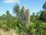
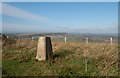
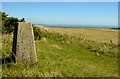
A small tumulus.
You may be viewing yesterday's version of this page. To see the most up to date information please register for a free account.
Do not use the above information on other web sites or publications without permission of the contributor.
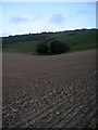
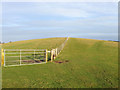
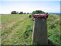
Nearby Images from Geograph Britain and Ireland:
©2008(licence)
©2009(licence)
©2013(licence)
©2011(licence)
©2005(licence)
The above images may not be of the site on this page, they are loaded from Geograph.
Please Submit an Image of this site or go out and take one for us!
Click here to see more info for this site
Nearby sites
Key: Red: member's photo, Blue: 3rd party photo, Yellow: other image, Green: no photo - please go there and take one, Grey: site destroyed
Download sites to:
KML (Google Earth)
GPX (GPS waypoints)
CSV (Garmin/Navman)
CSV (Excel)
To unlock full downloads you need to sign up as a Contributory Member. Otherwise downloads are limited to 50 sites.
Turn off the page maps and other distractions
Nearby sites listing. In the following links * = Image available
122m ENE 67° Wilmington Hill Tumulus* Round Barrow(s) (TQ54850344)
269m W 264° Windover-Wilmington Barrow* Round Barrow(s) (TQ5447103350)
355m NE 44° Hunters Burgh Long Barrow* Long Barrow (TQ54980365)
446m W 260° Windover Hill Flint Mines* Ancient Mine, Quarry or other Industry (TQ543033)
490m W 278° Long Man of Wilmington* Hill Figure or Geoglyph (TQ54250344)
535m WSW 257° Windover Hill * Barrow Cemetery (TQ54220325)
537m W 264° Long Man Hill Cuttings* Misc. Earthwork (TQ5420503315)
558m WNW 286° Long Man Ring Platform* Misc. Earthwork (TQ5419603527)
582m WNW 288° Long Man Bottom* Round Barrow(s) (TQ5417603547)
742m W 265° Windover Hill * Long Barrow (TQ540033)
776m SSE 150° Barrows West of Hill Barn* Artificial Mound (TQ55150273)
795m SE 127° Hill Barn Tumuli* Barrow Cemetery (TQ55390293)
1.0km WSW 238° Deep Dean Tenantry Ground Barrow* Round Barrow(s) (TQ53870282)
1.1km ESE 123° Folkington Hill Round Barrow(s) (TQ55720279)
1.2km SSE 165° Holt Brow Tumulus* Round Barrow(s) (TQ5506802270)
1.3km SW 234° Deap Dean* Barrow Cemetery (TQ537026)
1.4km SSE 167° Holt Brow South Tumulus* Artificial Mound (TQ55090205)
1.8km WNW 285° The Rookery Earthworks* Misc. Earthwork (TQ5300003800)
1.8km SW 214° Fore Down Cross Dyke* Misc. Earthwork (TQ5376701881)
1.9km SW 214° Fore Down Tumulus * Round Barrow(s) (TQ53710178)
2.0km SSW 196° Lullington/Clay Bottom* Misc. Earthwork (TQ5424201455)
2.1km S 177° Clay Bottom Tumulus* Artificial Mound (TQ5491401269)
2.5km SSW 205° Friston Forest* Round Barrow(s) (TQ53760107)
2.7km W 266° Alfriston Natural Stone / Erratic / Other Natural Feature (TQ520031)
2.9km ESE 116° Combe West (Tumulus B)* Artificial Mound (TQ5736502230)
View more nearby sites and additional images


 We would like to know more about this location. Please feel free to add a brief description and any relevant information in your own language.
 Wir möchten mehr über diese Stätte erfahren. Bitte zögern Sie nicht, eine kurze Beschreibung und relevante Informationen in Deutsch hinzuzufügen.
 Nous aimerions en savoir encore un peu sur les lieux. S'il vous plaît n'hesitez pas à ajouter une courte description et tous les renseignements pertinents dans votre propre langue.
 Quisieramos informarnos un poco más de las lugares. No dude en añadir una breve descripción y otros datos relevantes en su propio idioma.