


<< Our Photo Pages >> New Barn Tumuli - Barrow Cemetery in England in East Sussex
Submitted by coldrum on Wednesday, 23 July 2008 Page Views: 3801
Neolithic and Bronze AgeSite Name: New Barn TumuliCountry: England
NOTE: This site is 1.4 km away from the location you searched for.
County: East Sussex Type: Barrow Cemetery
Nearest Village: Alfriston
Map Ref: TQ507040
Latitude: 50.815947N Longitude: 0.137871E
Condition:
| 5 | Perfect |
| 4 | Almost Perfect |
| 3 | Reasonable but with some damage |
| 2 | Ruined but still recognisable as an ancient site |
| 1 | Pretty much destroyed, possibly visible as crop marks |
| 0 | No data. |
| -1 | Completely destroyed |
| 5 | Superb |
| 4 | Good |
| 3 | Ordinary |
| 2 | Not Good |
| 1 | Awful |
| 0 | No data. |
| 5 | Can be driven to, probably with disabled access |
| 4 | Short walk on a footpath |
| 3 | Requiring a bit more of a walk |
| 2 | A long walk |
| 1 | In the middle of nowhere, a nightmare to find |
| 0 | No data. |
| 5 | co-ordinates taken by GPS or official recorded co-ordinates |
| 4 | co-ordinates scaled from a detailed map |
| 3 | co-ordinates scaled from a bad map |
| 2 | co-ordinates of the nearest village |
| 1 | co-ordinates of the nearest town |
| 0 | no data |
Be the first person to rate this site - see the 'Contribute!' box in the right hand menu.
Internal Links:
External Links:
I have visited· I would like to visit
jonm visited on 7th Nov 2012 - their rating: Amb: 3 Access: 3 Could not see these tumuli, but they're not on public land
")
Tumuli.
You may be viewing yesterday's version of this page. To see the most up to date information please register for a free account.
")
")
Do not use the above information on other web sites or publications without permission of the contributor.
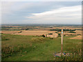
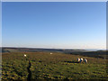
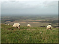
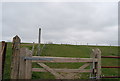
Nearby Images from Geograph Britain and Ireland:
©2010(licence)
©2012(licence)
©2011(licence)
©2010(licence)
©2019(licence)
The above images may not be of the site on this page, they are loaded from Geograph.
Please Submit an Image of this site or go out and take one for us!
Click here to see more info for this site
Nearby sites
Key: Red: member's photo, Blue: 3rd party photo, Yellow: other image, Green: no photo - please go there and take one, Grey: site destroyed
Download sites to:
KML (Google Earth)
GPX (GPS waypoints)
CSV (Garmin/Navman)
CSV (Excel)
To unlock full downloads you need to sign up as a Contributory Member. Otherwise downloads are limited to 50 sites.
Turn off the page maps and other distractions
Nearby sites listing. In the following links * = Image available
300m S 182° Short Bottom Cross Dyke Misc. Earthwork (TQ507037)
670m SSE 155° Long Burgh Long Barrow* Long Barrow (TQ510034)
787m WNW 302° Bostal Hill Intermediate High Tumulus* Round Barrow(s) (TQ5001904397)
858m NW 305° Bostal Hill Intermediate North* Round Barrow(s) (TQ4998004470)
892m WSW 245° Greenway Bottom Tumulus Round Barrow(s) (TQ499036)
901m WNW 301° Bostal Hill Intermediate Staging Tumuli* Artificial Mound (TQ4991304442)
998m NW 309° Bostal Hill Tumuli* Barrow Cemetery (TQ499046)
1.5km SSW 213° France Bottom Tumulus and Cross Dyke Round Barrow(s) (TQ499027)
1.6km SE 126° Alfriston Natural Stone / Erratic / Other Natural Feature (TQ520031)
1.9km NW 312° Bopeep West tumulus* Round Barrow(s) (TQ4926905232)
1.9km W 281° Bostal Bottom Tumuli Barrow Cemetery (TQ488043)
2.0km NW 309° Loose Plantation Tumuli* Barrow Cemetery (TQ491052)
2.2km NW 313° Loose Plantation crossways group* Barrow Cemetery (TQ4903405436)
2.3km WSW 237° Blackstone Bottom Tumuli Barrow Cemetery (TQ488027)
2.3km E 97° The Rookery Earthworks* Misc. Earthwork (TQ5300003800)
2.3km W 259° Five Lord's Burgh Tumulus Round Barrow(s) (TQ484035)
2.5km NW 315° Trilton Tumuli* Barrow Cemetery (TQ4885205728)
2.7km NW 314° Firle Beacon Tumuli* Barrow Cemetery (TQ487058)
2.7km NW 314° Firle East Barrow* Round Barrow(s) (TQ4867305813)
2.8km S 175° Cradle Hill Tumulus* Round Barrow(s) (TQ5103101246)
2.9km NW 310° Firle Beacon Long Barrow* Long Barrow (TQ484058)
3.1km S 175° Litlington White Horse* Hill Figure or Geoglyph (TQ51070095)
3.3km ESE 117° Deap Dean* Barrow Cemetery (TQ537026)
3.4km ESE 104° Windover Hill * Long Barrow (TQ540033)
3.4km ESE 112° Deep Dean Tenantry Ground Barrow* Round Barrow(s) (TQ53870282)
View more nearby sites and additional images

")
 We would like to know more about this location. Please feel free to add a brief description and any relevant information in your own language.
 Wir möchten mehr über diese Stätte erfahren. Bitte zögern Sie nicht, eine kurze Beschreibung und relevante Informationen in Deutsch hinzuzufügen.
 Nous aimerions en savoir encore un peu sur les lieux. S'il vous plaît n'hesitez pas à ajouter une courte description et tous les renseignements pertinents dans votre propre langue.
 Quisieramos informarnos un poco más de las lugares. No dude en añadir una breve descripción y otros datos relevantes en su propio idioma.