<< Other Photo Pages >> The Gurdy Stone - Modern Stone Circle etc in England in West Sussex
Submitted by Andy B on Sunday, 30 April 2023 Page Views: 4629
Modern SitesSite Name: The Gurdy Stone Alternative Name: The Hurdy-Gurdy StoneCountry: England County: West Sussex Type: Modern Stone Circle etc
Nearest Town: Lewes Nearest Village: Kingston near Lewes
Map Ref: TQ3948408002
Latitude: 50.854721N Longitude: 0.019717W
Condition:
| 5 | Perfect |
| 4 | Almost Perfect |
| 3 | Reasonable but with some damage |
| 2 | Ruined but still recognisable as an ancient site |
| 1 | Pretty much destroyed, possibly visible as crop marks |
| 0 | No data. |
| -1 | Completely destroyed |
| 5 | Superb |
| 4 | Good |
| 3 | Ordinary |
| 2 | Not Good |
| 1 | Awful |
| 0 | No data. |
| 5 | Can be driven to, probably with disabled access |
| 4 | Short walk on a footpath |
| 3 | Requiring a bit more of a walk |
| 2 | A long walk |
| 1 | In the middle of nowhere, a nightmare to find |
| 0 | No data. |
| 5 | co-ordinates taken by GPS or official recorded co-ordinates |
| 4 | co-ordinates scaled from a detailed map |
| 3 | co-ordinates scaled from a bad map |
| 2 | co-ordinates of the nearest village |
| 1 | co-ordinates of the nearest town |
| 0 | no data |
Internal Links:
External Links:
")
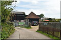
Access to the stone is through Lovebrook Farm, with permission, on Saturdays only when they are open.
You may be viewing yesterday's version of this page. To see the most up to date information please register for a free account.
")
")
Do not use the above information on other web sites or publications without permission of the contributor.
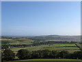
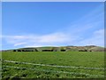
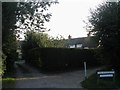
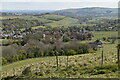
Nearby Images from Geograph Britain and Ireland:
©2012(licence)
©2014(licence)
©2012(licence)
©2021(licence)
©2021(licence)
The above images may not be of the site on this page, they are loaded from Geograph.
Please Submit an Image of this site or go out and take one for us!
Click here to see more info for this site
Nearby sites
Key: Red: member's photo, Blue: 3rd party photo, Yellow: other image, Green: no photo - please go there and take one, Grey: site destroyed
Download sites to:
KML (Google Earth)
GPX (GPS waypoints)
CSV (Garmin/Navman)
CSV (Excel)
To unlock full downloads you need to sign up as a Contributory Member. Otherwise downloads are limited to 50 sites.
Turn off the page maps and other distractions
Nearby sites listing. In the following links * = Image available
3.7km N 8° Offham Hill Causewayed Enclosure (TQ399117)
4.1km WNW 281° Stones around Falmer Village Pump Natural Stone / Erratic / Other Natural Feature (TQ354087)
4.4km NE 48° Malling Hill Field System Misc. Earthwork (TQ427110)
4.4km ENE 77° Ranscombe Camp* Ancient Village or Settlement (TQ438091)
4.7km ENE 65° The Bible Earthwork Misc. Earthwork (TQ437101)
4.7km NE 52° Malling Hill Long Barrow Long Barrow (TQ4311810996)
4.7km NE 55° Cliffe Hill Tumuli Round Barrow(s) (TQ433108)
4.8km ENE 69° Oxteddle Bottom Field System. Misc. Earthwork (TQ439098)
5.1km E 81° The Caburn* Hillfort (TQ445089)
5.1km NNW 334° Novington Farm Round Barrow(s) (TQ3709412537)
5.2km S 174° Telscombe Cross Dyke Misc. Earthwork (TQ402029)
5.4km S 180° Pedlersburgh* Round Barrow(s) (TQ396026)
5.4km NNW 328° Plumpton Barrows Barrow Cemetery (TQ3652312543)
5.5km ENE 65° Oxteddle Bottom Barrow Cemetery (TQ444104)
5.6km ESE 123° Pook's Dyke Misc. Earthwork (TQ44270507)
5.7km NW 320° Plumpton Plain Bronze Age Settlement* Ancient Village or Settlement (TQ35671224)
5.8km WNW 299° Moon's Bottom Tumulus Round Barrow(s) (TQ343107)
5.9km ESE 119° Itford Hill Ancient Village or Settlement (TQ447053)
6.1km SSW 212° Beacon Hill Tumuli Barrow Cemetery (TQ364027)
6.3km SSW 203° Hangman's Stone (Rottingdean ) Marker Stone (TQ372021)
6.5km WNW 295° Stanmer Stones Natural Stone / Erratic / Other Natural Feature (TQ335106)
7.0km WNW 290° Pudding Bag Tumuli Barrow Cemetery (TQ328102)
7.1km NW 315° Western Brow Tumuli* Round Barrow(s) (TQ343129)
7.2km WSW 245° Whitehawk* Causewayed Enclosure (TQ33030477)
7.3km W 270° Hollingbury* Hillfort (TQ322078)
View more nearby sites and additional images


 We would like to know more about this location. Please feel free to add a brief description and any relevant information in your own language.
 Wir möchten mehr über diese Stätte erfahren. Bitte zögern Sie nicht, eine kurze Beschreibung und relevante Informationen in Deutsch hinzuzufügen.
 Nous aimerions en savoir encore un peu sur les lieux. S'il vous plaît n'hesitez pas à ajouter une courte description et tous les renseignements pertinents dans votre propre langue.
 Quisieramos informarnos un poco más de las lugares. No dude en añadir una breve descripción y otros datos relevantes en su propio idioma.