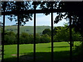
<< Other Photo Pages >> Devil's Dyke (West Sussex) - Hillfort in England in West Sussex
Submitted by vicky on Sunday, 07 March 2004 Page Views: 18093
Iron Age and Later PrehistorySite Name: Devil's Dyke (West Sussex) Alternative Name: Brighton Dyke; Poor Man's WallsCountry: England
NOTE: This site is 0.948 km away from the location you searched for.
County: West Sussex Type: Hillfort
Nearest Town: Brighton Nearest Village: Poynings
Map Ref: TQ2597311088 Landranger Map Number: 198
Latitude: 50.885556N Longitude: 0.210501W
Condition:
| 5 | Perfect |
| 4 | Almost Perfect |
| 3 | Reasonable but with some damage |
| 2 | Ruined but still recognisable as an ancient site |
| 1 | Pretty much destroyed, possibly visible as crop marks |
| 0 | No data. |
| -1 | Completely destroyed |
| 5 | Superb |
| 4 | Good |
| 3 | Ordinary |
| 2 | Not Good |
| 1 | Awful |
| 0 | No data. |
| 5 | Can be driven to, probably with disabled access |
| 4 | Short walk on a footpath |
| 3 | Requiring a bit more of a walk |
| 2 | A long walk |
| 1 | In the middle of nowhere, a nightmare to find |
| 0 | No data. |
| 5 | co-ordinates taken by GPS or official recorded co-ordinates |
| 4 | co-ordinates scaled from a detailed map |
| 3 | co-ordinates scaled from a bad map |
| 2 | co-ordinates of the nearest village |
| 1 | co-ordinates of the nearest town |
| 0 | no data |
Be the first person to rate this site - see the 'Contribute!' box in the right hand menu.
Internal Links:
External Links:
I have visited· I would like to visit
lucasn visited on 29th Jan 2022 - their rating: Cond: 3 Amb: 4 Access: 4
stolinskie visited on 1st Jan 2020 - their rating: Cond: 1 Amb: 2 Access: 5
Average ratings for this site from all visit loggers: Condition: 2 Ambience: 3 Access: 4.5
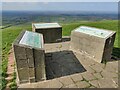
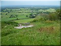
This site is recorded as Pastscape Monument No. 399072, an extract of which reads: "Yeakell and Gardner's map of 1778-83 shows that the hillfort was known in the 18th century as Poor Man's Walls; the present name derives from the striking coombe to the east, which penetrates deep into the downland escarpment from the north. It has been suggested ... that the hillfort may have been begun, perhaps in the early Iron Age, on the highest ground as a smaller enclosure, whose north-east end is represented by a rampart now ploughed down to a maximum of 0.2m high ... and subsequently expanded to take in the entire promontory in the later Iron Age ... The hillfort became the site of an 'adventure park' in the late 19th and early 20th centuries, centred on the hotel of around 1817 ... During the Second World War, it became a 'defended locality', incorporating a pre-War building whose function remains uncertain."
This hillfort also features on The Northern Antiquarian - see their page for Devil’s Dyke, Poynings, Sussex, which describes this as a "huge fella!" Their page includes directions for finding the fort, together with a map, a plan and a brief archaeology and history.
Note: Have you visited this site? Do you have any photographs or further information to add?
You may be viewing yesterday's version of this page. To see the most up to date information please register for a free account.
Do not use the above information on other web sites or publications without permission of the contributor.
coldrum has found this location on Google Street View:
Nearby Images from Geograph Britain and Ireland:
©2009(licence)
©2023(licence)
©2009(licence)
©2011(licence)
©2011(licence)
The above images may not be of the site on this page, they are loaded from Geograph.
Please Submit an Image of this site or go out and take one for us!
Click here to see more info for this site
Nearby sites
Key: Red: member's photo, Blue: 3rd party photo, Yellow: other image, Green: no photo - please go there and take one, Grey: site destroyed
Download sites to:
KML (Google Earth)
GPX (GPS waypoints)
CSV (Garmin/Navman)
CSV (Excel)
To unlock full downloads you need to sign up as a Contributory Member. Otherwise downloads are limited to 50 sites.
Turn off the page maps and other distractions
Nearby sites listing. In the following links * = Image available
1.2km WSW 258° Fulking Hill Tumulus 1* Round Barrow(s) (TQ248108)
1.3km SW 217° Adder Bottom Tumulus Round Barrow(s) (TQ252100)
1.4km NE 50° North Hill Tumuli Barrow Cemetery (TQ270120)
1.5km SW 232° Fulking Hill Tumulus 2 Round Barrow(s) (TQ24771011)
2.2km SW 224° Tenant Hill Fields System Misc. Earthwork (TQ245095)
2.2km W 270° Edburton Hill Motte and Bailey* Artificial Mound (TQ23771102)
2.6km W 269° Edburton Hill Tumulus* Round Barrow(s) (TQ23381100)
3.0km SW 227° Tenant Hill Tumulus Round Barrow(s) (TQ238090)
3.5km NE 44° Wolstonbury* Ancient Village or Settlement (TQ28401368)
4.1km SW 227° Thunders Barrow Misc. Earthwork (TQ230082)
4.1km SW 229° Thundersbarrow Hill Hillfort (TQ229083)
4.3km SW 227° Thunders Barrow Field System Misc. Earthwork (TQ229081)
4.6km SSW 208° Rest And Be Thankful Marker Stone (TQ239070)
4.8km S 186° Church Hill Standing Stones Natural Stone / Erratic / Other Natural Feature (TQ2554506318)
5.6km ENE 73° Tumuli near Ditchling Beacon* Round Barrow(s) (TQ313129)
5.7km E 81° Standean* Natural Stone / Erratic / Other Natural Feature (TQ316121)
5.7km SSE 153° The Goldstone* Natural Stone / Erratic / Other Natural Feature (TQ2868306021)
5.9km S 176° St. Leonards Church Sarsens Natural Stone / Erratic / Other Natural Feature (TQ26560524)
6.2km ENE 73° Ditchling Beacon Tumuli 2* Round Barrow(s) (TQ319130)
6.4km ENE 78° Ditchling Beacon Field System Misc. Earthwork (TQ322126)
6.6km E 100° Rocky Clump* Natural Stone / Erratic / Other Natural Feature (TQ325101)
6.6km ENE 74° Ditchling Beacon Tumuli* Round Barrow(s) (TQ323131)
6.7km SSE 162° Hove Museum and Art Gallery* Museum (TQ282048)
6.9km E 99° Pudding Bag Tumuli Barrow Cemetery (TQ328102)
6.9km SSE 151° Hove Barrow* Round Barrow(s) (TQ2948105096)
View more nearby sites and additional images


 We would like to know more about this location. Please feel free to add a brief description and any relevant information in your own language.
 Wir möchten mehr über diese Stätte erfahren. Bitte zögern Sie nicht, eine kurze Beschreibung und relevante Informationen in Deutsch hinzuzufügen.
 Nous aimerions en savoir encore un peu sur les lieux. S'il vous plaît n'hesitez pas à ajouter une courte description et tous les renseignements pertinents dans votre propre langue.
 Quisieramos informarnos un poco más de las lugares. No dude en añadir una breve descripción y otros datos relevantes en su propio idioma.