


<< Text Pages >> King Clump - Artificial Mound in England in Greater London
Submitted by vicky on Saturday, 06 December 2003 Page Views: 8553
Multi-periodSite Name: King ClumpCountry: England County: Greater London Type: Artificial Mound
Nearest Town: Kingston-upon-Thames
Map Ref: TQ195708 Landranger Map Number: 176
Latitude: 51.423622N Longitude: 0.282668W
Condition:
| 5 | Perfect |
| 4 | Almost Perfect |
| 3 | Reasonable but with some damage |
| 2 | Ruined but still recognisable as an ancient site |
| 1 | Pretty much destroyed, possibly visible as crop marks |
| 0 | No data. |
| -1 | Completely destroyed |
| 5 | Superb |
| 4 | Good |
| 3 | Ordinary |
| 2 | Not Good |
| 1 | Awful |
| 0 | No data. |
| 5 | Can be driven to, probably with disabled access |
| 4 | Short walk on a footpath |
| 3 | Requiring a bit more of a walk |
| 2 | A long walk |
| 1 | In the middle of nowhere, a nightmare to find |
| 0 | No data. |
| 5 | co-ordinates taken by GPS or official recorded co-ordinates |
| 4 | co-ordinates scaled from a detailed map |
| 3 | co-ordinates scaled from a bad map |
| 2 | co-ordinates of the nearest village |
| 1 | co-ordinates of the nearest town |
| 0 | no data |
Internal Links:
External Links:
Artificial Mound in Greater London
Have you visited this site? Please add a comment below.
You may be viewing yesterday's version of this page. To see the most up to date information please register for a free account.
Do not use the above information on other web sites or publications without permission of the contributor.
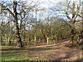
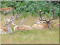
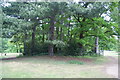
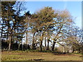
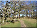
Nearby Images from Geograph Britain and Ireland:
©2013(licence)
©2007(licence)
©2011(licence)
©2015(licence)
©2013(licence)
The above images may not be of the site on this page, they are loaded from Geograph.
Please Submit an Image of this site or go out and take one for us!
Click here to see more info for this site
Nearby sites
Key: Red: member's photo, Blue: 3rd party photo, Yellow: other image, Green: no photo - please go there and take one, Grey: site destroyed
Download sites to:
KML (Google Earth)
GPX (GPS waypoints)
CSV (Garmin/Navman)
CSV (Excel)
To unlock full downloads you need to sign up as a Contributory Member. Otherwise downloads are limited to 50 sites.
Turn off the page maps and other distractions
Nearby sites listing. In the following links * = Image available
1.4km NNW 337° Richmond Park Long Barrow Artificial Mound (TQ189721)
2.0km SW 218° Kingston Museum* Museum (TQ1830169219)
2.4km SW 225° King Stone (Kingston-upon-Thames)* Marker Stone (TQ1786769069)
2.5km NNW 340° King Henry's Mound* Artificial Mound (TQ18607315)
2.9km E 85° Caesar's Camp (Wimbledon)* Hillfort (TQ224711)
2.9km ENE 77° Caesar's Well (Wimbledon) Holy Well or Sacred Spring (TQ22377151)
3.2km W 264° Barrow Hill (Teddington)* Round Barrow(s) (TQ16287037)
3.9km ENE 58° Putney Heath Round Barrow(s) (TQ22797295)
4.3km NNW 337° Museum of Richmond* Museum (TQ1774374697)
6.0km SE 126° Morden Park* Artificial Mound (TQ245674)
8.4km SSE 166° Bourne Hall Museum* Museum (TQ218627)
8.4km SSE 165° Ewell Springs (Surrey)* Holy Well or Sacred Spring (TQ219627)
8.8km SSE 163° Hatch Furlong Ritual Shafts* Misc. Earthwork (TQ223625)
9.4km NNW 339° Elthorne Park Sarsen* Natural Stone / Erratic / Other Natural Feature (TQ15927947)
10.5km SE 128° Queen Anne's Well (Carshalton)* Holy Well or Sacred Spring (TQ279645)
11.0km ESE 102° Pollards Hill Hillfort (TQ303688)
11.0km SSW 191° Ashtead Common Earthwork* Misc. Earthwork (TQ176600)
11.0km NE 41° London Natural History Museum* Museum (TQ266792)
11.2km NE 37° St Govor's Well* Holy Well or Sacred Spring (TQ2605079887)
11.3km NE 49° Tutankhamun: Treasures of the Golden Pharaoh exhibition, Saatchi Gallery* Museum (TQ279784)
11.4km SSE 153° Gally Hills Barrow Cemetery (TQ249607)
12.0km W 259° Shepperton Henge* Henge (TQ07686832)
12.2km NNE 19° Kensal Green* Modern Stone Circle etc (TQ233824)
12.3km WNW 285° Bedfont Cursus (TQ075738)
13.0km ENE 57° Mesolithic structure near Vauxhall bridge* Timber Circle (TQ30217814)
View more nearby sites and additional images


 We would like to know more about this location. Please feel free to add a brief description and any relevant information in your own language.
 Wir möchten mehr über diese Stätte erfahren. Bitte zögern Sie nicht, eine kurze Beschreibung und relevante Informationen in Deutsch hinzuzufügen.
 Nous aimerions en savoir encore un peu sur les lieux. S'il vous plaît n'hesitez pas à ajouter une courte description et tous les renseignements pertinents dans votre propre langue.
 Quisieramos informarnos un poco más de las lugares. No dude en añadir una breve descripción y otros datos relevantes en su propio idioma.