<< Our Photo Pages >> Rudston Beacon Round Barrow - Round Barrow(s) in England in Yorkshire (East)
Submitted by SumDoood on Saturday, 13 October 2018 Page Views: 1193
Neolithic and Bronze AgeSite Name: Rudston Beacon Round BarrowCountry: England County: Yorkshire (East) Type: Round Barrow(s)
Nearest Town: Bridlington Nearest Village: Rudston
Map Ref: TA0945365617
Latitude: 54.074859N Longitude: 0.328691W
Condition:
| 5 | Perfect |
| 4 | Almost Perfect |
| 3 | Reasonable but with some damage |
| 2 | Ruined but still recognisable as an ancient site |
| 1 | Pretty much destroyed, possibly visible as crop marks |
| 0 | No data. |
| -1 | Completely destroyed |
| 5 | Superb |
| 4 | Good |
| 3 | Ordinary |
| 2 | Not Good |
| 1 | Awful |
| 0 | No data. |
| 5 | Can be driven to, probably with disabled access |
| 4 | Short walk on a footpath |
| 3 | Requiring a bit more of a walk |
| 2 | A long walk |
| 1 | In the middle of nowhere, a nightmare to find |
| 0 | No data. |
| 5 | co-ordinates taken by GPS or official recorded co-ordinates |
| 4 | co-ordinates scaled from a detailed map |
| 3 | co-ordinates scaled from a bad map |
| 2 | co-ordinates of the nearest village |
| 1 | co-ordinates of the nearest town |
| 0 | no data |
Internal Links:
External Links:
")
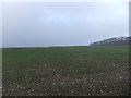
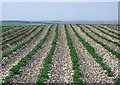
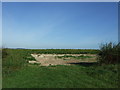
A great location being at the side of (pre?)-Roman Woldgate, at the highest point for a long way around, and close to due south of the ploughed out Argham Henge (across the Gypsey Race and the Great Wold Valley to the north), but dismal too in that so very much of this barrow has been destroyed by farmers. And continues to be. Other ploughed out barrows can still be discerned a little to the east.
Pastscape 79464
"A Bronze Age round barrow still extant as an earthwork mound circa 32 metres in diameter and 1.5 metres high. In the 1870s Greenwell described it as "almost entirely removed many years ago, when bones are said to have been found in large quantities"."
You may be viewing yesterday's version of this page. To see the most up to date information please register for a free account.
")
Do not use the above information on other web sites or publications without permission of the contributor.
Nearby Images from Geograph Britain and Ireland:
©2018(licence)
©2007(licence)
©2016(licence)
©2015(licence)

©2021(licence)
The above images may not be of the site on this page, they are loaded from Geograph.
Please Submit an Image of this site or go out and take one for us!
Click here to see more info for this site
Nearby sites
Key: Red: member's photo, Blue: 3rd party photo, Yellow: other image, Green: no photo - please go there and take one, Grey: site destroyed
Download sites to:
KML (Google Earth)
GPX (GPS waypoints)
CSV (Garmin/Navman)
CSV (Excel)
To unlock full downloads you need to sign up as a Contributory Member. Otherwise downloads are limited to 50 sites.
Turn off the page maps and other distractions
Nearby sites listing. In the following links * = Image available
453m E 81° Rudston A Cursus* Cursus (TA099657)
482m ENE 69° Rudston Cult Centre* Ancient Village or Settlement (TA099658)
1.6km NE 55° Southside Mount* Round Barrow(s)
1.8km N 353° Rudston Cursus Group Cursus (TA092674)
1.9km NW 315° Rudston B Cursus Cursus (TA081669)
1.9km N 360° Rudston B Cursus Cursus (TA094675)
2.2km N 11° Rudston Monolith* Standing Stone (Menhir) (TA0980367743)
2.2km N 8° Rudston D Cursus Cursus (TA097678)
2.5km NNE 19° Rudston C Cursus Cursus (TA102680)
2.7km NNW 347° Rudston C Cursus Cursus (TA088682)
2.9km NW 321° Rudstone Long Barrow Long Barrow (TA07586779)
2.9km NNE 18° Rudston A Cursus Cursus (TA103684)
3.4km NE 38° Greenland Fort Hillfort (TA115684)
3.7km NE 56° Caythorpe Misc. Earthwork (TA125678)
3.9km S 181° St John's Well (Harpham)* Holy Well or Sacred Spring (TA095617)
4.2km WNW 295° Kilham Long Barrow Long Barrow (TA056673)
4.4km SSW 206° Fox Hill Tumulus* Round Barrow(s) (TA07606167)
5.0km WSW 250° Gallows Hill Barrow Round Barrow(s) (TA04776379)
5.0km N 4° Maidens Grave* Henge (TA09677063)
5.6km SW 221° Ruston Beacon (Ruston Parva) Cairn (TA05846128)
6.3km N 8° Rudston D Cursus Cursus (TA102719)
6.7km NNE 31° Keld Spring* Holy Well or Sacred Spring (TA128714)
7.5km NNW 335° Willy Howe* Round Barrow(s) (TA06167235)
8.0km WSW 254° Dane's Graves* Barrow Cemetery (TA01806330)
8.2km NW 310° Paddock Hill* Henge (TA030707)
View more nearby sites and additional images


 We would like to know more about this location. Please feel free to add a brief description and any relevant information in your own language.
 Wir möchten mehr über diese Stätte erfahren. Bitte zögern Sie nicht, eine kurze Beschreibung und relevante Informationen in Deutsch hinzuzufügen.
 Nous aimerions en savoir encore un peu sur les lieux. S'il vous plaît n'hesitez pas à ajouter une courte description et tous les renseignements pertinents dans votre propre langue.
 Quisieramos informarnos un poco más de las lugares. No dude en añadir una breve descripción y otros datos relevantes en su propio idioma.