


<< Text Pages >> Springhead Hill Cross Dyke - Misc. Earthwork in England in West Sussex
Submitted by coldrum on Wednesday, 23 July 2008 Page Views: 3173
Multi-periodSite Name: Springhead Hill Cross DykeCountry: England County: West Sussex Type: Misc. Earthwork
Map Ref: TQ062125
Latitude: 50.902218N Longitude: 0.491076W
Condition:
| 5 | Perfect |
| 4 | Almost Perfect |
| 3 | Reasonable but with some damage |
| 2 | Ruined but still recognisable as an ancient site |
| 1 | Pretty much destroyed, possibly visible as crop marks |
| 0 | No data. |
| -1 | Completely destroyed |
| 5 | Superb |
| 4 | Good |
| 3 | Ordinary |
| 2 | Not Good |
| 1 | Awful |
| 0 | No data. |
| 5 | Can be driven to, probably with disabled access |
| 4 | Short walk on a footpath |
| 3 | Requiring a bit more of a walk |
| 2 | A long walk |
| 1 | In the middle of nowhere, a nightmare to find |
| 0 | No data. |
| 5 | co-ordinates taken by GPS or official recorded co-ordinates |
| 4 | co-ordinates scaled from a detailed map |
| 3 | co-ordinates scaled from a bad map |
| 2 | co-ordinates of the nearest village |
| 1 | co-ordinates of the nearest town |
| 0 | no data |
Be the first person to rate this site - see the 'Contribute!' box in the right hand menu.
Internal Links:
External Links:
I have visited· I would like to visit
Spiderdrone visited - their rating: Cond: -1 Amb: 3 Access: 4 Parking in the Kithurst car park at the end of Parham Post road. Great views of the SDW and sheep but not much else.
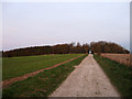
Cross Dyke.
You may be viewing yesterday's version of this page. To see the most up to date information please register for a free account.
")
Do not use the above information on other web sites or publications without permission of the contributor.
Nearby Images from Geograph Britain and Ireland:
©2011(licence)
©2024(licence)
©2024(licence)
©2008(licence)
©2009(licence)
The above images may not be of the site on this page, they are loaded from Geograph.
Please Submit an Image of this site or go out and take one for us!
Click here to see more info for this site
Nearby sites
Key: Red: member's photo, Blue: 3rd party photo, Yellow: other image, Green: no photo - please go there and take one, Grey: site destroyed
Download sites to:
KML (Google Earth)
GPX (GPS waypoints)
CSV (Garmin/Navman)
CSV (Excel)
To unlock full downloads you need to sign up as a Contributory Member. Otherwise downloads are limited to 50 sites.
Turn off the page maps and other distractions
Nearby sites listing. In the following links * = Image available
509m ESE 103° Springhead Hill Tumuli Barrow Cemetery (TQ067124)
905m W 277° Rackham Hill Earthwork and Tumuli* Round Barrow(s) (TQ0529712589)
1.2km W 267° Rackham Banks* Ancient Village or Settlement (TQ05001242)
1.7km E 90° Kithurst Hill Tumuli* Barrow Cemetery (TQ07871254)
1.7km W 261° Amberley Mount Field System Misc. Earthwork (TQ045122)
1.9km W 268° Amberley Mount Tumuli Barrow Cemetery (TQ043124)
2.3km E 86° Chantry Hill Cross Dyke* Misc. Earthwork (TQ0850512712)
2.4km W 271° Highdown Tumulus Round Barrow(s) (TQ038125)
2.5km S 183° Wepham Down Earthwork* Misc. Earthwork (TQ06141001)
2.6km ESE 103° Chantry Hill Tumuli* Barrow Cemetery (TQ08731197)
2.7km S 172° Friday's Well Holy Well or Sacred Spring (TQ06620983)
2.9km S 174° Barpham Hill Cross Dyke Round Barrow(s) (TQ06550959)
3.2km SSW 192° Norfolk Clump Tumulus Round Barrow(s) (TQ056094)
3.2km SE 143° Harrow Hill enclosure* Ancient Village or Settlement (TQ08151000)
3.2km SE 143° Harrow Hill Flint Mines* Ancient Mine, Quarry or other Industry (TQ082100)
3.2km SSE 155° Harrow Hill Tumulus Round Barrow(s) (TQ07610959)
3.2km E 94° Sullington Hill Cross Dyke* Misc. Earthwork (TQ09451232)
3.3km ESE 122° Old Gray's Wood Bowl Barrow Round Barrow(s) (TQ09051078)
3.7km SE 129° Harrow Hill Barrows Barrow Cemetery (TQ09141026)
3.8km SE 131° Cock Hill Barrow* Round Barrow(s) (TQ09101007)
3.9km SE 137° Cock Hill Settlement Ancient Village or Settlement (TQ08920974)
3.9km SSE 147° New Barn Down Barrows Barrow Cemetery (TQ08430926)
4.0km SSE 147° New Barn Down Ancient Village or Settlement (TQ08460922)
4.4km SE 132° Blackpatch Hill Bowl Barrow* Round Barrow(s) (TQ09540966)
4.5km SE 140° Blackpatch Settlement Ancient Village or Settlement (TQ09150908)
View more nearby sites and additional images

")
 We would like to know more about this location. Please feel free to add a brief description and any relevant information in your own language.
 Wir möchten mehr über diese Stätte erfahren. Bitte zögern Sie nicht, eine kurze Beschreibung und relevante Informationen in Deutsch hinzuzufügen.
 Nous aimerions en savoir encore un peu sur les lieux. S'il vous plaît n'hesitez pas à ajouter une courte description et tous les renseignements pertinents dans votre propre langue.
 Quisieramos informarnos un poco más de las lugares. No dude en añadir una breve descripción y otros datos relevantes en su propio idioma.