 with our Megalithic Portal iPhone app")


<< Our Photo Pages >> Wold Newton - Round Barrow(s) in England in Yorkshire (East)
Submitted by ainsloch on Wednesday, 24 September 2014 Page Views: 3601
Neolithic and Bronze AgeSite Name: Wold NewtonCountry: England County: Yorkshire (East) Type: Round Barrow(s)
Nearest Town: Bridlington Nearest Village: Wold Newton
Map Ref: TA04527287
Latitude: 54.141044N Longitude: 0.401546W
Condition:
| 5 | Perfect |
| 4 | Almost Perfect |
| 3 | Reasonable but with some damage |
| 2 | Ruined but still recognisable as an ancient site |
| 1 | Pretty much destroyed, possibly visible as crop marks |
| 0 | No data. |
| -1 | Completely destroyed |
| 5 | Superb |
| 4 | Good |
| 3 | Ordinary |
| 2 | Not Good |
| 1 | Awful |
| 0 | No data. |
| 5 | Can be driven to, probably with disabled access |
| 4 | Short walk on a footpath |
| 3 | Requiring a bit more of a walk |
| 2 | A long walk |
| 1 | In the middle of nowhere, a nightmare to find |
| 0 | No data. |
| 5 | co-ordinates taken by GPS or official recorded co-ordinates |
| 4 | co-ordinates scaled from a detailed map |
| 3 | co-ordinates scaled from a bad map |
| 2 | co-ordinates of the nearest village |
| 1 | co-ordinates of the nearest town |
| 0 | no data |
Internal Links:
External Links:
I have visited· I would like to visit
SumDoood visited on 6th Apr 2017 - their rating: Cond: 2 Amb: 3 Access: 3
")
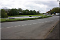
One of the four great Yorkshire barrows, Wold Newton is somewhat overshadowed by its close relative the Willy Howe barrow, which is situated about 0.85 miles to the east. Wold is now greatly denuded due to plough damage, but was once an imposing edifice.
You may be viewing yesterday's version of this page. To see the most up to date information please register for a free account.
")
")
")
")
Do not use the above information on other web sites or publications without permission of the contributor.
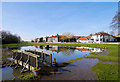
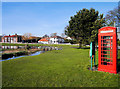
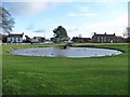
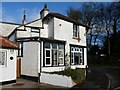
Nearby Images from Geograph Britain and Ireland:
©2013(licence)
©2013(licence)
©2011(licence)
©2011(licence)
©2009(licence)
The above images may not be of the site on this page, they are loaded from Geograph.
Please Submit an Image of this site or go out and take one for us!
Click here to see more info for this site
Nearby sites
Key: Red: member's photo, Blue: 3rd party photo, Yellow: other image, Green: no photo - please go there and take one, Grey: site destroyed
Download sites to:
KML (Google Earth)
GPX (GPS waypoints)
CSV (Garmin/Navman)
CSV (Excel)
To unlock full downloads you need to sign up as a Contributory Member. Otherwise downloads are limited to 50 sites.
Turn off the page maps and other distractions
Nearby sites listing. In the following links * = Image available
388m SE 135° Ba’l Hill* Round Barrow(s) (TA048726)
1.7km ESE 109° Willy Howe* Round Barrow(s) (TA06167235)
2.6km SW 216° Paddock Hill* Henge (TA030707)
3.6km NNW 335° Willerby Wold Long Barrow Long Barrow (TA029761)
4.4km N 357° Elf Howe Round Barrow(s) (TA04227725)
4.6km NW 320° Willerby Wold House* Round Barrow(s) (TA015763)
4.8km N 6° Sharp Howes* Barrow Cemetery (TA049777)
5.1km NNE 17° Folkton Round Barrow* Round Barrow(s) (TA059778)
5.6km ESE 115° Maidens Grave* Henge (TA09677063)
5.7km S 170° Kilham Long Barrow Long Barrow (TA056673)
5.7km E 101° Rudston D Cursus Cursus (TA102719)
5.9km SSE 150° Rudstone Long Barrow Long Barrow (TA07586779)
6.2km NNE 20° Spell Howe (Folkton) Cairn (TA06577878)
6.3km SE 139° Rudston C Cursus Cursus (TA088682)
7.0km SSE 150° Rudston B Cursus Cursus (TA081669)
7.2km SE 141° Rudston Cursus Group Cursus (TA092674)
7.2km SE 136° Rudston D Cursus Cursus (TA097678)
7.2km SE 139° Rudston B Cursus Cursus (TA094675)
7.3km SE 129° Rudston A Cursus Cursus (TA103684)
7.3km SE 136° Rudston Monolith* Standing Stone (Menhir) (TA0980367743)
7.5km SE 132° Rudston C Cursus Cursus (TA102680)
8.3km SE 124° Greenland Fort Hillfort (TA115684)
8.3km N 350° Star Carr* Ancient Village or Settlement (TA0282181013)
8.4km ESE 101° Keld Spring* Holy Well or Sacred Spring (TA128714)
8.8km SSE 147° Rudston Beacon Round Barrow* Round Barrow(s) (TA0945365617)
View more nearby sites and additional images


 We would like to know more about this location. Please feel free to add a brief description and any relevant information in your own language.
 Wir möchten mehr über diese Stätte erfahren. Bitte zögern Sie nicht, eine kurze Beschreibung und relevante Informationen in Deutsch hinzuzufügen.
 Nous aimerions en savoir encore un peu sur les lieux. S'il vous plaît n'hesitez pas à ajouter une courte description et tous les renseignements pertinents dans votre propre langue.
 Quisieramos informarnos un poco más de las lugares. No dude en añadir una breve descripción y otros datos relevantes en su propio idioma.