<< Our Photo Pages >> Burn Howe Dale RB1 - Round Barrow(s) in England in Yorkshire (North)
Submitted by johndhunter on Friday, 20 November 2020 Page Views: 529
Neolithic and Bronze AgeSite Name: Burn Howe Dale RB1Country: England
NOTE: This site is 0.8 km away from the location you searched for.
County: Yorkshire (North) Type: Round Barrow(s)
Nearest Village: Ravenscar
Map Ref: NZ9415800384
Latitude: 54.390241N Longitude: 0.551464W
Condition:
| 5 | Perfect |
| 4 | Almost Perfect |
| 3 | Reasonable but with some damage |
| 2 | Ruined but still recognisable as an ancient site |
| 1 | Pretty much destroyed, possibly visible as crop marks |
| 0 | No data. |
| -1 | Completely destroyed |
| 5 | Superb |
| 4 | Good |
| 3 | Ordinary |
| 2 | Not Good |
| 1 | Awful |
| 0 | No data. |
| 5 | Can be driven to, probably with disabled access |
| 4 | Short walk on a footpath |
| 3 | Requiring a bit more of a walk |
| 2 | A long walk |
| 1 | In the middle of nowhere, a nightmare to find |
| 0 | No data. |
| 5 | co-ordinates taken by GPS or official recorded co-ordinates |
| 4 | co-ordinates scaled from a detailed map |
| 3 | co-ordinates scaled from a bad map |
| 2 | co-ordinates of the nearest village |
| 1 | co-ordinates of the nearest town |
| 0 | no data |
Internal Links:
External Links:
")
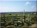
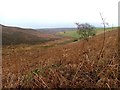
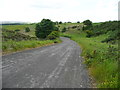
Located lower down, toward the beginning of the farmland at the northern edge of Jugger Howe Moor, it is still in a fairly prominent position beside a right of way overlooking Wragby Farm and the surrounding area
Its original shape has been distorted by the dumping of soil and rubble in the past, consequently Historic England List Entry 1019687 tell us that this has now left an elongated mound which measures 5m east to west (should be south east to north west) and 12m north to south (should be north east to south west) and that it stands 0.75m high.
Pastscape also has information at Monument 29791 which tells us that field investigators found in 1972 that the barrow was turf covered, 8m in diameter, 0.5 m high, with a slight depression in the centre. Presumably this is its original shape before the later dumping of materials.
You may be viewing yesterday's version of this page. To see the most up to date information please register for a free account.
")
Do not use the above information on other web sites or publications without permission of the contributor.
Nearby Images from Geograph Britain and Ireland:
©2011(licence)
©2005(licence)
©2015(licence)
©2017(licence)
©2015(licence)
The above images may not be of the site on this page, they are loaded from Geograph.
Please Submit an Image of this site or go out and take one for us!
Click here to see more info for this site
Nearby sites
Key: Red: member's photo, Blue: 3rd party photo, Yellow: other image, Green: no photo - please go there and take one, Grey: site destroyed
Download sites to:
KML (Google Earth)
GPX (GPS waypoints)
CSV (Garmin/Navman)
CSV (Excel)
To unlock full downloads you need to sign up as a Contributory Member. Otherwise downloads are limited to 50 sites.
Turn off the page maps and other distractions
Nearby sites listing. In the following links * = Image available
297m SE 136° Jugger Howes* Round Barrow(s) (NZ9436800173)
648m ENE 62° Stony Marl Ring Cairn 1* Ring Cairn (NZ9472600700)
1.2km ENE 64° Grey Horse Stone (Stony Marl Moor)* Standing Stone (Menhir) (NZ9525200936)
1.6km ENE 79° Stony Marl Howes* Barrow Cemetery (NZ9569900725)
1.7km ENE 63° The Map Stone (Fylingdales Moor) Rock Art (NZ957012)
2.3km NE 41° Brow Moor RB5* Round Barrow(s) (NZ9563302119)
2.3km NE 44° Brow Moor RB4* Round Barrow(s) (NZ9572802103)
2.4km NE 48° Brow Moor RB3* Round Barrow(s) (NZ9593602045)
2.4km ENE 69° Fylingdales Moor, Brow Moor, East Butts, (Area E)* Rock Art (NZ9642001307)
2.4km ENE 69° Brow Moor - Rock 87* Rock Art (NZ9642501323)
2.5km ENE 69° Brow Moor - Rock 72* Rock Art (NZ9645001320)
2.5km NE 51° Brow Moor RB2* Round Barrow(s) (NZ9604301989)
2.5km ENE 71° Brow Moor - Rock 82* Rock Art (NZ9649401219)
2.5km ENE 70° Brow Moor - Rock 76* Rock Art (NZ9648201282)
2.5km NE 54° Brow Moor - Rock 2* Rock Art (NZ9615701874)
2.5km ENE 71° Brow Moor - Rock 80* Rock Art (NZ9650801226)
2.5km ENE 71° Brow Moor - Rock 79* Rock Art (NZ9649801261)
2.5km ENE 71° Brow Moor - Rock 83* Rock Art (NZ9651601226)
2.5km ENE 70° Hugh Kendall Stone* Rock Art (NZ9652101275)
2.5km ENE 70° Brow Moor - Rock 74* Rock Art (NZ9650801316)
2.5km ENE 71° Robin Hood's Bay Cup and Ring Stone (Whitby)* Rock Art (NZ9652501274)
2.5km ENE 71° Brow Moor - Rock 78* Rock Art (NZ9652701270)
2.5km ENE 59° Brow Moor SS2* Marker Stone (NZ9629901740)
2.5km NE 56° Brow Moor CC1* Cairn (NZ9623101859)
2.6km NE 55° Robin Hood's Butts (Stoupe Brow)* Round Barrow(s) (NZ96250193)
View more nearby sites and additional images


 We would like to know more about this location. Please feel free to add a brief description and any relevant information in your own language.
 Wir möchten mehr über diese Stätte erfahren. Bitte zögern Sie nicht, eine kurze Beschreibung und relevante Informationen in Deutsch hinzuzufügen.
 Nous aimerions en savoir encore un peu sur les lieux. S'il vous plaît n'hesitez pas à ajouter une courte description et tous les renseignements pertinents dans votre propre langue.
 Quisieramos informarnos un poco más de las lugares. No dude en añadir una breve descripción y otros datos relevantes en su propio idioma.