<< Our Photo Pages >> Low Woof Howe - Round Barrow(s) in England in Yorkshire (North)
Submitted by coldrum on Friday, 28 October 2011 Page Views: 2449
Neolithic and Bronze AgeSite Name: Low Woof HoweCountry: England County: Yorkshire (North) Type: Round Barrow(s)
Map Ref: SE89219618
Latitude: 54.353360N Longitude: 0.628898W
Condition:
| 5 | Perfect |
| 4 | Almost Perfect |
| 3 | Reasonable but with some damage |
| 2 | Ruined but still recognisable as an ancient site |
| 1 | Pretty much destroyed, possibly visible as crop marks |
| 0 | No data. |
| -1 | Completely destroyed |
| 5 | Superb |
| 4 | Good |
| 3 | Ordinary |
| 2 | Not Good |
| 1 | Awful |
| 0 | No data. |
| 5 | Can be driven to, probably with disabled access |
| 4 | Short walk on a footpath |
| 3 | Requiring a bit more of a walk |
| 2 | A long walk |
| 1 | In the middle of nowhere, a nightmare to find |
| 0 | No data. |
| 5 | co-ordinates taken by GPS or official recorded co-ordinates |
| 4 | co-ordinates scaled from a detailed map |
| 3 | co-ordinates scaled from a bad map |
| 2 | co-ordinates of the nearest village |
| 1 | co-ordinates of the nearest town |
| 0 | no data |
Be the first person to rate this site - see the 'Contribute!' box in the right hand menu.
Internal Links:
External Links:
")
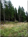
"A round barrow with an earth and stone mound, standing up to 1.2 metres high. There is a hollow in the centre of the mound, caused by partial excavation in the past. On the west side of this hollow is a boundary stone, bearing on its south-eastern face the inscription 'By Order of the Commissioner of Wykeham Inclosure 1786'. Scheduled."
Read More at Pastscape Monument No 62792.
You may be viewing yesterday's version of this page. To see the most up to date information please register for a free account.
")
")
")
")
Do not use the above information on other web sites or publications without permission of the contributor.
Nearby Images from Geograph Britain and Ireland:
©2023(licence)
©2018(licence)
©2013(licence)
©2006(licence)
©2006(licence)
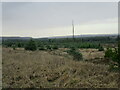
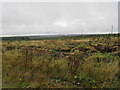
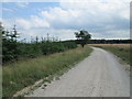
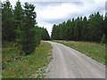
The above images may not be of the site on this page, they are loaded from Geograph.
Please Submit an Image of this site or go out and take one for us!
Click here to see more info for this site
Nearby sites
Key: Red: member's photo, Blue: 3rd party photo, Yellow: other image, Green: no photo - please go there and take one, Grey: site destroyed
Download sites to:
KML (Google Earth)
GPX (GPS waypoints)
CSV (Garmin/Navman)
CSV (Excel)
To unlock full downloads you need to sign up as a Contributory Member. Otherwise downloads are limited to 50 sites.
Turn off the page maps and other distractions
Nearby sites listing. In the following links * = Image available
643m N 7° High Woof Howe* Round Barrow(s) (SE8928096820)
658m NNE 20° Round Barrow 145m East of Woof Howe* Round Barrow(s) (SE8942396803)
679m NNE 24° Round Barrow 200m East of Woof Howe* Round Barrow(s) (SE8947496806)
2.1km ESE 106° High Greens Cairn Cemetery Cairn (SE91239564)
2.4km NW 312° Lilla Rigg (Fylingdales)* Marker Stone (SE8735197763)
2.5km N 355° Lilla Cross* Ancient Cross (SE8892398687)
2.7km W 261° Saltergate Moor* Stone Row / Alignment (SE865957)
2.8km WSW 245° Malo Cross* Ancient Cross (SE8667594943)
3.1km N 351° Louven Howe* Round Barrow(s) (SE8866699192)
3.4km SW 217° Blakey Topping* Stone Circle (SE87199338)
3.8km WSW 242° Cross Dyke on Saltergate Brow* Misc. Earthwork (SE8587194356)
4.2km NNW 341° Ann's Cross* Ancient Cross (NZ8777400168)
4.8km WSW 246° Gallows Dyke* Misc. Earthwork (SE84849416)
4.9km S 178° Dargate Dykes* Ancient Village or Settlement (SE89519132)
5.1km NNW 341° Foster Howes* Round Barrow(s) (NZ8744800991)
5.2km WSW 247° Levisham Moor North RB1* Round Barrow(s) (SE8446294083)
5.3km S 170° Fox Howe* Round Barrow(s) (SE90249096)
5.4km S 176° Brown Howes* Round Barrow(s) (SE89709084)
5.4km SSW 203° The Bridestones (Staindale)* Natural Stone / Erratic / Other Natural Feature (SE872912)
5.5km NNW 347° York Cross (Sneaton High Moor)* Ancient Cross (NZ8785901524)
5.7km S 170° Three Howes (South Moor)* Round Barrow(s) (SE90329063)
6.0km N 9° Old Wife's Neck* Standing Stones (NZ90060214)
6.2km SSW 194° Adder Stone (Dalby Forest)* Natural Stone / Erratic / Other Natural Feature (SE8778090110)
6.2km NNW 339° Robbed Howe* Round Barrow(s) (NZ8685001958)
6.5km WNW 289° Simon Howe* Barrow Cemetery (SE8302398124)
View more nearby sites and additional images


 We would like to know more about this location. Please feel free to add a brief description and any relevant information in your own language.
 Wir möchten mehr über diese Stätte erfahren. Bitte zögern Sie nicht, eine kurze Beschreibung und relevante Informationen in Deutsch hinzuzufügen.
 Nous aimerions en savoir encore un peu sur les lieux. S'il vous plaît n'hesitez pas à ajouter une courte description et tous les renseignements pertinents dans votre propre langue.
 Quisieramos informarnos un poco más de las lugares. No dude en añadir una breve descripción y otros datos relevantes en su propio idioma.