<< Our Photo Pages >> Blakey Topping - Stone Circle in England in Yorkshire (North)
Submitted by S.Slater on Wednesday, 12 November 2003 Page Views: 17608
Neolithic and Bronze AgeSite Name: Blakey ToppingCountry: England County: Yorkshire (North) Type: Stone Circle
Nearest Town: Scarborough
Map Ref: SE87199338 Landranger Map Number: 94
Latitude: 54.328552N Longitude: 0.660786W
Condition:
| 5 | Perfect |
| 4 | Almost Perfect |
| 3 | Reasonable but with some damage |
| 2 | Ruined but still recognisable as an ancient site |
| 1 | Pretty much destroyed, possibly visible as crop marks |
| 0 | No data. |
| -1 | Completely destroyed |
| 5 | Superb |
| 4 | Good |
| 3 | Ordinary |
| 2 | Not Good |
| 1 | Awful |
| 0 | No data. |
| 5 | Can be driven to, probably with disabled access |
| 4 | Short walk on a footpath |
| 3 | Requiring a bit more of a walk |
| 2 | A long walk |
| 1 | In the middle of nowhere, a nightmare to find |
| 0 | No data. |
| 5 | co-ordinates taken by GPS or official recorded co-ordinates |
| 4 | co-ordinates scaled from a detailed map |
| 3 | co-ordinates scaled from a bad map |
| 2 | co-ordinates of the nearest village |
| 1 | co-ordinates of the nearest town |
| 0 | no data |
Internal Links:
External Links:
I have visited· I would like to visit
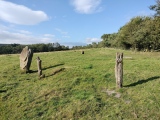
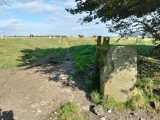
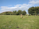
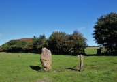
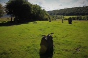
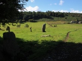
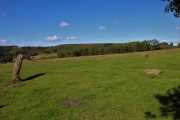
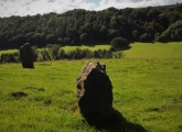
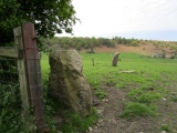
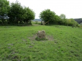
TheCaptain visited on 14th Sep 2024 - their rating: Cond: 2 Amb: 4 Access: 3 Walk from Saltergate layby above the Hole of Horcum along Old Wife's Way to Newgate Foot and up to Blakey Topping and it's stone circle. One six foot standing stone and a stump in the field, with another stone standing at the gate, a flat stone in the field, and a couple of wooden posts. Is that another stone in the hedge I see?
TheWhiteRider visited on 20th Jun 2012 - their rating: Cond: 2 Amb: 5 Access: 2
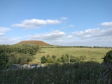
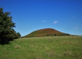
tlgreen visited on 4th Sep 2011 - their rating: Cond: 2 Amb: 4 Access: 3 Small stone circle, 2 stones remain upright, 2 flat on the ground, some obviously missing. The setting below Blakey Topping adds to the ambiance, as it is a hill with some air of mystery, that from certain angles does not look natural!
Reached by public footpath from the pay & display car park at the Hole of Horcum, we had to walk about two miles to get there.
JimChampion have visited here
Average ratings for this site from all visit loggers: Condition: 2 Ambience: 4.33 Access: 2.67

Nearby, the ordnance survey map shows 2, possibly 3 cairns in alignment.
You may be viewing yesterday's version of this page. To see the most up to date information please register for a free account.






These are just the first 25 photos of Blakey Topping. If you log in with a free user account you will be able to see our entire collection.
Do not use the above information on other web sites or publications without permission of the contributor.
Click here to see more info for this site
Nearby sites
Key: Red: member's photo, Blue: 3rd party photo, Yellow: other image, Green: no photo - please go there and take one, Grey: site destroyed
Download sites to:
KML (Google Earth)
GPX (GPS waypoints)
CSV (Garmin/Navman)
CSV (Excel)
To unlock full downloads you need to sign up as a Contributory Member. Otherwise downloads are limited to 50 sites.
Turn off the page maps and other distractions
Nearby sites listing. In the following links * = Image available
1.6km NW 308° Cross Dyke on Saltergate Brow* Misc. Earthwork (SE8587194356)
1.6km NNW 343° Malo Cross* Ancient Cross (SE8667594943)
2.2km S 181° The Bridestones (Staindale)* Natural Stone / Erratic / Other Natural Feature (SE872912)
2.3km NNW 340° Saltergate Moor* Stone Row / Alignment (SE86359555)
2.5km WNW 289° Gallows Dyke* Misc. Earthwork (SE84849416)
2.8km WNW 286° Levisham Moor North RB1* Round Barrow(s) (SE8446294083)
3.1km SE 133° Dargate Dykes* Ancient Village or Settlement (SE89519132)
3.3km S 171° Adder Stone (Dalby Forest)* Natural Stone / Erratic / Other Natural Feature (SE8778090110)
3.4km NE 37° Low Woof Howe* Round Barrow(s) (SE89219618)
3.6km SE 136° Brown Howes* Round Barrow(s) (SE89709084)
3.9km SE 130° Fox Howe* Round Barrow(s) (SE90249096)
3.9km W 263° Sheephouse Rigg RB1* Round Barrow(s) (SE8328192848)
3.9km W 274° Seavy Pond Round Barrows* Barrow Cemetery (SE8324893610)
4.0km W 272° Levisham Moor Cross Dyke North* Misc. Earthwork (SE8322293450)
4.0km NNE 32° High Woof Howe* Round Barrow(s) (SE8928096820)
4.1km WSW 254° Levisham Moor South RB1* Round Barrow(s) (SE8329592214)
4.1km NE 34° Round Barrow 145m East of Woof Howe* Round Barrow(s) (SE8942396803)
4.1km NE 35° Round Barrow 200m East of Woof Howe* Round Barrow(s) (SE8947496806)
4.1km WSW 257° Pigtrough Rigg Settlement* Ancient Village or Settlement (SE8319492354)
4.2km SE 132° Three Howes (South Moor)* Round Barrow(s) (SE90329063)
4.2km W 268° Levisham Moor Cross Dyke South* Misc. Earthwork (SE8298893126)
4.4km SW 226° St Robert's Holy Well* Holy Well or Sacred Spring (SE841903)
4.4km WSW 252° Dundale Rigg RB1* Round Barrow(s) (SE8306091935)
4.4km N 3° Lilla Rigg (Fylingdales)* Marker Stone (SE8735197763)
4.4km W 261° Levisham Moor South RB2* Round Barrow(s) (SE8280792608)
View more nearby sites and additional images


 We would like to know more about this location. Please feel free to add a brief description and any relevant information in your own language.
 Wir möchten mehr über diese Stätte erfahren. Bitte zögern Sie nicht, eine kurze Beschreibung und relevante Informationen in Deutsch hinzuzufügen.
 Nous aimerions en savoir encore un peu sur les lieux. S'il vous plaît n'hesitez pas à ajouter une courte description et tous les renseignements pertinents dans votre propre langue.
 Quisieramos informarnos un poco más de las lugares. No dude en añadir una breve descripción y otros datos relevantes en su propio idioma.