<< Our Photo Pages >> Glaisdale Stone - Standing Stone (Menhir) in England in Yorkshire (North)
Submitted by kelpie on Monday, 01 March 2004 Page Views: 8213
Neolithic and Bronze AgeSite Name: Glaisdale StoneCountry: England
NOTE: This site is 0.2 km away from the location you searched for.
County: Yorkshire (North) Type: Standing Stone (Menhir)
Nearest Town: Whitby Nearest Village: Glaisdale
Map Ref: NZ7366603471 Landranger Map Number: 94
Latitude: 54.421351N Longitude: 0.8662W
Condition:
| 5 | Perfect |
| 4 | Almost Perfect |
| 3 | Reasonable but with some damage |
| 2 | Ruined but still recognisable as an ancient site |
| 1 | Pretty much destroyed, possibly visible as crop marks |
| 0 | No data. |
| -1 | Completely destroyed |
| 5 | Superb |
| 4 | Good |
| 3 | Ordinary |
| 2 | Not Good |
| 1 | Awful |
| 0 | No data. |
| 5 | Can be driven to, probably with disabled access |
| 4 | Short walk on a footpath |
| 3 | Requiring a bit more of a walk |
| 2 | A long walk |
| 1 | In the middle of nowhere, a nightmare to find |
| 0 | No data. |
| 5 | co-ordinates taken by GPS or official recorded co-ordinates |
| 4 | co-ordinates scaled from a detailed map |
| 3 | co-ordinates scaled from a bad map |
| 2 | co-ordinates of the nearest village |
| 1 | co-ordinates of the nearest town |
| 0 | no data |
Internal Links:
External Links:
I have visited· I would like to visit
kelpie has visited here
")
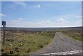
Glaisdale Stone - I first found this standing stone when visiting the nearby Hart Leap Stones. It does not appear on any map and I could see no evidence of either markings or other stones in the formation.
You may be viewing yesterday's version of this page. To see the most up to date information please register for a free account.
")
")
")
")
Do not use the above information on other web sites or publications without permission of the contributor.
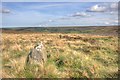
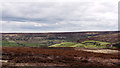
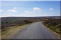
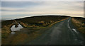
Nearby Images from Geograph Britain and Ireland:
©2008(licence)
©2013(licence)
©2020(licence)
©2011(licence)
©2020(licence)
The above images may not be of the site on this page, they are loaded from Geograph.
Please Submit an Image of this site or go out and take one for us!
Click here to see more info for this site
Nearby sites
Key: Red: member's photo, Blue: 3rd party photo, Yellow: other image, Green: no photo - please go there and take one, Grey: site destroyed
Download sites to:
KML (Google Earth)
GPX (GPS waypoints)
CSV (Garmin/Navman)
CSV (Excel)
To unlock full downloads you need to sign up as a Contributory Member. Otherwise downloads are limited to 50 sites.
Turn off the page maps and other distractions
Nearby sites listing. In the following links * = Image available
337m WNW 303° Hart Leap Stones* Misc. Earthwork (NZ73380365)
425m ENE 70° Glaisdale Rigg Tall Cairn* Cairn (NZ7406403622)
865m SW 233° Rokan Stone* Marker Stone (NZ7298402936)
1.3km NNE 27° Black Hill Cross (Glaisdale Rigg)* Ancient Cross (NZ7425304643)
1.4km SSW 202° Caper Hill Cross* Ancient Cross (NZ7317402205)
1.6km NE 49° Glaisdale Rigg Guide Stone* Marker Stone (NZ7488204579)
1.7km NE 46° Glaisdale Low Moor South West* Marker Stone (NZ7487004674)
1.9km SSW 208° Peat Hill Round Cairn (Cock Heads)* Round Cairn (NZ7281001791)
2.0km S 182° Grey Mare Stone (Glaisdale)* Marker Stone (NZ7361601491)
2.0km NNE 26° Glaisdale Rigg (Hill Top)* Marker Stone (NZ7452605269)
2.0km NE 35° Glaisdale Low Moor West* Marker Stone (NZ7480805138)
2.1km SW 221° Peat Hill Marker Stone (Cock Heads)* Marker Stone (NZ7229401851)
2.2km S 182° Flat Howe Guide Stones* Marker Stone (NZ7362601275)
2.4km S 177° Flat Howe (Glaisdale High Moor)* Round Barrow(s) (NZ7382801025)
2.6km NE 53° Glaisdale Low Moor RC1* Round Cairn (NZ7575205110)
2.7km SSE 167° Traverse Moor RB1* Round Barrow(s) (NZ7431200856)
2.7km NNE 32° Busco Beck Standing Stones* Standing Stones (NZ7508505817)
2.8km ENE 57° Glaisdale Low Moor RB1* Round Barrow(s) (NZ75960500)
2.8km NE 55° Glaisdale Low Moor Central* Marker Stone (NZ7590305102)
3.1km SSE 156° Yarlsey Hill Waymarker Stone* Standing Stone (Menhir) (NZ7495700636)
3.1km NNE 31° Lane Head Guide Stone* Marker Stone (NZ7523206184)
3.3km S 170° Goose i' th' nest* Marker Stone (NZ7431100201)
3.4km NE 54° Glaisdale Low Moor North East* Marker Stone (NZ7643905513)
3.6km E 100° Dog Howe* Round Cairn (NZ7722702935)
3.6km NW 314° Old Wife's Stones (Danby Rigg)* Standing Stones (NZ7103705927)
View more nearby sites and additional images


 We would like to know more about this location. Please feel free to add a brief description and any relevant information in your own language.
 Wir möchten mehr über diese Stätte erfahren. Bitte zögern Sie nicht, eine kurze Beschreibung und relevante Informationen in Deutsch hinzuzufügen.
 Nous aimerions en savoir encore un peu sur les lieux. S'il vous plaît n'hesitez pas à ajouter une courte description et tous les renseignements pertinents dans votre propre langue.
 Quisieramos informarnos un poco más de las lugares. No dude en añadir una breve descripción y otros datos relevantes en su propio idioma.