<< Text Pages >> Danes Hills (Riccall) - Barrow Cemetery in England in Yorkshire (North)
Submitted by Anne T on Wednesday, 02 August 2017 Page Views: 3435
Neolithic and Bronze AgeSite Name: Danes Hills (Riccall) Alternative Name: Danes Hills (Skipwith Common)Country: England
NOTE: This site is 6.101 km away from the location you searched for.
County: Yorkshire (North) Type: Barrow Cemetery
Nearest Town: Selby Nearest Village: Riccall
Map Ref: SE6440837723
Latitude: 53.831785N Longitude: 1.022853W
Condition:
| 5 | Perfect |
| 4 | Almost Perfect |
| 3 | Reasonable but with some damage |
| 2 | Ruined but still recognisable as an ancient site |
| 1 | Pretty much destroyed, possibly visible as crop marks |
| 0 | No data. |
| -1 | Completely destroyed |
| 5 | Superb |
| 4 | Good |
| 3 | Ordinary |
| 2 | Not Good |
| 1 | Awful |
| 0 | No data. |
| 5 | Can be driven to, probably with disabled access |
| 4 | Short walk on a footpath |
| 3 | Requiring a bit more of a walk |
| 2 | A long walk |
| 1 | In the middle of nowhere, a nightmare to find |
| 0 | No data. |
| 5 | co-ordinates taken by GPS or official recorded co-ordinates |
| 4 | co-ordinates scaled from a detailed map |
| 3 | co-ordinates scaled from a bad map |
| 2 | co-ordinates of the nearest village |
| 1 | co-ordinates of the nearest town |
| 0 | no data |
Be the first person to rate this site - see the 'Contribute!' box in the right hand menu.
Internal Links:
External Links:
Barrow Cemetery in Yorkshire (North)
Historic England give three grid references for the barrows in this cemetery: SE 64408 37723, SE 64784 37763 and SE 64879 37675. More information can be found on Historic England List Entry 1018603, the description of which starts: "The monument includes the buried and earthwork remains of an Iron Age cemetery located on the north western side of Skipwith Common and extending into Mound Plantation, which is part of the adjoining Riccall Common. The monument is within three areas of protection. The barrows on Skipwith Common are traditionally, but erroneously, believed to be the burial mounds of members of the Norwegian army killed, at the battle of Stamford Bridge in 1066. They have been the subject of several small scale excavations in the past."
Pastscape record this site as Monument No. 58019, and says this is: "Iron Age square barrow cemetery, consisting of more than 20 barrows prior to the construction of an airfield. Now partially visible as cropmarks and low mounds."
The Northern Antiquarian (TNA) also feature these tumuli and say "If you wanna get a clear picture of all of them, a full day would be a good bet!". See their page for Danes Hills, Riccall, North Yorkshire which includes directions for finding this barrow cemetery, a 1849 sketch of the site layout, a brief archaeology and history and local folklore.
Note: Have you visited this site? Do you have any comments or photographs to add?
You may be viewing yesterday's version of this page. To see the most up to date information please register for a free account.
Do not use the above information on other web sites or publications without permission of the contributor.
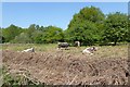
Nearby Images from Geograph Britain and Ireland:
©2007(licence)
©2009(licence)
©2007(licence)
©2022(licence)
©2018(licence)
The above images may not be of the site on this page, they are loaded from Geograph.
Please Submit an Image of this site or go out and take one for us!
Click here to see more info for this site
Nearby sites
Key: Red: member's photo, Blue: 3rd party photo, Yellow: other image, Green: no photo - please go there and take one, Grey: site destroyed
Download sites to:
KML (Google Earth)
GPX (GPS waypoints)
CSV (Garmin/Navman)
CSV (Excel)
To unlock full downloads you need to sign up as a Contributory Member. Otherwise downloads are limited to 50 sites.
Turn off the page maps and other distractions
Nearby sites listing. In the following links * = Image available
10.4km SSE 154° St. Helen's Well (Barmby) Holy Well or Sacred Spring (SE691284)
12.9km NNW 345° Fulford Cross* Ancient Cross (SE6086750131)
13.4km N 351° Siwards How Round Barrow(s) (SE6218450899)
13.5km NNW 344° Pikeing Well Holy Well or Sacred Spring (SE6057650665)
13.5km NNW 348° Lamel Hill Round Barrow(s) (SE6144450947)
13.8km NNW 337° The Hob Stone* Sculptured Stone (SE5891450417)
14.1km SE 133° Ringstone Wood (Howden) Stone Circle (SE748282)
14.2km WNW 284° St John the Baptist (Kirkby Wharfe) Ancient Cross (SE50604107)
14.2km E 80° Lady Well (Seaton Ross) Holy Well or Sacred Spring (SE784403)
14.4km NNW 343° St Mary Bishophill Junior* Ancient Cross (SE5999751471)
14.5km NNW 345° Jorvik Viking Centre Museum (SE6044451645)
14.6km NNW 344° York Roman remains* Ancient Village or Settlement (SE603517)
15.0km NNW 345° St Peter's Well (York Minster) Holy Well or Sacred Spring (SE60385219)
15.0km NNW 345° York Minster* Museum (SE6032252180)
15.1km N 11° Dunnington Village Cross Ancient Cross (SE6703052591)
15.2km NNW 344° Yorkshire Museum* Museum (SE599522)
15.7km NNW 343° The Burton Stone* Ancient Cross (SE5960252718)
16.1km WSW 256° Sherburn Cross* Ancient Cross (SE488335)
16.7km N 9° Holtby Timber Circle (SE668543)
16.8km W 268° Saxton Church* Ancient Cross (SE47583689)
16.9km NNE 26° Catton Cursus (SE716530)
17.4km NNE 27° Catton Cursus (SE721534)
19.8km WNW 292° Newton Kyme Henge Henge (SE45934499)
20.9km WNW 294° St Helen's Well (Boston Spa)* Holy Well or Sacred Spring (SE45134583)
21.0km NW 308° St Helen's Church (Bilton-in-Ainsty)* Ancient Cross (SE476504)
View more nearby sites and additional images


 We would like to know more about this location. Please feel free to add a brief description and any relevant information in your own language.
 Wir möchten mehr über diese Stätte erfahren. Bitte zögern Sie nicht, eine kurze Beschreibung und relevante Informationen in Deutsch hinzuzufügen.
 Nous aimerions en savoir encore un peu sur les lieux. S'il vous plaît n'hesitez pas à ajouter une courte description et tous les renseignements pertinents dans votre propre langue.
 Quisieramos informarnos un poco más de las lugares. No dude en añadir una breve descripción y otros datos relevantes en su propio idioma.