<< Our Photo Pages >> Roseberry Topping - Natural Stone / Erratic / Other Natural Feature in England in Yorkshire (North)
Submitted by johndhunter on Friday, 28 December 2018 Page Views: 14169
Natural PlacesSite Name: Roseberry Topping Alternative Name: Teesside Matterhorn, Odin's HillCountry: England County: Yorkshire (North) Type: Natural Stone / Erratic / Other Natural Feature
Nearest Town: Great Ayton Nearest Village: Newton under Roseberry
Map Ref: NZ5791012603
Latitude: 54.505444N Longitude: 1.107203W
Condition:
| 5 | Perfect |
| 4 | Almost Perfect |
| 3 | Reasonable but with some damage |
| 2 | Ruined but still recognisable as an ancient site |
| 1 | Pretty much destroyed, possibly visible as crop marks |
| 0 | No data. |
| -1 | Completely destroyed |
| 5 | Superb |
| 4 | Good |
| 3 | Ordinary |
| 2 | Not Good |
| 1 | Awful |
| 0 | No data. |
| 5 | Can be driven to, probably with disabled access |
| 4 | Short walk on a footpath |
| 3 | Requiring a bit more of a walk |
| 2 | A long walk |
| 1 | In the middle of nowhere, a nightmare to find |
| 0 | No data. |
| 5 | co-ordinates taken by GPS or official recorded co-ordinates |
| 4 | co-ordinates scaled from a detailed map |
| 3 | co-ordinates scaled from a bad map |
| 2 | co-ordinates of the nearest village |
| 1 | co-ordinates of the nearest town |
| 0 | no data |
Internal Links:
External Links:
I have visited· I would like to visit
SumDoood would like to visit
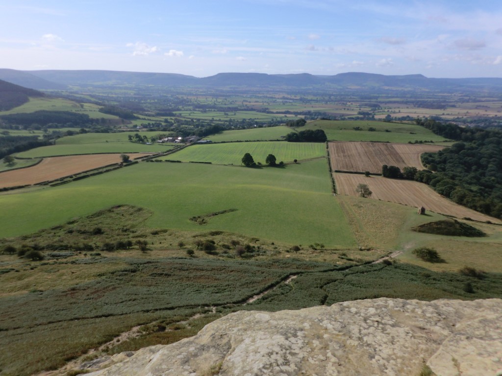
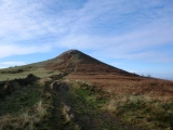
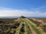
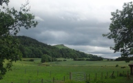
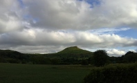
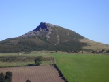
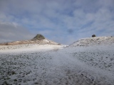
Originally a conical shape a geological fault in 1912 possibly exacerbated by jet and ironstone mining caused a collapse at the summit of the western face giving it the mini Matterhorn shape we see today. Its earliest documented name is Othenesbery, this was in the Guisborough Cartulary of 1119. There have been many variations on this name down through the ages such as Ohenseberg, Ouesberry etc, before ending up as Roseberry. It has been concluded that Othenesbery means the place where Othin was worshipped. Othin is a variant of Odin, consequently you will often see it referred to as Odin's Hill.
In 1826 a Bronze-smith's hoard was discovered by a workman in a cleft in the rocks on the southern slope at NZ 579126. It consisted of 14 pieces, five of which are now lost. The nine surviving pieces are in the Sheffield Museum they are: Three socketed axes, a spearhead, gouge, hammer, chisel, knife and axe mould. Items that are missing included a whetstone, a bronze object that was probably a dagger sheath, a flat plate of bronze, a lump of jet and about 5 lbs of copper.
Roseberry Well indicated on the OS map near the summit at NZ 57956 12650 was a holy well (spring?). It is however no longer extant and hasn’t been for a long time, I don’t really understand why they even show it on the map. It seems to me that indicating it by the term “Site of” would be more appropriate. I believe it was last photographed in existence about 1926.
Iron Age or Roman field systems - In a field on the lower southern slope centred around NZ 5785 1207 crop marks on air photographs indicate the presence of enclosures and field boundaries this is Pastscape Monument 1552845 and further details can be found there. Also in a field to the north of Roseberry Topping above Mount House Farm at NZ 58492 13541 further crop marks from air photographs indicate another enclosure and field boundaries. This is Pastscape Monument 1552496 and further details can be found there.
Earthworks – There are numerous earthworks on and around Roseberry Topping the majority of which are post medieval relating to jet and ironstone mining, However there are those which are earlier whose purpose is unknown. One of which is what has been described as an uneven ditch which starts at NZ 57599 12606 (my gps) and then runs south for about 130m. This is at the 200m level just to the south of the main trail (west side) before you go through the gate leaving Newton Wood. There is a branch off from the main trail which runs just above this “ditch” from where it can be clearly seen that it has been formed by the digging of a series of contiguous large irregular pits – purpose unknown.
About 25m from the northern end of the ditch still at the 200m level and through the gate leaving Newton Wood immediately on your left you will see a large pit at NZ 57615 12635 (my gps) this is the first of a series of pits, ten of which have been recorded also over a distance of about 130 m continuing northerly around the hill at the 200m level. They are not regular in shape, size or depth and the spacing between them varies considerably also erosion and landslips are further confusing the issue and more have probably been lost as they ran round the hill. However those nearest the gate are quite close together and I get the distinct impression that they were just carrying on doing the same thing with these pits as what they were doing with those pits that formed the ditch to the south, whatever that was. As already stated there purpose is unknown but it is not for jet or ironstone extraction as they are at the wrong level.
Continuing further around the 200m level to the north of the hill at about NZ 5794 1302 (from old OS map) are another two pits similar to those on the western side, they lie within an earthwork. This earthwork is a low bank 0.25m high and 3.5m wide with traces of an exterior ditch and runs west to east for about 220m. It encloses an area including the two pits with a cliff edge to the north. I am not sure of where its east and west grid reference end points are but I had a look at it at NZ 57912 12904 (my gps) and at NZ 57984 12922 (my gps) where a trail bisects it. When I visited December 2018 the bracken was dying off and it was clearly visible, I am not sure what it would be like in the summer with the bracken growing. Its purpose is also unknown but it is not defensive because the higher ground of Roseberry Topping to its south overlooks it, making it impossible to defend. One idea put forward is that it may have been a holding area for livestock prior to ascending/descending from Newton Moor to Newton under Roseberry.
Sources Include: The archaeology of Roseberry Topping by Stephen J Sherlock (CBA Research Report 101, 1995)
You may be viewing yesterday's version of this page. To see the most up to date information please register for a free account.







These are just the first 25 photos of Roseberry Topping. If you log in with a free user account you will be able to see our entire collection.
Do not use the above information on other web sites or publications without permission of the contributor.
Click here to see more info for this site
Nearby sites
Key: Red: member's photo, Blue: 3rd party photo, Yellow: other image, Green: no photo - please go there and take one, Grey: site destroyed
Download sites to:
KML (Google Earth)
GPX (GPS waypoints)
CSV (Garmin/Navman)
CSV (Excel)
To unlock full downloads you need to sign up as a Contributory Member. Otherwise downloads are limited to 50 sites.
Turn off the page maps and other distractions
Nearby sites listing. In the following links * = Image available
1.0km WNW 299° Newton Under Roseberry Standing Stone* Standing Stone (Menhir) (NZ570131)
1.1km ENE 73° Pinchinthorpe Moor tumuli* Cairn (NZ5900612945)
1.3km E 100° Newton Moor GA2* Marker Stone (NZ5919912388)
1.5km NE 56° Hanging Stone (Hutton Lowcross Woods)* Rock Outcrop (NZ5914713460)
1.6km E 86° Newton Moor RC6 & RC7* Round Cairn (NZ5948612730)
1.6km E 88° Newton Moor RC5* Round Cairn (NZ5951412666)
1.7km E 94° Newton Moor RC4* Round Cairn (NZ5962612519)
1.7km E 94° Newton Moor RC3* Round Cairn (NZ5962812494)
1.8km E 96° Newton Moor RC2* Round Cairn (NZ5971312441)
1.8km SE 127° Great Ayton Moor Chambered Cairn* Cairn (NZ5939811514)
1.9km E 95° Newton Moor RC1* Round Cairn (NZ5979412448)
1.9km SE 136° Great Ayton Moor HC3* Ancient Village or Settlement (NZ5927311231)
2.2km ESE 108° Great Ayton Moor Cairns 2* Cairn (NZ6003611926)
2.2km SE 126° Great Ayton Moor HC2* Ancient Village or Settlement (NZ5973611291)
2.3km ESE 123° Great Ayton Moor HC1* Ancient Village or Settlement (NZ5987711340)
2.9km ESE 106° Percy Cross and Bowl Barrow* Ancient Cross (NZ6067411848)
3.0km SE 141° Coate Moor* Round Barrow(s) (NZ59841025)
3.2km E 97° Codhill Slack* Ring Cairn (NZ6112812241)
3.3km ESE 110° Percy Cross Rigg Settlement* Ancient Village or Settlement (NZ6099911551)
3.4km E 89° Codhill Heights* Round Barrow(s) (NZ6136812677)
3.5km NE 48° Ruther Cross* Ancient Cross (NZ6044514960)
4.1km ESE 111° Percy Rigg* Standing Stone (Menhir) (NZ61761120)
4.5km NNW 333° Mount Pleasant (Eston)* Cairn (NZ55821654)
4.6km E 83° Three Howes (Gisborough Moor)* Barrow Cemetery (NZ6249913201)
4.9km E 90° Pretty Hut Howe* Round Barrow(s) (NZ6278412680)
View more nearby sites and additional images


 We would like to know more about this location. Please feel free to add a brief description and any relevant information in your own language.
 Wir möchten mehr über diese Stätte erfahren. Bitte zögern Sie nicht, eine kurze Beschreibung und relevante Informationen in Deutsch hinzuzufügen.
 Nous aimerions en savoir encore un peu sur les lieux. S'il vous plaît n'hesitez pas à ajouter une courte description et tous les renseignements pertinents dans votre propre langue.
 Quisieramos informarnos un poco más de las lugares. No dude en añadir una breve descripción y otros datos relevantes en su propio idioma.