<< Text Pages >> Slip Gill windypit - Cave or Rock Shelter in England in Yorkshire (North)
Submitted by vicky on Sunday, 21 July 2002 Page Views: 11975
Natural PlacesSite Name: Slip Gill windypitCountry: England County: Yorkshire (North) Type: Cave or Rock Shelter
Map Ref: SE577836 Landranger Map Number: 100
Latitude: 54.244847N Longitude: 1.116061W
Condition:
| 5 | Perfect |
| 4 | Almost Perfect |
| 3 | Reasonable but with some damage |
| 2 | Ruined but still recognisable as an ancient site |
| 1 | Pretty much destroyed, possibly visible as crop marks |
| 0 | No data. |
| -1 | Completely destroyed |
| 5 | Superb |
| 4 | Good |
| 3 | Ordinary |
| 2 | Not Good |
| 1 | Awful |
| 0 | No data. |
| 5 | Can be driven to, probably with disabled access |
| 4 | Short walk on a footpath |
| 3 | Requiring a bit more of a walk |
| 2 | A long walk |
| 1 | In the middle of nowhere, a nightmare to find |
| 0 | No data. |
| 5 | co-ordinates taken by GPS or official recorded co-ordinates |
| 4 | co-ordinates scaled from a detailed map |
| 3 | co-ordinates scaled from a bad map |
| 2 | co-ordinates of the nearest village |
| 1 | co-ordinates of the nearest town |
| 0 | no data |
Be the first person to rate this site - see the 'Contribute!' box in the right hand menu.
Internal Links:
External Links:
Cave or Rock Shelter in North Yorshire
Have you visited this site? Please add a comment below.
You may be viewing yesterday's version of this page. To see the most up to date information please register for a free account.
Do not use the above information on other web sites or publications without permission of the contributor.
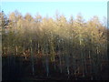
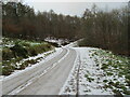
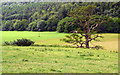
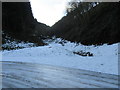
Nearby Images from Geograph Britain and Ireland:
©2013(licence)
©2020(licence)
©2007(licence)
©2018(licence)
©2018(licence)
The above images may not be of the site on this page, they are loaded from Geograph.
Please Submit an Image of this site or go out and take one for us!
Click here to see more info for this site
Nearby sites
Key: Red: member's photo, Blue: 3rd party photo, Yellow: other image, Green: no photo - please go there and take one, Grey: site destroyed
Download sites to:
KML (Google Earth)
GPX (GPS waypoints)
CSV (Garmin/Navman)
CSV (Excel)
To unlock full downloads you need to sign up as a Contributory Member. Otherwise downloads are limited to 50 sites.
Turn off the page maps and other distractions
Nearby sites listing. In the following links * = Image available
859m SE 145° Ashberry windypit* Cave or Rock Shelter (SE582829)
859m SE 145° Antofts windypit Cave or Rock Shelter (SE582829)
1.4km SE 130° Buckland's Windypit Cave or Rock Shelter (SE588827)
3.5km E 86° All Saints (Helmsley)* Early Christian Sculptured Stone (SE61188387)
3.8km S 174° Studfold Ring (Ampleforth)* Ancient Village or Settlement (SE5812279855)
4.1km WNW 300° Kirby Ley* Round Barrow(s) (SE5408985584)
4.8km SW 234° Cockerdale Wood Cairn Cairn (SE53838075)
5.8km WSW 253° High Town round cairn Cairn (SE52138179)
6.1km W 265° Cooper Cross (Sutton Bank)* Ancient Cross (SE5157082994)
6.4km SE 138° St Oswald (Oswaldkirk)* Ancient Cross (SE62107892)
6.5km WSW 250° High Town Brow Round Barrow(s) (SE51598128)
6.5km WSW 251° Roulston Scar Barrow Round Barrow(s) (SE51538139)
6.6km WSW 253° Roulston Scar Camp Hillfort (SE514816)
6.6km W 271° Sutton Bank Round Barrow* Round Barrow(s) (SE5108283684)
6.7km WSW 250° Kilburn White Horse* Hill Figure or Geoglyph (SE51438129)
6.9km WNW 285° Hambleton Down North* Round Barrow(s) (SE5102885301)
7.3km NNW 327° All Saints Church, Hawnby* Ancient Cross (SE53658967)
7.4km WNW 287° Boltby Scar Camp Hillfort (SE506857)
7.6km NW 320° Sunny Bank Barrows* Round Barrow(s) (SE527893)
7.7km WSW 253° Hood Hill Stone Natural Stone / Erratic / Other Natural Feature (SE50378125)
8.7km N 10° Helmsley Moor RB1* Round Barrow(s) (SE5904992216)
9.1km N 7° Roppa Cross South* Ancient Cross (SE5872492614)
9.3km N 5° Carr Cote Ridge (Laskill Pasture Moor)* Round Barrow(s) (SE5844092920)
9.4km N 7° Roppa Cross North* Ancient Cross (SE5869992992)
9.5km NNW 337° Long Hill (Hawnby Moor) RB1* Round Barrow(s) (SE5386292307)
View more nearby sites and additional images


 We would like to know more about this location. Please feel free to add a brief description and any relevant information in your own language.
 Wir möchten mehr über diese Stätte erfahren. Bitte zögern Sie nicht, eine kurze Beschreibung und relevante Informationen in Deutsch hinzuzufügen.
 Nous aimerions en savoir encore un peu sur les lieux. S'il vous plaît n'hesitez pas à ajouter une courte description et tous les renseignements pertinents dans votre propre langue.
 Quisieramos informarnos un poco más de las lugares. No dude en añadir una breve descripción y otros datos relevantes en su propio idioma.