<< Our Photo Pages >> Cheesefoot Head Barrows - Barrow Cemetery in England in Hampshire
Submitted by SolarMegalith on Friday, 11 November 2011 Page Views: 5295
Neolithic and Bronze AgeSite Name: Cheesefoot Head BarrowsCountry: England County: Hampshire Type: Barrow Cemetery
Nearest Town: Winchester
Map Ref: SU52572777
Latitude: 51.046883N Longitude: 1.251452W
Condition:
| 5 | Perfect |
| 4 | Almost Perfect |
| 3 | Reasonable but with some damage |
| 2 | Ruined but still recognisable as an ancient site |
| 1 | Pretty much destroyed, possibly visible as crop marks |
| 0 | No data. |
| -1 | Completely destroyed |
| 5 | Superb |
| 4 | Good |
| 3 | Ordinary |
| 2 | Not Good |
| 1 | Awful |
| 0 | No data. |
| 5 | Can be driven to, probably with disabled access |
| 4 | Short walk on a footpath |
| 3 | Requiring a bit more of a walk |
| 2 | A long walk |
| 1 | In the middle of nowhere, a nightmare to find |
| 0 | No data. |
| 5 | co-ordinates taken by GPS or official recorded co-ordinates |
| 4 | co-ordinates scaled from a detailed map |
| 3 | co-ordinates scaled from a bad map |
| 2 | co-ordinates of the nearest village |
| 1 | co-ordinates of the nearest town |
| 0 | no data |
Internal Links:
External Links:
I have visited· I would like to visit
SolarMegalith visited on 11th Nov 2011 - their rating: Cond: 2 Amb: 3 Access: 4
")
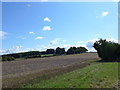
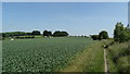
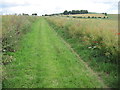
A group of three bowl barrows is located on slope of the hill east from Winchester, SE from Chilcombe. The barrows are heavily mutilated, they might be one of very few Neolithic round barrows.
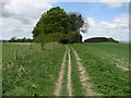
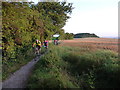
Barrow A (in older reports named as C) is the most obvious one - it is still 1 m high, there are traces of a quarry ditch around it. Barrows B and C are almost completely leveled, however their area is excluded from plough. The cemetery is easy to reach, follow the public bridleway towards Telegraph Hill (another barrow near the top of it !).
You may be viewing yesterday's version of this page. To see the most up to date information please register for a free account.
")
")
")
")
Do not use the above information on other web sites or publications without permission of the contributor.
Nearby Images from Geograph Britain and Ireland:
©2014(licence)
©2010(licence)
©2017(licence)
©2015(licence)
©2016(licence)
The above images may not be of the site on this page, they are loaded from Geograph.
Please Submit an Image of this site or go out and take one for us!
Click here to see more info for this site
Nearby sites
Key: Red: member's photo, Blue: 3rd party photo, Yellow: other image, Green: no photo - please go there and take one, Grey: site destroyed
Download sites to:
KML (Google Earth)
GPX (GPS waypoints)
CSV (Garmin/Navman)
CSV (Excel)
To unlock full downloads you need to sign up as a Contributory Member. Otherwise downloads are limited to 50 sites.
Turn off the page maps and other distractions
Nearby sites listing. In the following links * = Image available
573m NW 306° Telegraph Hill Bowl Barrow* Round Barrow(s) (SU521281)
2.6km SSW 196° Morestead Warren* Long Barrow (SU519253)
3.0km WNW 302° Magdalen Hill Down* Barrow Cemetery (SU49992933)
3.5km W 268° The Dongas* Ancient Trackway (SU491276)
3.5km SSE 167° Longwood Barrow Long Barrow (SU534244)
3.6km W 267° Twyford Down monument* Modern Stone Circle etc (SU48962757)
4.1km W 269° Mizmaze* Turf Maze (SU48482769)
4.1km W 269° St Catherine's Hill (Hampshire)* Hillfort (SU48422766)
4.6km WNW 289° Winchester Cathedral Wells* Holy Well or Sacred Spring (SU482292)
4.8km WNW 291° Winchester City Museum* Museum (SU4809729407)
5.2km WNW 290° Hampshire Jubilee Sculpture* Modern Stone Circle etc (SU477295)
5.2km WSW 239° Twyford stone circle* Stone Circle (SU481250)
5.4km WNW 291° Oram's Arbour Hillfort (SU475297)
5.9km W 259° Compton Down Barrows* Round Barrow(s) (SU46762660)
6.7km E 85° Cheriton Long Barrow* Long Barrow (SU5926328419)
6.7km E 90° Hinton Ampner tumuli* Round Barrow(s) (SU593278)
7.0km W 264° Texas Barrows* Round Barrow(s) (SU4558926993)
7.2km NNE 25° Itchen Stoke Down Barrows Round Barrow(s) (SU5554334384)
7.9km WNW 303° Flowerdown Barrows* Barrow Cemetery (SU459320)
8.8km N 6° Micheldever Wood Banjo Enclosure* Ancient Village or Settlement (SU53353658)
9.0km N 5° Micheldever Wood Bell Barrow* Round Barrow(s) (SU53213678)
9.4km N 2° Micheldever Wood Bowl Barrow* Round Barrow(s) (SU52773721)
9.6km SE 124° Beacon Hill (Warnford)* Barrow Cemetery (SU606224)
9.9km NNW 328° South Wonston* Barrow Cemetery (SU4723736091)
10.2km W 280° West Wood Bowl Barrow* Round Barrow(s) (SU42522949)
View more nearby sites and additional images


 We would like to know more about this location. Please feel free to add a brief description and any relevant information in your own language.
 Wir möchten mehr über diese Stätte erfahren. Bitte zögern Sie nicht, eine kurze Beschreibung und relevante Informationen in Deutsch hinzuzufügen.
 Nous aimerions en savoir encore un peu sur les lieux. S'il vous plaît n'hesitez pas à ajouter une courte description et tous les renseignements pertinents dans votre propre langue.
 Quisieramos informarnos un poco más de las lugares. No dude en añadir una breve descripción y otros datos relevantes en su propio idioma.