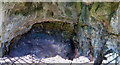
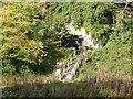
<< Text Pages >> Mother Grundy’s Parlour - Cave or Rock Shelter in England in Derbyshire
Submitted by vicky on Sunday, 18 May 2003 Page Views: 6328
Natural PlacesSite Name: Mother Grundy’s ParlourCountry: England County: Derbyshire Type: Cave or Rock Shelter
Map Ref: SK536743 Landranger Map Number: 120
Latitude: 53.262999N Longitude: 1.1979W
Condition:
| 5 | Perfect |
| 4 | Almost Perfect |
| 3 | Reasonable but with some damage |
| 2 | Ruined but still recognisable as an ancient site |
| 1 | Pretty much destroyed, possibly visible as crop marks |
| 0 | No data. |
| -1 | Completely destroyed |
| 5 | Superb |
| 4 | Good |
| 3 | Ordinary |
| 2 | Not Good |
| 1 | Awful |
| 0 | No data. |
| 5 | Can be driven to, probably with disabled access |
| 4 | Short walk on a footpath |
| 3 | Requiring a bit more of a walk |
| 2 | A long walk |
| 1 | In the middle of nowhere, a nightmare to find |
| 0 | No data. |
| 5 | co-ordinates taken by GPS or official recorded co-ordinates |
| 4 | co-ordinates scaled from a detailed map |
| 3 | co-ordinates scaled from a bad map |
| 2 | co-ordinates of the nearest village |
| 1 | co-ordinates of the nearest town |
| 0 | no data |
Be the first person to rate this site - see the 'Contribute!' box in the right hand menu.
Internal Links:
External Links:
Cave or Rock Shelter in Derbyshire
Have you visited this site? Please add a comment below.
You may be viewing yesterday's version of this page. To see the most up to date information please register for a free account.
Do not use the above information on other web sites or publications without permission of the contributor.
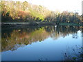
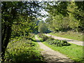
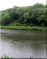
Nearby Images from Geograph Britain and Ireland:
©2007(licence)
©2011(licence)
©2015(licence)
©2015(licence)
©2019(licence)
The above images may not be of the site on this page, they are loaded from Geograph.
Please Submit an Image of this site or go out and take one for us!
Click here to see more info for this site
Nearby sites
Key: Red: member's photo, Blue: 3rd party photo, Yellow: other image, Green: no photo - please go there and take one, Grey: site destroyed
Download sites to:
KML (Google Earth)
GPX (GPS waypoints)
CSV (Garmin/Navman)
CSV (Excel)
To unlock full downloads you need to sign up as a Contributory Member. Otherwise downloads are limited to 50 sites.
Turn off the page maps and other distractions
Nearby sites listing. In the following links * = Image available
100m W 271° Creswell Crags* Cave or Rock Shelter (SK535743)
223m WSW 244° Robin Hood’s Cave* Cave or Rock Shelter (SK534742)
360m WSW 237° Ossiferous Fissure Cave or Rock Shelter (SK533741)
360m WSW 237° Pin Hole Cave Cave or Rock Shelter (SK533741)
446m WSW 244° Church Hole* Cave or Rock Shelter (SK532741)
2.7km WNW 290° Markland Grips Hillfort* Hillfort (SK511752)
2.7km WNW 288° Markland Grips Cave* Cave or Rock Shelter (SK510751)
2.8km NW 312° Ash Tree Cave* Cave or Rock Shelter (SK5148576144)
3.3km SW 229° Whaley Rock Shelter2 Cave or Rock Shelter (SK511721)
3.3km SW 220° Whaley Rock Shelter1 Cave or Rock Shelter (SK515717)
5.1km SSW 201° Langwith Cave* Cave or Rock Shelter (SK518695)
5.1km N 353° Thorpe Common Shelter Cave or Rock Shelter (SK529794)
6.1km SSW 207° Scarcliffe Shelter 4 Cave or Rock Shelter (SK509688)
6.6km SSW 209° Scarcliffe Shelter 2 Cave or Rock Shelter (SK504685)
6.6km SSW 209° Scarcliffe Shelter 3 Cave or Rock Shelter (SK504685)
6.9km SSW 211° Scarcliffe Shelter 1 Cave or Rock Shelter (SK501684)
8.3km S 178° Sookholme Bath* Holy Well or Sacred Spring (SK5466)
8.7km SE 134° Thynghowe* Artificial Mound (SK59936834)
9.2km ESE 112° Budby Barrow* Round Barrow(s) (SK62187087)
9.3km N 355° Dead Man's Cave/Anston Stones Wood* Cave or Rock Shelter (SK5276283530)
10.3km NNE 21° St Mary's Well (Wallingwells) Holy Well or Sacred Spring (SK572840)
12.8km S 175° The Lady Well (Mansfield) Holy Well or Sacred Spring (SK548616)
15.7km NW 307° Birley Spa Holy Well or Sacred Spring (SK40908361)
17.7km S 170° Friar Tuck's Well* Holy Well or Sacred Spring (SK568569)
18.5km SSW 211° Blackwell Cross* Ancient Cross (SK443583)
View more nearby sites and additional images


 We would like to know more about this location. Please feel free to add a brief description and any relevant information in your own language.
 Wir möchten mehr über diese Stätte erfahren. Bitte zögern Sie nicht, eine kurze Beschreibung und relevante Informationen in Deutsch hinzuzufügen.
 Nous aimerions en savoir encore un peu sur les lieux. S'il vous plaît n'hesitez pas à ajouter une courte description et tous les renseignements pertinents dans votre propre langue.
 Quisieramos informarnos un poco más de las lugares. No dude en añadir una breve descripción y otros datos relevantes en su propio idioma.