<< Our Photo Pages >> Near Moor 3b - Rock Art in England in Yorkshire (North)
Submitted by SolarMegalith on Friday, 29 November 2013 Page Views: 1878
Rock ArtSite Name: Near Moor 3bCountry: England
NOTE: This site is 2.0 km away from the location you searched for.
County: Yorkshire (North) Type: Rock Art
Nearest Village: Osmotherley
Map Ref: NZ4790300151
Latitude: 54.394589N Longitude: 1.263736W
Condition:
| 5 | Perfect |
| 4 | Almost Perfect |
| 3 | Reasonable but with some damage |
| 2 | Ruined but still recognisable as an ancient site |
| 1 | Pretty much destroyed, possibly visible as crop marks |
| 0 | No data. |
| -1 | Completely destroyed |
| 5 | Superb |
| 4 | Good |
| 3 | Ordinary |
| 2 | Not Good |
| 1 | Awful |
| 0 | No data. |
| 5 | Can be driven to, probably with disabled access |
| 4 | Short walk on a footpath |
| 3 | Requiring a bit more of a walk |
| 2 | A long walk |
| 1 | In the middle of nowhere, a nightmare to find |
| 0 | No data. |
| 5 | co-ordinates taken by GPS or official recorded co-ordinates |
| 4 | co-ordinates scaled from a detailed map |
| 3 | co-ordinates scaled from a bad map |
| 2 | co-ordinates of the nearest village |
| 1 | co-ordinates of the nearest town |
| 0 | no data |
Internal Links:
External Links:
I have visited· I would like to visit
SolarMegalith visited on 23rd Nov 2013 - their rating: Cond: 4 Amb: 5 Access: 3
")
A rectangular boulder with a single well-defined cup-mark. The location offers great views to the S-SW.
Reference:
Brown, P. and Chappell, G. 2012. "Prehistoric Rock Art in the North York Moors". Stroud: The History Press, p. 269.
You may be viewing yesterday's version of this page. To see the most up to date information please register for a free account.
")
")
Do not use the above information on other web sites or publications without permission of the contributor.
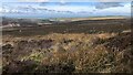
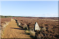
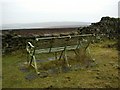
Nearby Images from Geograph Britain and Ireland:
©2022(licence)
©2006(licence)
©2011(licence)
©2018(licence)
©2006(licence)
The above images may not be of the site on this page, they are loaded from Geograph.
Please Submit an Image of this site or go out and take one for us!
Click here to see more info for this site
Nearby sites
Key: Red: member's photo, Blue: 3rd party photo, Yellow: other image, Green: no photo - please go there and take one, Grey: site destroyed
Download sites to:
KML (Google Earth)
GPX (GPS waypoints)
CSV (Garmin/Navman)
CSV (Excel)
To unlock full downloads you need to sign up as a Contributory Member. Otherwise downloads are limited to 50 sites.
Turn off the page maps and other distractions
Nearby sites listing. In the following links * = Image available
73m SSE 157° Near Moor 3a* Rock Art (NZ4793300084)
112m SSW 214° Near Moor 4a* Rock Art (NZ4784200057)
114m SSW 213° Near Moor 4b Rock Art (NZ4784200055)
244m W 268° Near Moor 1b Rock Art (NZ4765800142)
245m W 268° Near Moor 1a Rock Art (NZ4765800139)
280m W 267° Near Moor 2a* Rock Art (NZ4762300132)
306m W 264° Near Moor 2b Rock Art (NZ4759800117)
320m W 268° Near Moor 2c* Rock Art (NZ4758200139)
327m SW 226° Near Moor 4c Rock Art (SE4766899923)
352m SW 216° Near Moor 6c Rock Art (SE4769999864)
365m SW 222° Near Moor 6b Rock Art (SE4766199877)
366m SW 229° Near Moor 6a* Rock Art (SE4762899909)
384m WSW 246° Near Moor 5a* Rock Art (SE4755499989)
464m SSW 214° Near Moor 7a Rock Art (SE4765099761)
477m WSW 243° Near Moor 5b Rock Art (SE4747899932)
485m SSW 211° Near Moor 9d Rock Art (SE4765699733)
571m WSW 248° Near Moor 8a Rock Art (SE4737699928)
612m SW 236° Near Moor 9b Rock Art (SE47409980)
614m SW 234° Near Moor 9c Rock Art (SE4741099782)
632m SW 220° Near Moor 10d* Rock Art (SE4749899665)
656m WSW 247° Near Moor 9a Rock Art (SE4730199887)
707m SW 218° Near Moor 10e Rock Art (SE4747099591)
711m SW 225° Near Moor 10c Rock Art (SE4740399644)
747m SW 224° Near Moor 10b Rock Art (SE4738499612)
769m SW 218° Near Moor 10f* Rock Art (SE4743599539)
View more nearby sites and additional images


 We would like to know more about this location. Please feel free to add a brief description and any relevant information in your own language.
 Wir möchten mehr über diese Stätte erfahren. Bitte zögern Sie nicht, eine kurze Beschreibung und relevante Informationen in Deutsch hinzuzufügen.
 Nous aimerions en savoir encore un peu sur les lieux. S'il vous plaît n'hesitez pas à ajouter une courte description et tous les renseignements pertinents dans votre propre langue.
 Quisieramos informarnos un poco más de las lugares. No dude en añadir una breve descripción y otros datos relevantes en su propio idioma.