 with our Megalithic Portal iPhone app")

<< Our Photo Pages >> Ladle Hill - Hillfort in England in Hampshire
Submitted by JimChampion on Monday, 14 October 2002 Page Views: 24182
Iron Age and Later PrehistorySite Name: Ladle HillCountry: England County: Hampshire Type: Hillfort
Nearest Town: Newbury Nearest Village: Kingsclere
Map Ref: SU47885683
Latitude: 51.308580N Longitude: 1.314489W
Condition:
| 5 | Perfect |
| 4 | Almost Perfect |
| 3 | Reasonable but with some damage |
| 2 | Ruined but still recognisable as an ancient site |
| 1 | Pretty much destroyed, possibly visible as crop marks |
| 0 | No data. |
| -1 | Completely destroyed |
| 5 | Superb |
| 4 | Good |
| 3 | Ordinary |
| 2 | Not Good |
| 1 | Awful |
| 0 | No data. |
| 5 | Can be driven to, probably with disabled access |
| 4 | Short walk on a footpath |
| 3 | Requiring a bit more of a walk |
| 2 | A long walk |
| 1 | In the middle of nowhere, a nightmare to find |
| 0 | No data. |
| 5 | co-ordinates taken by GPS or official recorded co-ordinates |
| 4 | co-ordinates scaled from a detailed map |
| 3 | co-ordinates scaled from a bad map |
| 2 | co-ordinates of the nearest village |
| 1 | co-ordinates of the nearest town |
| 0 | no data |
Internal Links:
External Links:
I have visited· I would like to visit
NDM visited on 17th Sep 2023 - their rating: Cond: 2 Amb: 3 Access: 3
Tomba visited on 1st Nov 2021 - their rating: Cond: 4 Amb: 4 Access: 3 Flew an aerial (drone) survey of the site, to generate orthophotos and 3D models (point clouds, DSM, etc) for fun and interest.
Will lookup a copy of the 1931 paper by Stuart Piggott in due course.
fibo74 visited on 6th Jul 2018 - their rating: Cond: 2 Amb: 4 Access: 3 Easy to recognise and stunning views and wildlife.
TheCaptain JimChampion myf have visited here
Average ratings for this site from all visit loggers: Condition: 2.67 Ambience: 3.67 Access: 3
")
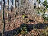
A unique example of an 'unfinished' hillfort on the site of an earlier Bronze Age settlement. It shows features which would not be seen in a completed work e.g. marking-out trenches, partly dug sections of ditch and untidy spoil heaps. [source]
The patterns of lumps and bumps at the site make much more sense from aerial photographs - click on one of the aeroplane icons above for aerial photography.
Access The busy A34 road runs N-S in the valley to the west of Ladle Hill. Leave the A34 at the Beacon Hill junction and follow the signs east towards Kingsclere. After the hamlet of Sydmonton turn right at the crossroads, up the very steep narrow lane (Watership down on your left) and park at the top on the gravelly verge where the Wayfarer's Walk footpath crosses the lane. Follow the footpath to the west (field systems and round barrows on the way) for about a mile.
Further reading (recommended by s.t.champion) A good paper by Stuart Piggott in Antiquity 5, 1931, 474 ff. Brief details in James Dyers' Penguin Guide to Prehistoric England and Wales (Allen Lane 1981), pp 154 and 159-60. Cunliffe refers to in his Wessex to AD 1000 (Longman 1993), his Iron Age Britain (Batsford 1995), and to pre-hillfort features at Ladle Hill in his paper 'Before hillforts' in the Oxford Journal of Archaeology 9 (1990), 323-36.
You may be viewing yesterday's version of this page. To see the most up to date information please register for a free account.
")
")
")
")
")
")
")
")
")
")
")
")
Do not use the above information on other web sites or publications without permission of the contributor.
Click here to see more info for this site
Nearby sites
Key: Red: member's photo, Blue: 3rd party photo, Yellow: other image, Green: no photo - please go there and take one, Grey: site destroyed
Download sites to:
KML (Google Earth)
GPX (GPS waypoints)
CSV (Garmin/Navman)
CSV (Excel)
To unlock full downloads you need to sign up as a Contributory Member. Otherwise downloads are limited to 50 sites.
Turn off the page maps and other distractions
Nearby sites listing. In the following links * = Image available
1.7km E 93° Nuthanger Down* Round Barrow(s) (SU49605676)
2.0km W 275° Beacon Hill Barrow South Spur Round Barrow(s) (SU45865698)
2.1km WNW 282° Beacon Hill (Burghclere)* Hillfort (SU45785727)
2.2km SW 219° Great Licthfield Down Misc. Earthwork (SU46525513)
2.3km SW 228° Seven Barrows (Hampshire)* Barrow Cemetery (SU462553)
2.4km WNW 290° Beacon Hill Barrow North Spur Round Barrow(s) (SU45595762)
2.5km WNW 290° Beacon Hill Cross Dyke Misc. Earthwork (SU45565764)
3.0km WSW 240° Lower Woodcott Down* Misc. Earthwork (SU453553)
4.2km SE 128° Polhampton Bowl Barrow* Round Barrow(s) (SU5123554299)
4.7km E 91° Bowry Walls* Hillfort (SU52605676)
4.7km SSE 159° Ridgeway Farm* Long Barrow (SU496524)
5.0km S 183° Peak House Long Barrow* Long Barrow (SU47705179)
5.0km S 183° Peak House Bowl Barrow* Round Barrow(s) (SU47645179)
5.1km ESE 114° Tidgrove Warren* Round Barrow(s) (SU5253054807)
5.1km SSE 147° Willesley Warren Long Barrow (SU507526)
5.7km E 89° Cottington's Hill Bowl Barrow* Round Barrow(s) (SU53615695)
6.2km SSW 195° Larks Barrow* Round Barrow(s) (SU46355082)
8.4km NNW 344° Wash Common* Barrow Cemetery (SU45446484)
9.3km SSW 192° All Hallows (Whitchurch) Early Christian Sculptured Stone (SU45994775)
9.8km SSE 166° Abra Barrow* Round Barrow(s) (SU5030947359)
10.1km SSE 165° Turrill Hill Bowl Barrows* Round Barrow(s) (SU5052247092)
10.3km N 357° West Berkshire Museum Museum (SU472671)
10.3km WSW 244° Severals Copse Bowl Barrow* Round Barrow(s) (SU38615227)
11.0km E 87° Ramsdell Modern Stone Circle* Modern Stone Circle etc (SU5891457590)
11.3km NNW 348° The Ladywell* Holy Well or Sacred Spring (SU454679)
View more nearby sites and additional images


 We would like to know more about this location. Please feel free to add a brief description and any relevant information in your own language.
 Wir möchten mehr über diese Stätte erfahren. Bitte zögern Sie nicht, eine kurze Beschreibung und relevante Informationen in Deutsch hinzuzufügen.
 Nous aimerions en savoir encore un peu sur les lieux. S'il vous plaît n'hesitez pas à ajouter une courte description et tous les renseignements pertinents dans votre propre langue.
 Quisieramos informarnos un poco más de las lugares. No dude en añadir una breve descripción y otros datos relevantes en su propio idioma.