<< Our Photo Pages >> Thimbleby Nine Stones - Standing Stones in England in Yorkshire (North)
Submitted by SolarMegalith on Tuesday, 15 November 2022 Page Views: 7384
Neolithic and Bronze AgeSite Name: Thimbleby Nine Stones Alternative Name: Nine Stone of ThimblebyCountry: England County: Yorkshire (North) Type: Standing Stones
Nearest Village: Osmotherley
Map Ref: SE47099527
Latitude: 54.350802N Longitude: 1.277027W
Condition:
| 5 | Perfect |
| 4 | Almost Perfect |
| 3 | Reasonable but with some damage |
| 2 | Ruined but still recognisable as an ancient site |
| 1 | Pretty much destroyed, possibly visible as crop marks |
| 0 | No data. |
| -1 | Completely destroyed |
| 5 | Superb |
| 4 | Good |
| 3 | Ordinary |
| 2 | Not Good |
| 1 | Awful |
| 0 | No data. |
| 5 | Can be driven to, probably with disabled access |
| 4 | Short walk on a footpath |
| 3 | Requiring a bit more of a walk |
| 2 | A long walk |
| 1 | In the middle of nowhere, a nightmare to find |
| 0 | No data. |
| 5 | co-ordinates taken by GPS or official recorded co-ordinates |
| 4 | co-ordinates scaled from a detailed map |
| 3 | co-ordinates scaled from a bad map |
| 2 | co-ordinates of the nearest village |
| 1 | co-ordinates of the nearest town |
| 0 | no data |
Internal Links:
External Links:
I have visited· I would like to visit
SumDoood would like to visit
Chappers60 visited on 13th Apr 2025 - their rating: Cond: 3 Amb: 3 Access: 3
SandyG visited on 14th Sep 2017 - their rating: Cond: 2 Amb: 4 Access: 3 Car parking is available at SE 47973 95903. From here follow the trackway south to SE 47978 95640 and take the fork to the right and walk to around SE 47280 95708. From here cross the moorland to the row.
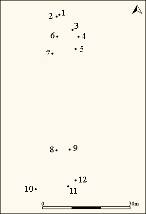
The considerable gap between the two groups of stones means that it is possible that this monument represents the remains of two separate settings. For this reason this site should properly be considered as a possible row.
Anne T visited on 9th Jun 2016 - their rating: Cond: 3 Amb: 4 Access: 3 Nine Stones Stone Row, near Osmotherley, North Yorkshire: Having added a few of the Stone Rows of Great Britain sites on the Portal, and needing to go down to Thirsk it was too much of a temptation to resist visiting one or two of the North Yorkshire sites. With only a 3 hour window before having to travel onto Doncaster, the only one we could reach and explore in time was Nine Stones, just outside Osmotherley.
We’ve been to this area before to look at Anglo Saxon crosses in churches and ended up getting hopelessly lost, but this time we had the OS map and our GPS. With the sun shining down from an almost cloudless sky, we reached the car park at Square Corner easily enough. It never ceases to amaze me that there are so many more people in this part of the world than in Northumberland. There were people picnicking on the side of the road near Solomon's Temple enjoying a wonderful view over Oak Dale valley and the woods of Crabtree Bank and Thimbleby Bank Plantations.
As we pulled up, a number of dog walkers drew up, chattering noisily, and I hoped they weren’t going to follow us and destroy the peace and quiet of the afternoon (I’m definitely getting to be a grumpy old woman!). Fortunately, they followed the Cleveland Way up the hill to the south.
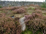
From the car park, we walked the couple of hundred metres to the gate where the footpath west over Thimbleby Moor and the Cleveland Way southwards meet. The GPS told us there was almost 700 metres to walk to Nine Stones, so we set off over the stile over the wall by a second gate to the west. The first couple of hundred yards were easy walking along a stoned footpath leading off to some modern shooting butts to the west. After 200 metres we needed to veer off southwards to follow the dry stone wall westwards. This was all through knee deep heather with the occasional field drain and boggy patch thrown in. After another 200 yards we realised we’d reached a much quarried area; there were deep holes full of water which we could only see when we were almost upon them. I managed to disappear up to my ankles in one, although there were other that looked far deeper.
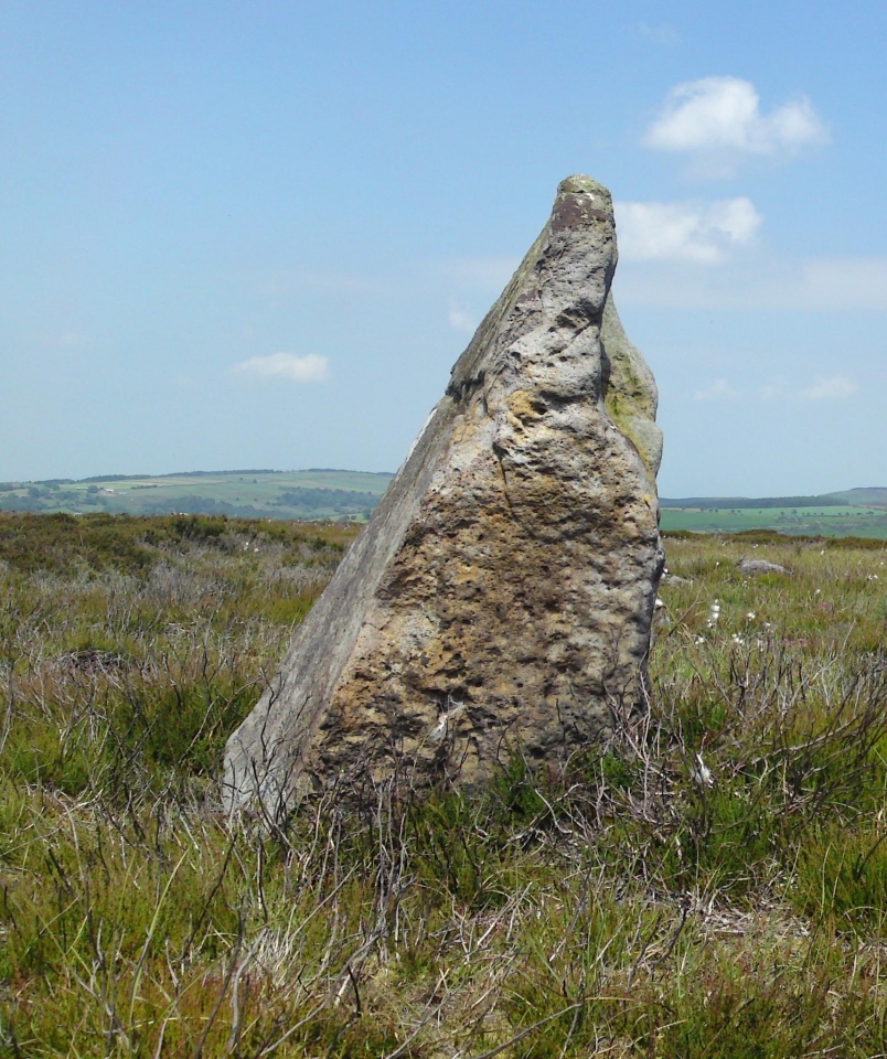
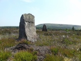
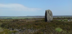
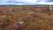
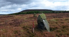
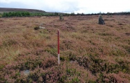
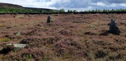
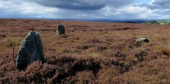
Whilst the area has many blocks of stone poking up through the heather, towards the top of the slope there suddenly appeared on the horizon two standing stones, looming large, beckoning the walker. Here was (were?) Nine Stones, at last.
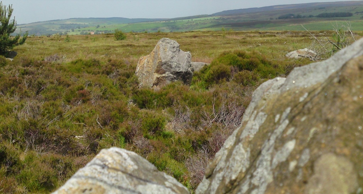
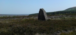
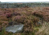
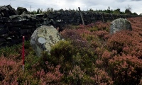
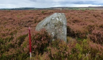
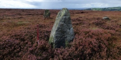
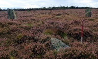
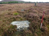
This stone row was well worth the trudge through the undergrowth. At the northern tip of the row there are five stones, two tall, two stumpy and one almost buried in the heather. We wondered which were actually part of the stone row. The north-western most stone looked as if there had been an attempt to quarry the top of it in the distant past (comparing the holes to some at Edges Green, near Cawfields) that we’ve seen recently.
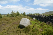
Two more tall stones sit close to the stone wall, and a few more stones appear further south in the forested area. The Stone Rows of Great Britain site tell us that this stone row is 60 metres long, but husband, tramping through the forest, thought it might be possible that the row was nearer to 100 metres (but then which are natural stones and which are recumbent standing stones?).
There are so many other features in this area to explore: Miley Pike Tumulus, Robinson’s Cross (remains of), a Holy Well, Faber’s Stone – well worth a repeat visit.
SolarMegalith visited on 11th Mar 2013 - their rating: Cond: 3 Amb: 4 Access: 3
Average ratings for this site from all visit loggers: Condition: 2.75 Ambience: 3.75 Access: 3

NE of the standing stones there are remains of a Bronze Age field system and enclosure.
Reference: Brown, P. and Chappell, G. 2012. "Prehistoric Rock Art in the North York Moors". Stroud: The History Press, p. 127.
Update October 2019: This row is featured on the Stone Rows of Great Britain website - see their entry for The Nine Stones, which includes a description, photographs of the alignment and the individual stones, a plan of the row, plus access information. The SRoGB describes a possible stone row measuring 57m long, including 12 small, medium and large stones; they note: "The considerable gap between the two (northern and southern) groups of stones means that it is possible that this monument represents the remains of two separate settings. For this reason this site should properly be considered as a possible row".
The row is also recorded as part of Pastscape Monument No. 55672, which describes "a complex of Bronze Age monuments, comprising a field system and nine standing stones, forming the possible remains of a stone alignment". Whilst the site is marked on the Historic England map when you enter its co-ordinates, there is no scheduling or listing information.
You may be viewing yesterday's version of this page. To see the most up to date information please register for a free account.



These are just the first 25 photos of Thimbleby Nine Stones. If you log in with a free user account you will be able to see our entire collection.
Do not use the above information on other web sites or publications without permission of the contributor.
Click here to see more info for this site
Nearby sites
Key: Red: member's photo, Blue: 3rd party photo, Yellow: other image, Green: no photo - please go there and take one, Grey: site destroyed
Download sites to:
KML (Google Earth)
GPX (GPS waypoints)
CSV (Garmin/Navman)
CSV (Excel)
To unlock full downloads you need to sign up as a Contributory Member. Otherwise downloads are limited to 50 sites.
Turn off the page maps and other distractions
Nearby sites listing. In the following links * = Image available
572m N 352° Thimbleby Moor 4* Rock Art (SE4700895837)
866m NW 320° Thimbleby Moor 2* Rock Art (SE4652595928)
868m NW 323° Thimbleby Moor 3* Rock Art (SE4656395961)
973m ENE 66° Cray Hall Stone* Marker Stone (SE4797895674)
997m NW 317° Thimbleby Moor 1* Rock Art (SE4639695988)
1.5km SE 138° Black Hambleton* Round Barrow(s) (SE4808994185)
1.5km ENE 77° Robinsons Cross* Ancient Cross (SE4854895631)
2.0km NE 56° Miley Pike* Round Barrow(s) (SE48769642)
2.3km WSW 245° Hanging Stone (Thimbleby Bank)* Rock Outcrop (SE4501694270)
2.4km NW 322° St Peter (Osmotherly)* Ancient Cross (SE45579718)
2.6km NE 49° Faber´s Stone* Marker Stone (SE4905997023)
3.0km SE 137° Whitestones (Arden Great Moor)* Round Barrow(s) (SE4916393116)
3.4km NE 43° Rye Head BS1* Marker Stone (SE4941697771)
3.7km NW 320° St John's Well (Osmotherley)* Holy Well or Sacred Spring (SE447981)
3.7km NW 325° St John's Well (Northallerton) Holy Well or Sacred Spring (SE449983)
3.7km NE 42° Nelson Stone (Swainby Shooting House)* Marker Stone (SE4956598093)
4.0km NE 44° Rye Head BS3* Marker Stone (SE4988798198)
4.1km N 352° Scarth Wood Moor* Ancient Village or Settlement (SE4650499372)
4.3km N 5° Near Moor 10f* Rock Art (SE4743599539)
4.3km NE 46° Rye Head BS4* Marker Stone (SE5017798290)
4.3km N 4° Near Moor 10a Rock Art (SE4735899599)
4.3km N 6° Near Moor 10e Rock Art (SE4747099591)
4.3km N 4° Near Moor 10b Rock Art (SE4738499612)
4.4km N 5° Near Moor 10c Rock Art (SE4740399644)
4.4km NE 47° Rye Head BS5* Marker Stone (SE5030298288)
View more nearby sites and additional images


 We would like to know more about this location. Please feel free to add a brief description and any relevant information in your own language.
 Wir möchten mehr über diese Stätte erfahren. Bitte zögern Sie nicht, eine kurze Beschreibung und relevante Informationen in Deutsch hinzuzufügen.
 Nous aimerions en savoir encore un peu sur les lieux. S'il vous plaît n'hesitez pas à ajouter une courte description et tous les renseignements pertinents dans votre propre langue.
 Quisieramos informarnos un poco más de las lugares. No dude en añadir una breve descripción y otros datos relevantes en su propio idioma.