 with our Megalithic Portal iPhone app")


<< Text Pages >> Wigston Parva - Henge in England in Leicestershire and Rutland
Submitted by enkidu41 on Saturday, 14 August 2004 Page Views: 8002
Neolithic and Bronze AgeSite Name: Wigston ParvaCountry: England
NOTE: This site is 3.4 km away from the location you searched for.
County: Leicestershire and Rutland Type: Henge
Map Ref: SP467893
Latitude: 52.499611N Longitude: 1.313504W
Condition:
| 5 | Perfect |
| 4 | Almost Perfect |
| 3 | Reasonable but with some damage |
| 2 | Ruined but still recognisable as an ancient site |
| 1 | Pretty much destroyed, possibly visible as crop marks |
| 0 | No data. |
| -1 | Completely destroyed |
| 5 | Superb |
| 4 | Good |
| 3 | Ordinary |
| 2 | Not Good |
| 1 | Awful |
| 0 | No data. |
| 5 | Can be driven to, probably with disabled access |
| 4 | Short walk on a footpath |
| 3 | Requiring a bit more of a walk |
| 2 | A long walk |
| 1 | In the middle of nowhere, a nightmare to find |
| 0 | No data. |
| 5 | co-ordinates taken by GPS or official recorded co-ordinates |
| 4 | co-ordinates scaled from a detailed map |
| 3 | co-ordinates scaled from a bad map |
| 2 | co-ordinates of the nearest village |
| 1 | co-ordinates of the nearest town |
| 0 | no data |
Be the first person to rate this site - see the 'Contribute!' box in the right hand menu.
Internal Links:
External Links:
Henge in Leicestershire and Rutland.
Cropmarks show triple concentric ring-ditches with the inner ring interrupted to provide a possible entrance.
This is either a henge or possibly a causewayed barrow.
You may be viewing yesterday's version of this page. To see the most up to date information please register for a free account.
Do not use the above information on other web sites or publications without permission of the contributor.
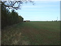
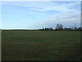
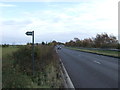
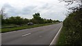
Nearby Images from Geograph Britain and Ireland:
©2016(licence)
©2016(licence)
©2016(licence)
©2017(licence)
©2008(licence)
The above images may not be of the site on this page, they are loaded from Geograph.
Please Submit an Image of this site or go out and take one for us!
Click here to see more info for this site
Nearby sites
Key: Red: member's photo, Blue: 3rd party photo, Yellow: other image, Green: no photo - please go there and take one, Grey: site destroyed
Download sites to:
KML (Google Earth)
GPX (GPS waypoints)
CSV (Garmin/Navman)
CSV (Excel)
To unlock full downloads you need to sign up as a Contributory Member. Otherwise downloads are limited to 50 sites.
Turn off the page maps and other distractions
Nearby sites listing. In the following links * = Image available
2.7km ESE 108° Claybrooke Magna Standing Stone (Menhir) (SP493885)
5.9km NNE 19° Stoney Stanton Stone Standing Stone (Menhir) (SP486949)
7.7km NNW 342° Barwell Stone* Standing Stone (Menhir) (SP4429096665)
8.6km N 11° Earl Shilton Bypass Round Barrow(s) (SP483978)
9.8km NE 36° Huncote Stone* Standing Stone (Menhir) (SP5246497256)
10.1km SSW 197° Brinklow Tumulus* Artificial Mound (SP43877957)
11.1km SSE 155° Churchover Bowl Barrow* Round Barrow(s) (SP51457929)
11.7km ESE 113° Tower Farm Long Barrow Long Barrow (SP575848)
11.8km ESE 113° Misterton and Walcote Cursus Cursus (SP576848)
12.5km NNW 329° King Richard's Well* Holy Well or Sacred Spring (SK402000)
12.9km NNE 26° Wishing Stone* Standing Stone (Menhir) (SK523009)
13.7km NW 306° Fenny Drayton Barrow* Round Barrow(s) (SP356973)
13.7km NE 38° Enderby Henge (SK551002)
14.0km NE 43° The Wethers* Standing Stones (SP56149972)
14.1km N 5° Desford Stone Standing Stone (Menhir) (SK478034)
15.0km SSE 166° The Island (Rugby School)* Round Barrow(s) (SP50367477)
16.2km SSW 203° Ryton on Dunsmore Cursus Cursus (SP404744)
16.2km NNE 33° Braunstone Church* Standing Stone (Menhir) (SK555029)
16.2km WNW 290° Oldbury Camp (Warwickshire)* Hillfort (SP3140094700)
16.5km WNW 285° Ansley Common Round Barrow(s) (SP307935)
16.7km N 11° Bury Camp (Leicestershire)* Hillfort (SK4980005700)
16.8km SSW 202° Knightlow barrow* Round Barrow(s) (SP405737)
16.8km WSW 256° Burrow Hill Camp (Warwickshire)* Hillfort (SP304850)
17.3km WSW 237° St. Catherine's Well (Coventry) Holy Well or Sacred Spring (SP323796)
17.4km NNE 31° Western Park (Leicester)* Misc. Earthwork (SK555043)
View more nearby sites and additional images


 We would like to know more about this location. Please feel free to add a brief description and any relevant information in your own language.
 Wir möchten mehr über diese Stätte erfahren. Bitte zögern Sie nicht, eine kurze Beschreibung und relevante Informationen in Deutsch hinzuzufügen.
 Nous aimerions en savoir encore un peu sur les lieux. S'il vous plaît n'hesitez pas à ajouter une courte description et tous les renseignements pertinents dans votre propre langue.
 Quisieramos informarnos un poco más de las lugares. No dude en añadir una breve descripción y otros datos relevantes en su propio idioma.