<< Our Photo Pages >> Hoar Stone at Barton - Long Barrow in England in Oxfordshire
Submitted by Baz on Sunday, 12 January 2003 Page Views: 9970
Neolithic and Bronze AgeSite Name: Hoar Stone at BartonCountry: England County: Oxfordshire Type: Long Barrow
Nearest Village: Steeple Barton
Map Ref: SP458241 Landranger Map Number: 164
Latitude: 51.913555N Longitude: 1.335558W
Condition:
| 5 | Perfect |
| 4 | Almost Perfect |
| 3 | Reasonable but with some damage |
| 2 | Ruined but still recognisable as an ancient site |
| 1 | Pretty much destroyed, possibly visible as crop marks |
| 0 | No data. |
| -1 | Completely destroyed |
| 5 | Superb |
| 4 | Good |
| 3 | Ordinary |
| 2 | Not Good |
| 1 | Awful |
| 0 | No data. |
| 5 | Can be driven to, probably with disabled access |
| 4 | Short walk on a footpath |
| 3 | Requiring a bit more of a walk |
| 2 | A long walk |
| 1 | In the middle of nowhere, a nightmare to find |
| 0 | No data. |
| 5 | co-ordinates taken by GPS or official recorded co-ordinates |
| 4 | co-ordinates scaled from a detailed map |
| 3 | co-ordinates scaled from a bad map |
| 2 | co-ordinates of the nearest village |
| 1 | co-ordinates of the nearest town |
| 0 | no data |
Internal Links:
External Links:
I have visited· I would like to visit
Smallgreenberd visited on 18th Jun 2011 - their rating: Cond: 2 Amb: 3 Access: 3 This requires leaving the bridle path that intersects Barton Farm just south of the farm's drive to the main Banbury Oxford road. Leave the bridle path on a track that heads westish down into a clearing. Keep walking, following the clearing, and there's another cleared bit heading uphill on the right. The stone is on top of this hill.
It's a lonely place and the stone is being a bit overtaken by grass and lichens.
NickyD have visited here
Average ratings for this site from all visit loggers: Condition: 2 Ambience: 3 Access: 3
")
All that remains is this large stone, 11ft long, which appears to lie within a small mound of about 30ft across.
You may be viewing yesterday's version of this page. To see the most up to date information please register for a free account.
")
")
Do not use the above information on other web sites or publications without permission of the contributor.
Nearby Images from Geograph Britain and Ireland:
©2007(licence)
©2007(licence)
©2021(licence)

©2014(licence)
©2021(licence)
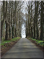
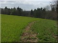
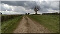
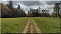
The above images may not be of the site on this page, they are loaded from Geograph.
Please Submit an Image of this site or go out and take one for us!
Click here to see more info for this site
Nearby sites
Key: Red: member's photo, Blue: 3rd party photo, Yellow: other image, Green: no photo - please go there and take one, Grey: site destroyed
Download sites to:
KML (Google Earth)
GPX (GPS waypoints)
CSV (Garmin/Navman)
CSV (Excel)
To unlock full downloads you need to sign up as a Contributory Member. Otherwise downloads are limited to 50 sites.
Turn off the page maps and other distractions
Nearby sites listing. In the following links * = Image available
5.1km WSW 239° Grimsdyke Farm Ancient Village or Settlement (SP41402141)
5.6km SW 234° Out Wood & Berrings Wood Ancient Village or Settlement (SP413208)
5.6km SW 219° Glympton Farm Ancient Village or Settlement (SP423197)
6.2km WSW 246° Home Farm Ancient Village or Settlement (SP402215)
6.6km SSW 209° Blenheim Great Park Ancient Village or Settlement (SP427183)
6.7km NNW 343° Ilbury Camp* Hillfort (SP438305)
7.2km ENE 58° Somerton Turf Maze (SP5187927901)
7.9km SSW 196° Fair Rosamund's Well* Holy Well or Sacred Spring (SP43651646)
8.0km W 268° Hoar Stone at Enstone* Chambered Tomb (SP37792375)
8.1km WSW 247° Model Farm Ancient Village or Settlement (SP383209)
10.0km WSW 258° Thorsbrook Spring* Holy Well or Sacred Spring (SP360219)
10.0km W 259° Thor Stone* Standing Stone (Menhir) (SP35932208)
10.6km SW 216° North Leigh Roman Villa* Ancient Village or Settlement (SP39661547)
10.9km WSW 243° Sturt Henge* Modern Stone Circle etc (SP36111899)
11.7km WSW 244° Cornbury Park Round Barrow(s) (SP35311878)
11.9km W 268° Hawk Stone* Standing Stone (Menhir) (SP33922354)
11.9km E 99° Bicester Burial Mounds Barrow Cemetery (SP576223)
12.2km S 175° Yarnton* Ancient Village or Settlement (SP4712)
12.5km SW 223° The Lady's Well (Oxfordshire)* Holy Well or Sacred Spring (SP374148)
12.7km NNE 33° Rainsborough Camp* Hillfort (SP526348)
13.0km NNE 22° Astrop Well* Holy Well or Sacred Spring (SP50603624)
13.2km E 101° Bicester Stone Circle* Modern Stone Circle etc (SP588217)
13.4km NNE 22° St Rumbald's Well* Holy Well or Sacred Spring (SP50783651)
13.5km NNW 329° Tadmarton Camp* Hillfort (SP38783568)
13.6km N 6° Bodicote Cursus Cursus (SP472376)
View more nearby sites and additional images


 We would like to know more about this location. Please feel free to add a brief description and any relevant information in your own language.
 Wir möchten mehr über diese Stätte erfahren. Bitte zögern Sie nicht, eine kurze Beschreibung und relevante Informationen in Deutsch hinzuzufügen.
 Nous aimerions en savoir encore un peu sur les lieux. S'il vous plaît n'hesitez pas à ajouter une courte description et tous les renseignements pertinents dans votre propre langue.
 Quisieramos informarnos un poco más de las lugares. No dude en añadir una breve descripción y otros datos relevantes en su propio idioma.